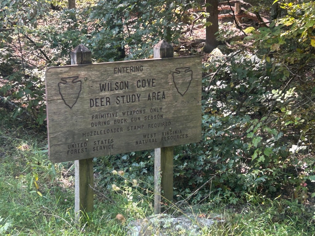
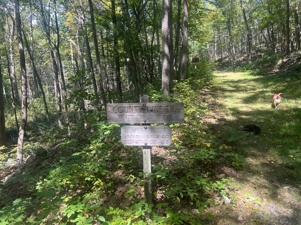
-Wilson’s Cove Trail/Fire road to the WV/VA line, continuing on Racer Hollow Camp Trail/Fire road.
Parking: at the end of Waites Run Rd is a Fire road/Wilson Cove Trail on the left. There is very limited parking at the end of the road. I fit my small rig facing out on the right shoulder. A car parked on the shoulder on the left facing out.
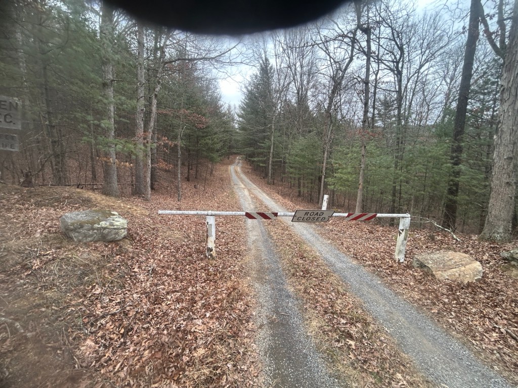
The fire road going up on the left of Waites Run Rd is a bit steep, narrow, rutted, and has low hanging growth. It’s a short climb to a nice clear parking circle just before a closed gate. The rest of the road/trail from this point is lovely.
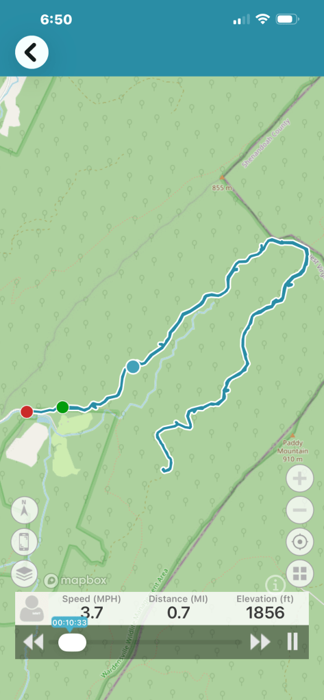
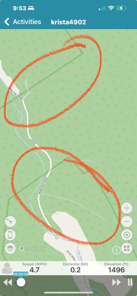
The video starts at the parking circle at the gate.
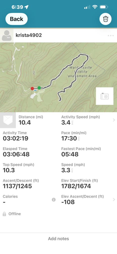
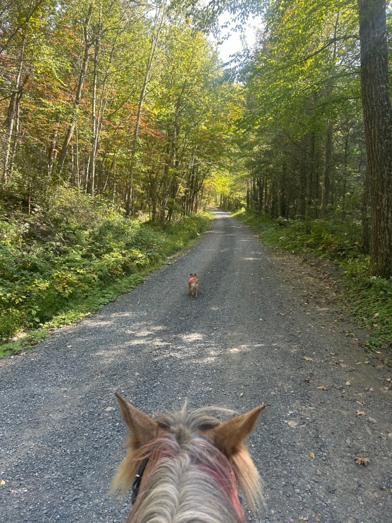
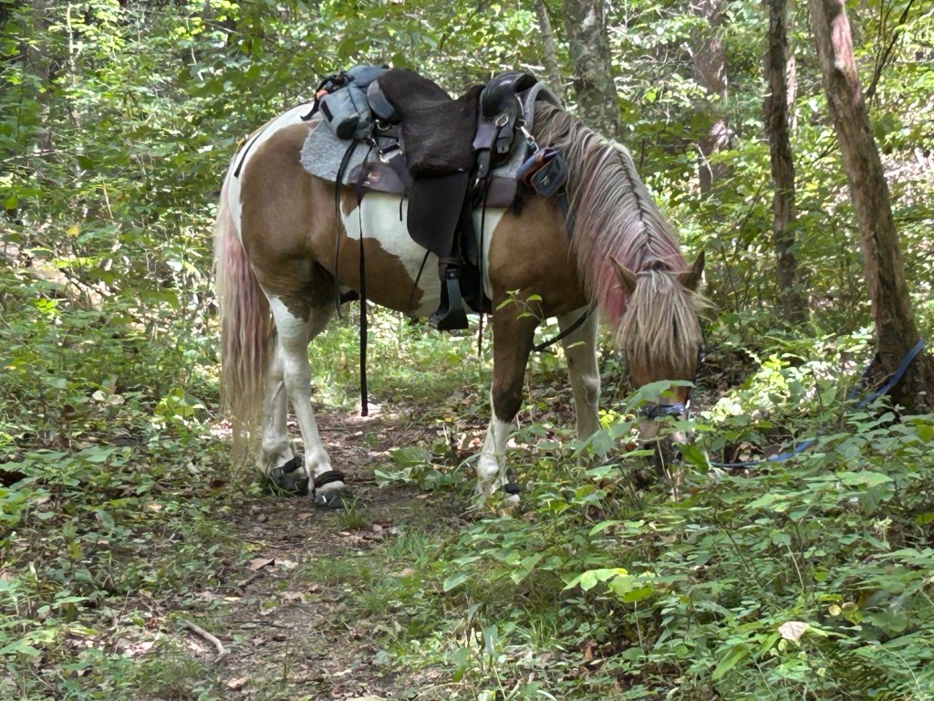
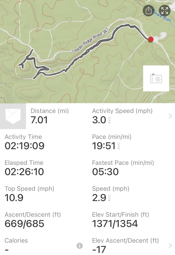
It was a chilly day, in the low 30s, no wind. I rode Simon and ponied Pip. 10ish miles. Some stops to explore. Some trotting and cantering. Pip on and off line.
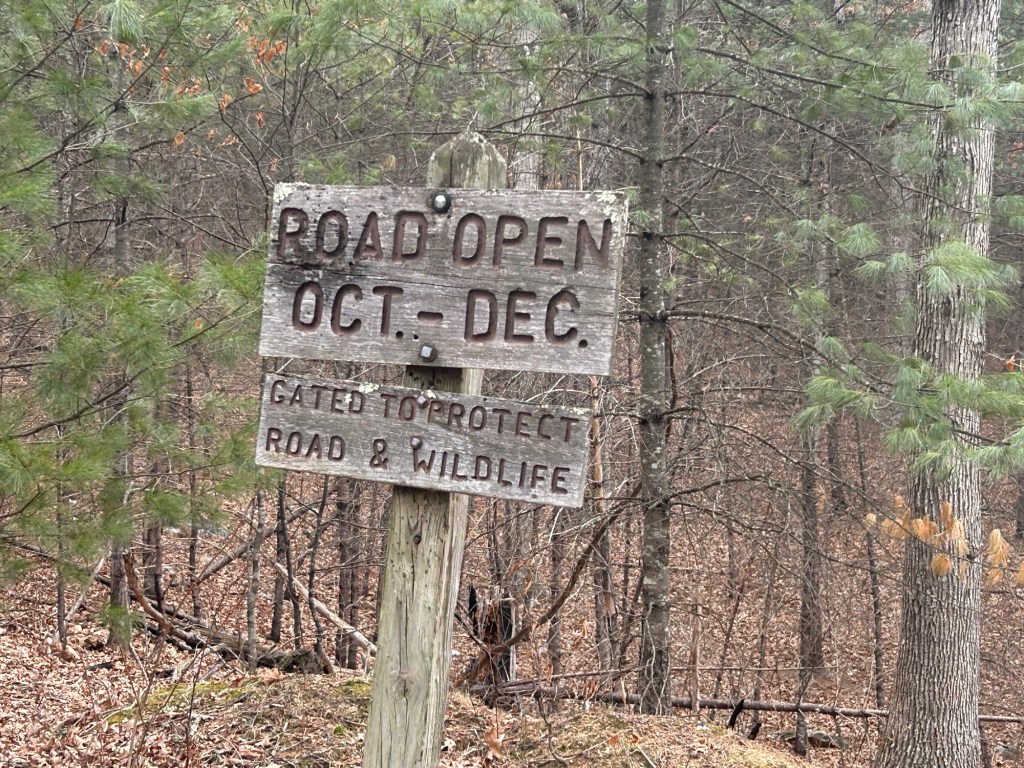
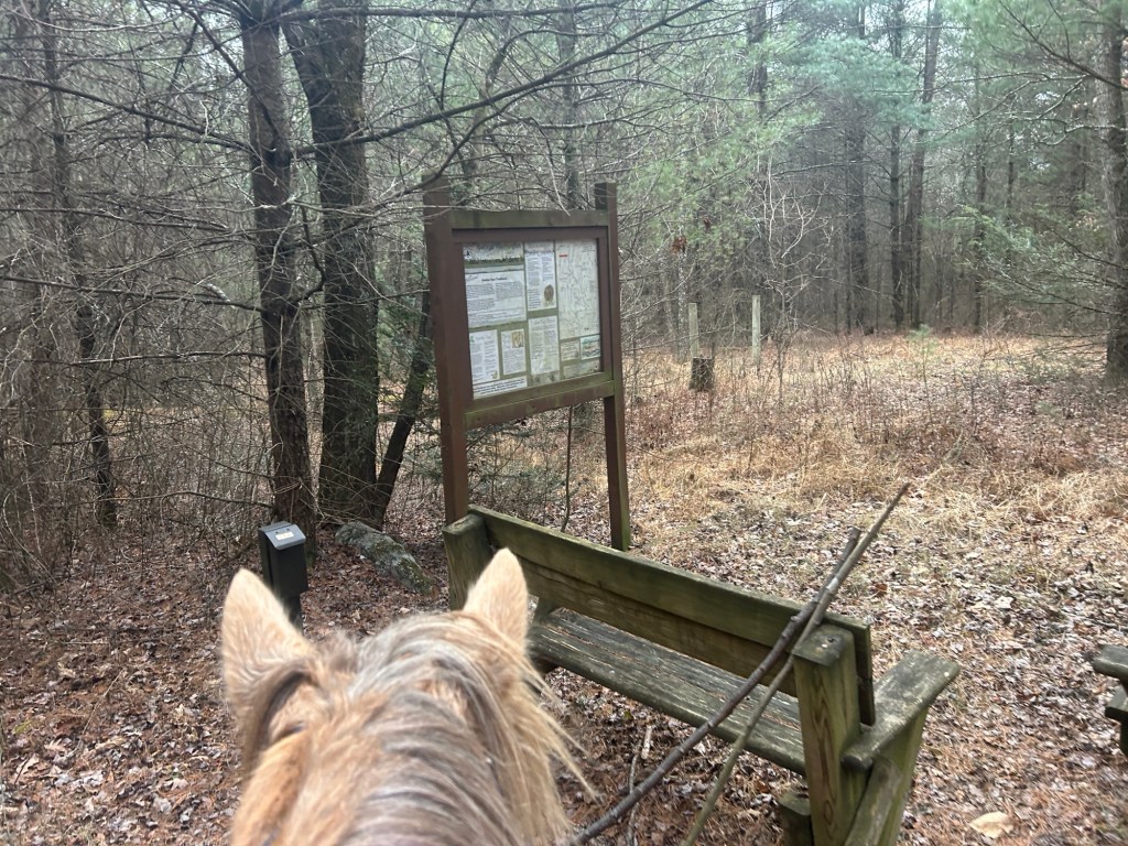
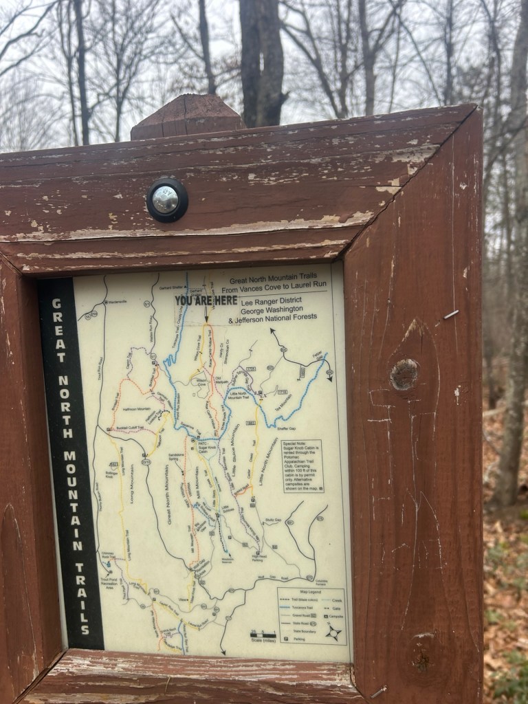
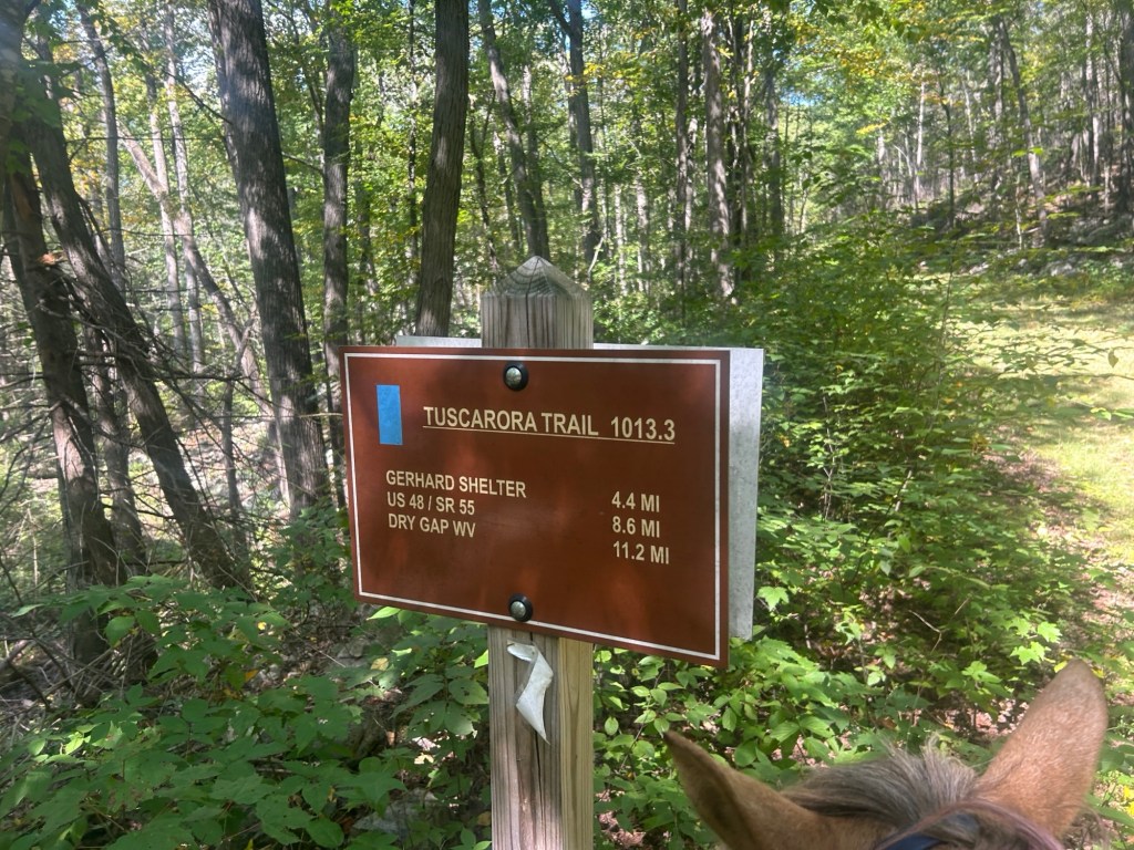
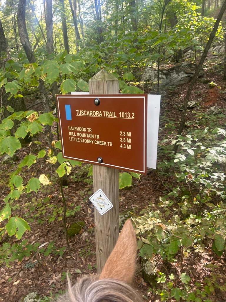
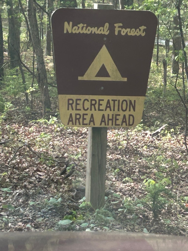
At the gate is a sign stating “road open Oct through Dec”. There is also a posted map on the right hand side of the gate.
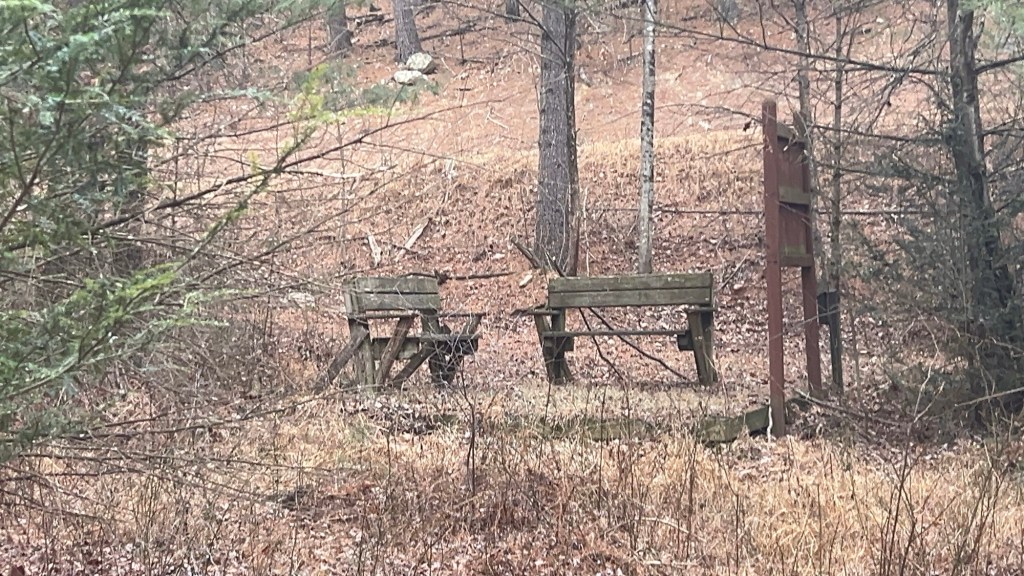
Shortly after the gate there is a right hand turn onto Old Mailpath Trail. This is well marked with some benches, an old fire pit, a bulletin board, and an empty map box.
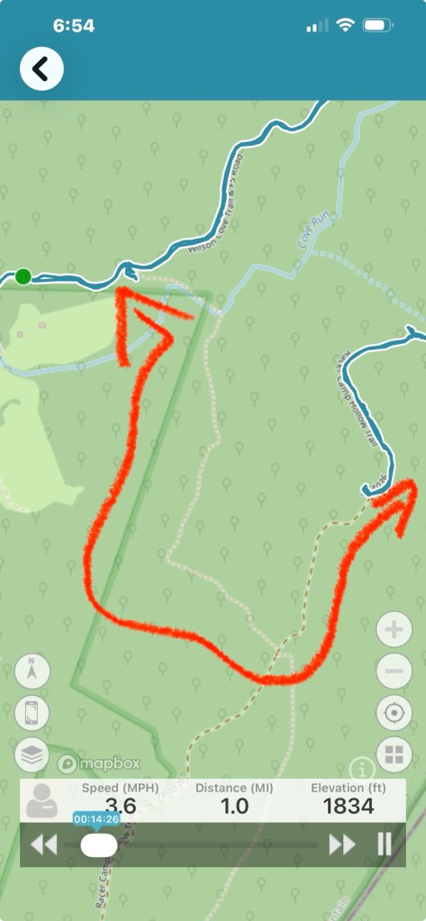
A car pulled up and parked right as I was heading out onto the trail so I trotted on past this area on the way out. I took a peek on the way back out and I’m excited to use it to make a loop in a future ride.
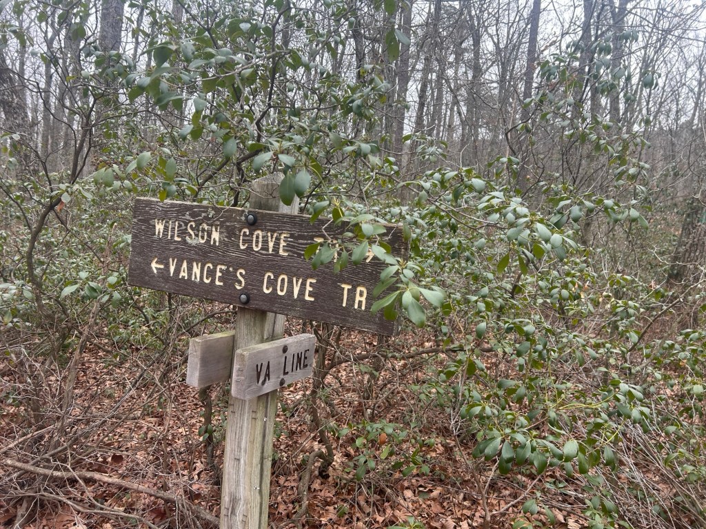
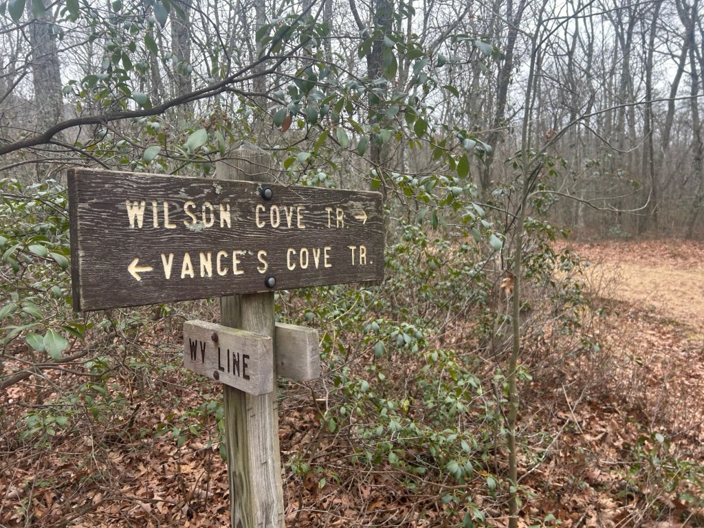
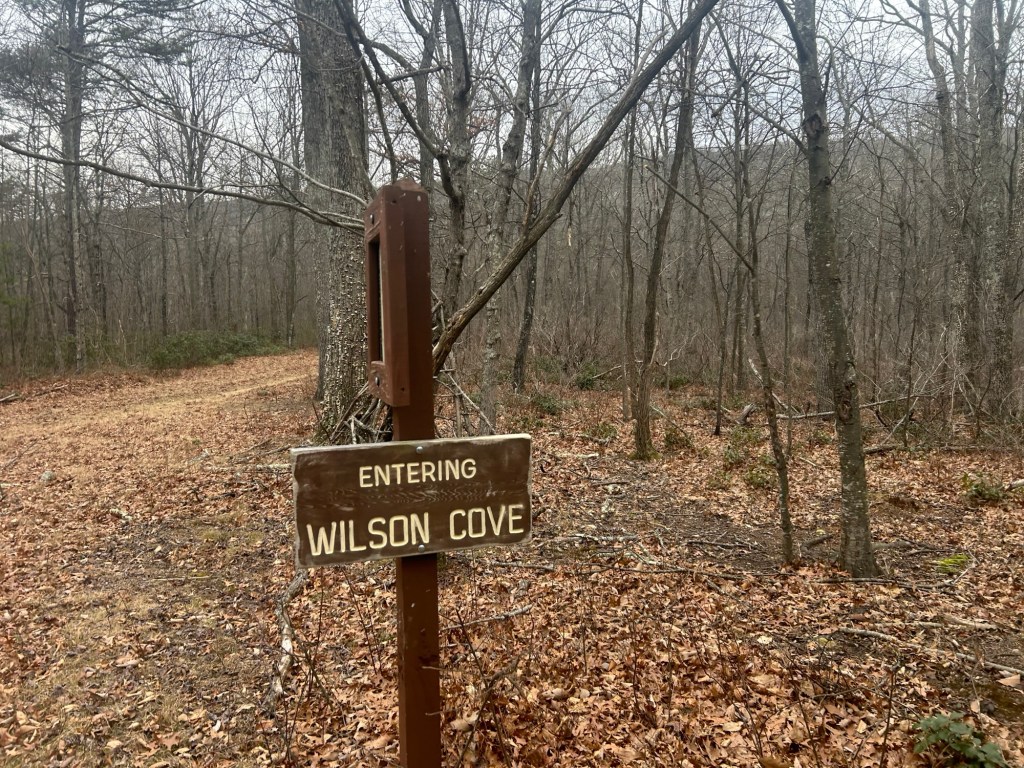
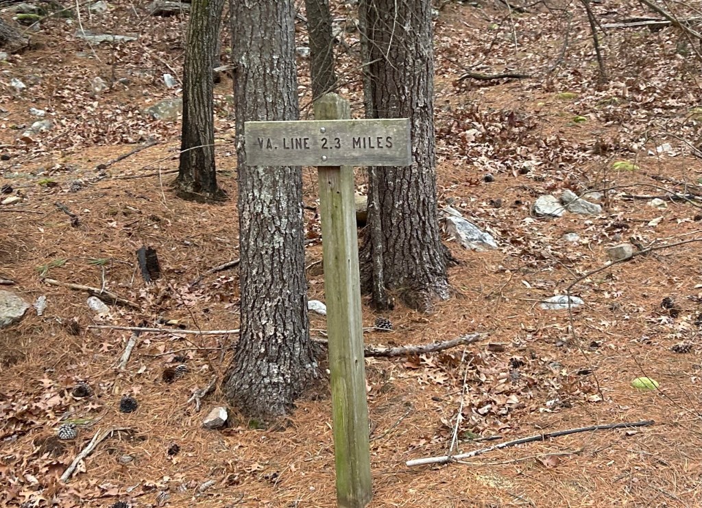
Continuing on is the state boarder, WV and VA. It’s marked by a map and sign posts. A trail breaks off to the left going towards Vance’s cove. I have ridden to this point from Paddy’s Cove.
On the way out I trucked on past here because a cyclist had just passed going that way. I did take the time to get some images of the signs on the way back though.
Next time I hope to take that Old Mailpath trail to make a loop.
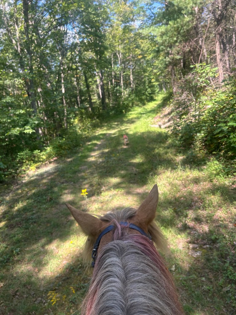
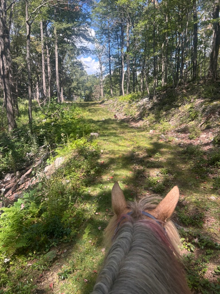
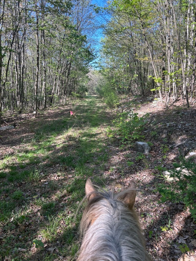
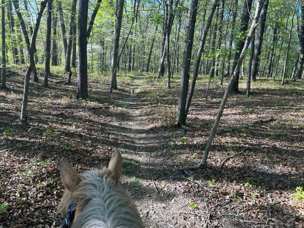
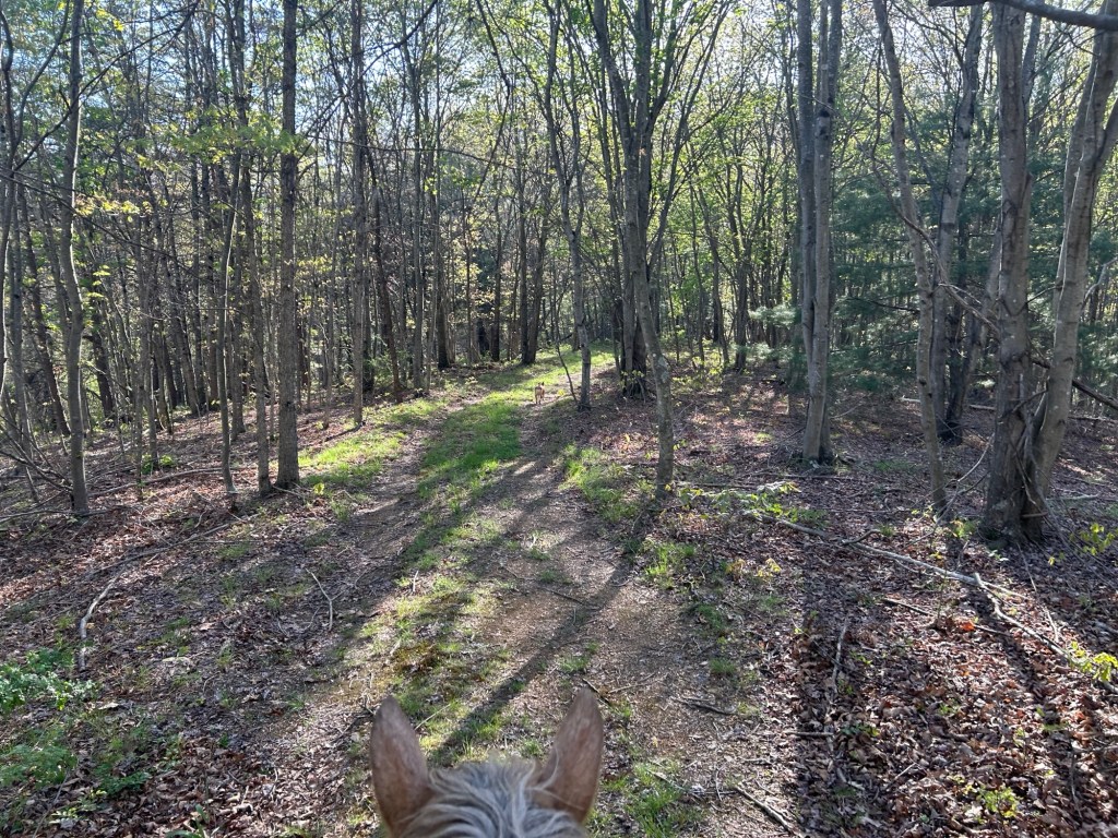
Most of the ride was gently rolling, not very rocky for the general area, and wide, cleared, maintained paths.
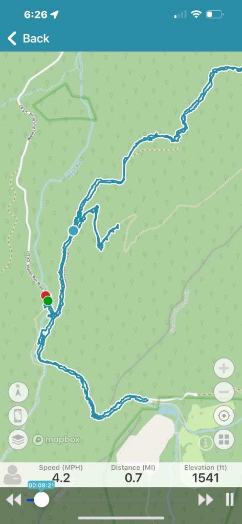
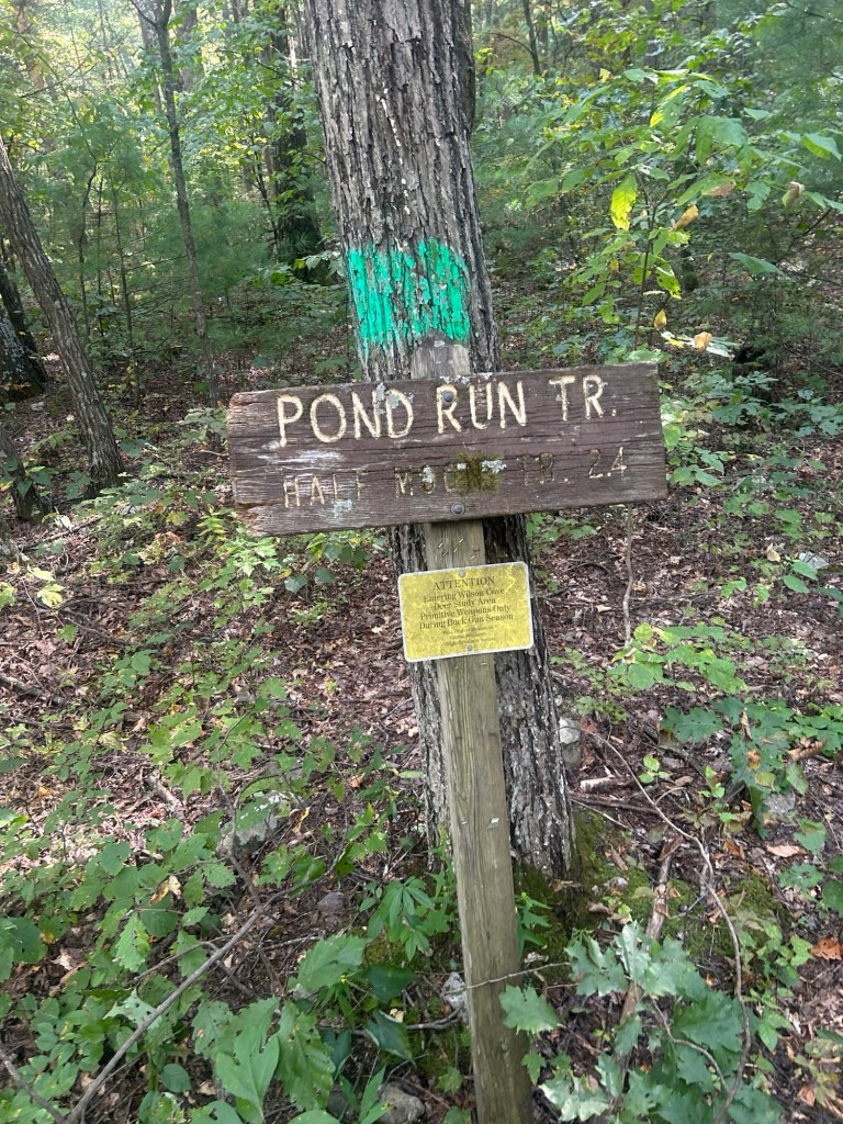
Today I drove to the County Line Trail head, on the left side of Waites Run Road, just after the bridge crossing. I backed into the trail head/fire road to turn around, then crossed back over the bridge and parked on my right. There is room for 2 or three rigs right here and another side pullover just ahead also on the right. This is directly across from the Pond Run Trail which is on the right as you drive in, or left after you turn around to park.
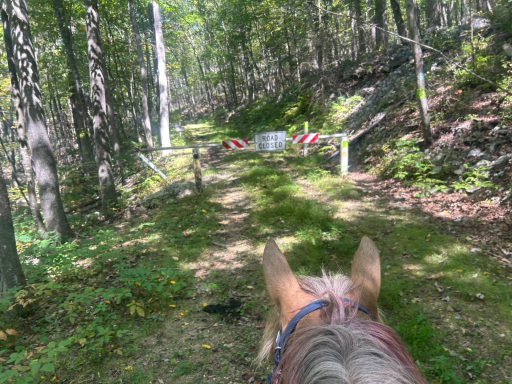
I rode back over the bridge to where I turned around. Then I started up the fire road/County Line Trail. There was a closed gate almost immediately.
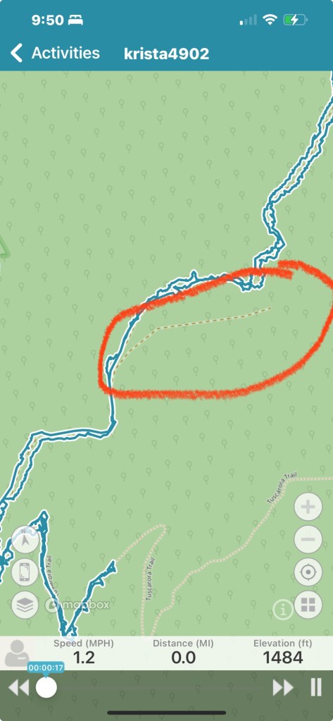
We are in the top left corner. (Not the nail mark in the middle)
I started up the trail which is nice and lush, excellent footing. Slightly uphill and good for moving out. This trail appears to be green boxed, like a double wide blaze.
It crosses through a clearing that was recently bush hogged.
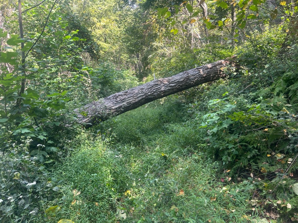
At about the 2.5mile point there was a large tree down across the trail. I did not see an obvious way around it. If I took Simon’s saddle off, he would have just fit under the higher end of the tree. But it was so buggy and other directions I could explore so I decided to turn around.
Riding back down there is an unmarked trail on the left, it’s slanted forward on the ride down and is not as obvious when riding up the trail. This is part of the Tuscarora trail. It rides forward and branches sharply up to the left.
It does seem to continue forward as well but does not appear to be maintained in that direction. I did not explore that way.
I took the left, and rode up maybe a 1/2 mile. It was a pretty cool trail, switching back and forth, with some rock scrambling. It is marked with light blue blazes.
After about a mile, maybe, I turned around. The bugs were really bothering me and I wanted to be in a place I could move out to create some anti-bug-wind.
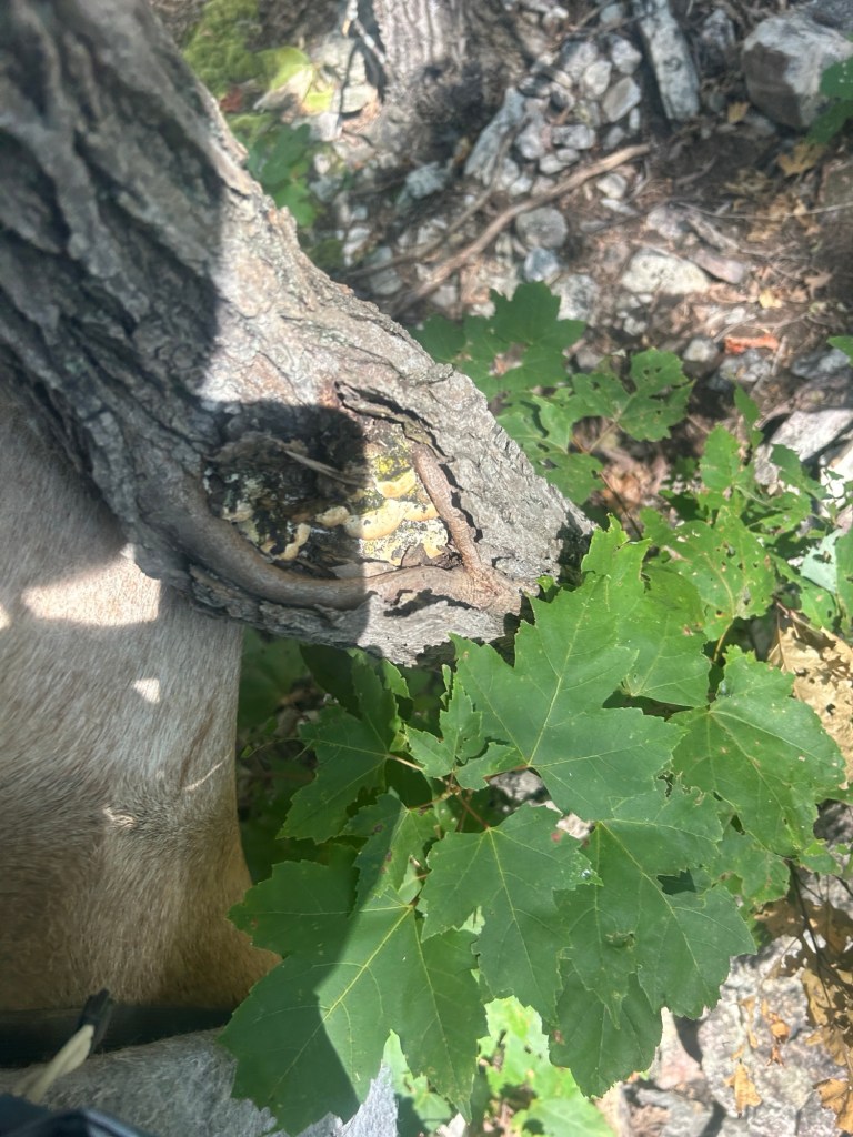
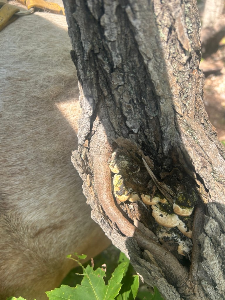
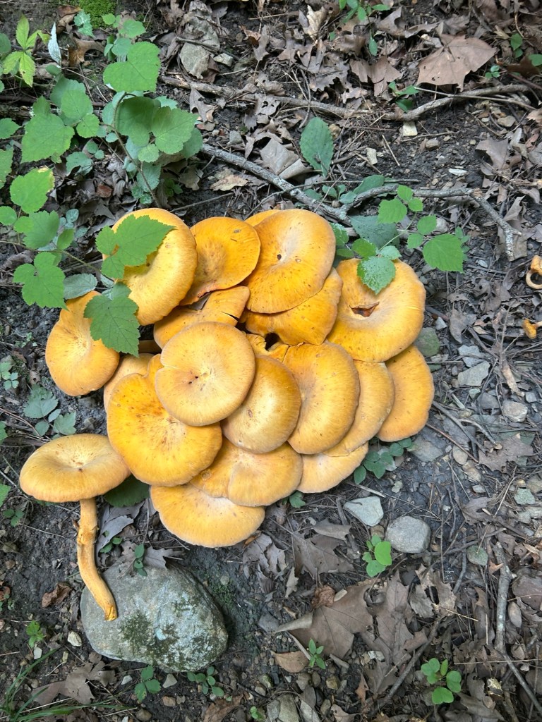
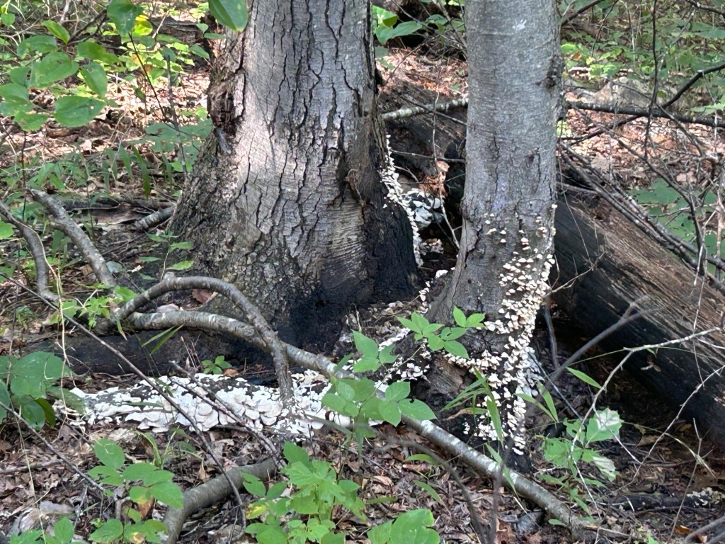
There was a cool knot in this tree with mushrooms growing in it.
Back to Waites Run Road, I took a left and continued down the road. I explored some camping spots on the right along the creek. I also noted a possibly unmaintained trail on the left, angled back so it was slightly easier to see on the ride back in the other direction. It was loosely marked with an old post, no sign attached.
Clip is from when I was riding back in the return direction when the trail was on the right.
Shortly after this trail I came to the end of Waites Run Road that appears to continue on the map becomes, what appears to be private property. But to the left there is a fire road going up. This makes a spot to turn the trailer around. And there is a small pullover on the right to park. The gate is open on this fire road but does not appear to be a smooth drive in a vehicle. At least at a glance from the bottom.
Waites Run was nice to ride along.
I rode back to the trailer, and glanced at the Pond Trail across from where I parked, on the left and just after crossing the bridge as you leave the area.
That wide green mark is what I meant by “green box, double wide blaze”
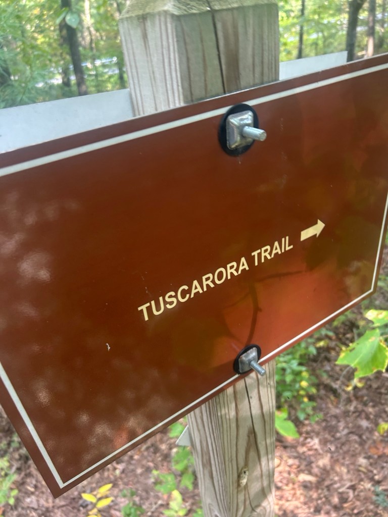
This last sign is if you were coming back down the trail to Waites Run Road.
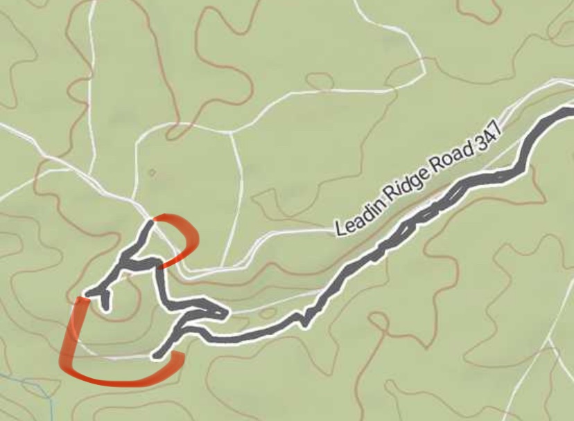
There appear to be other trails along this section that I did not see, or at least have not explored.
This branch is off County Line Trail on the right as you go up, after Tuscarora Trail and I did not see it. This is at the very end of Waites Run, the left hand branch is onto what appears in person to be private property. The right hand branch is the fire road to explore in the future. These two trails are on the left as you come into the area on Waites Run road. Or on the right as you leave. I do not know where they are. It’s possible the one towards the bottom of the image (on the left coming in) is where the old Iron Forge is with the largish parking right where the road goes from paved to gravel. But that trail did not appear to continue. But it might have and I just did not explore it assuming it ended. No idea about the other one. I’ll have to do some map comparisons.
Parking: just after the last house and not too far after the national forest sign is a parking area to the left of the road.
It’s large enough for a trailer to turn around in.
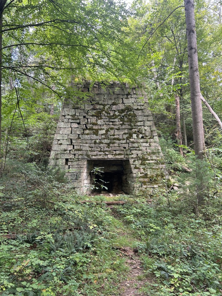
In this image the red circle in the top left is parking. You see the trail down to the other red circle on the right, which is where the furnace is.This trail meets up at the bridge going to the circle from Bucktail parking off Trout Run Road.
I started off going down the trail from the back right of the parking area. There are National Forest sign posts along the trail but no signs are attached. There is also an old small bridge that you almost can’t see as you cross over it on the trail. It’s mostly flat into the ground where run off must have trickled.
Simon waiting while I checked out the furnace a little close up.
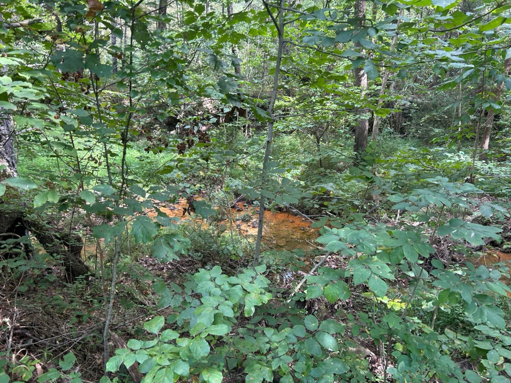
I rode down the trail which is not very long, maybe 0.7miles to the bottom. At the bottom is the furnace. you can see the old water canal to Waites Run. And in Waites Run you can see a few really orange water pooled. I assume??? From metals in the water.
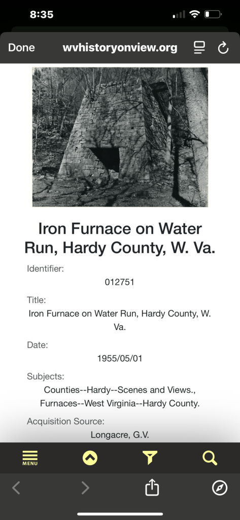
I spent a while on ChatGPT to try and find any info on this furnace. The closest I came is to “Iron Furnace on Water Run” which served Capon Iron Works Company. I’m not 100% sure that this is accurate info but it’s the best I could find.There was this image and info from 1955. It fits what I saw.
You do see the back and top of the furnace from above while traveling down the trail. This portion is at the end of the video when I rode back up the trail.
The furnace from behind on the trail down to the furnace front. Also one of the orange pools of water in Waites Run just opposite the furnace front
The trail also continues past the furnace but it crossed the creek and went steeply up the hill and did not make clear if it continues beyond that.
Again, there are sign posts with no signs at the furnace.
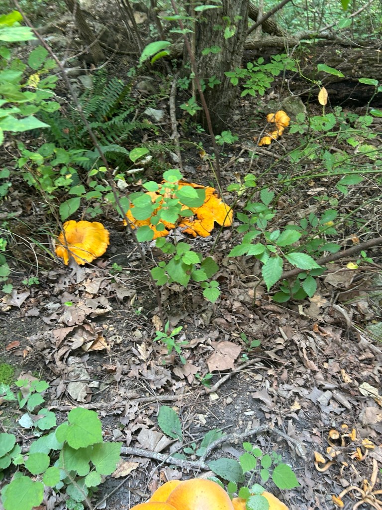
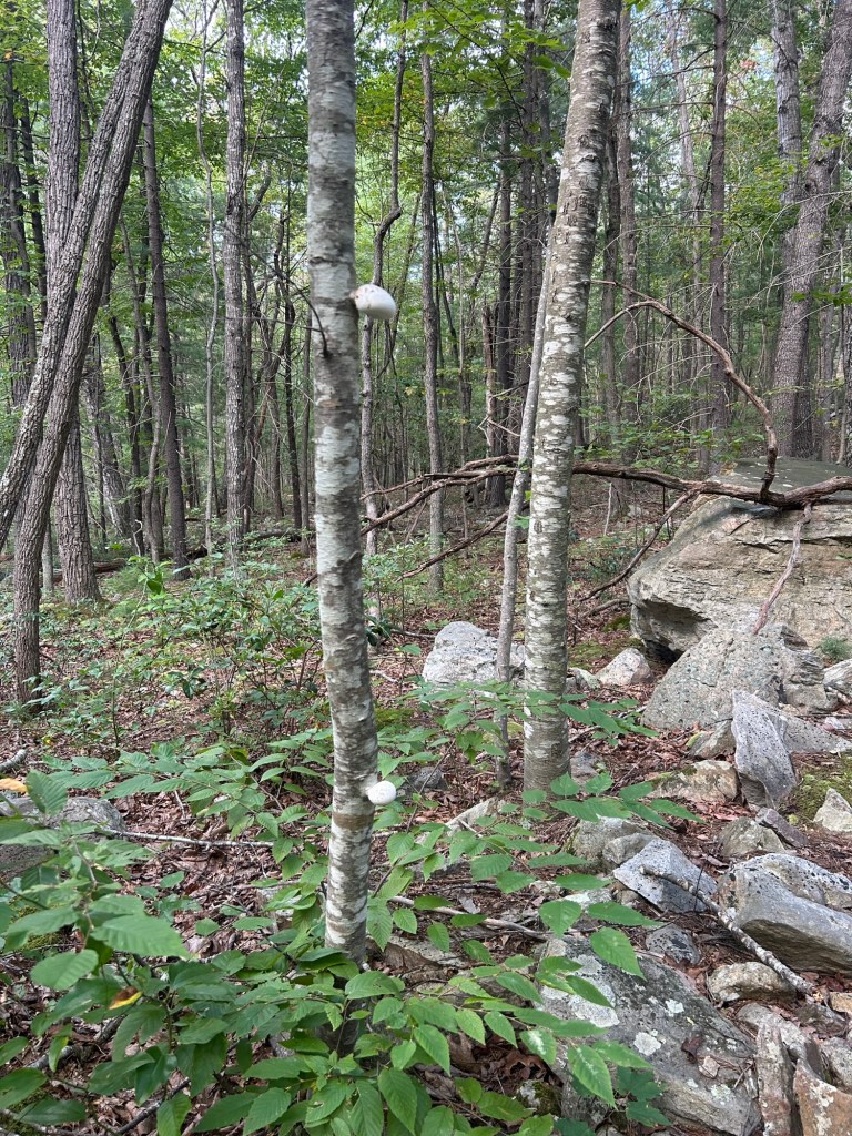
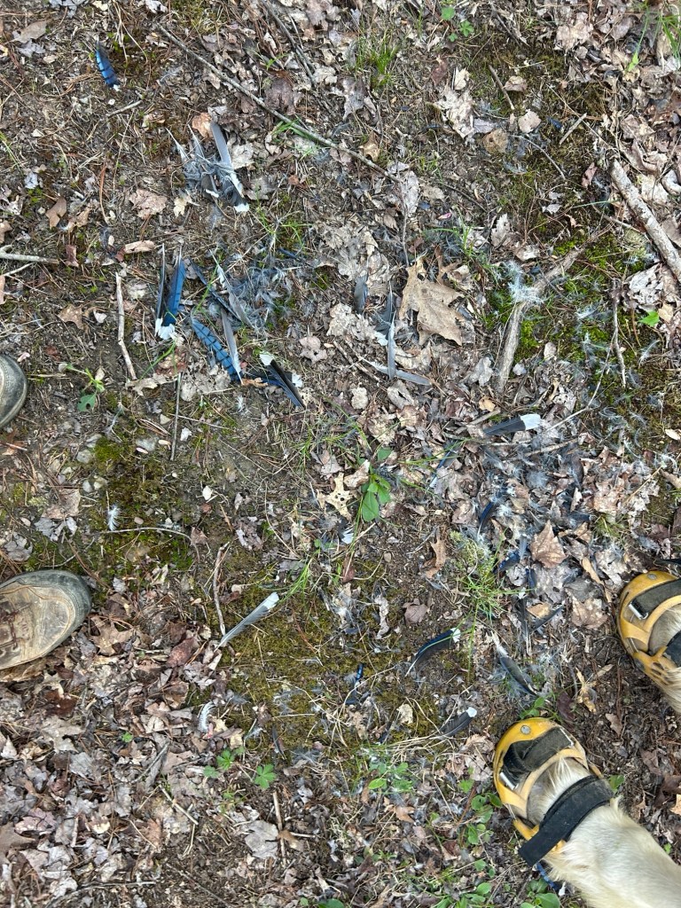
I saw Jack O Lantern mushrooms along the trail! Toxic but pretty.
After checking out the furnace, I headed up to some camp spots and then out to Waites run road. It is gravel at this point. I turned right and went about half way back to where I parked and got onto a marked trail to the left (it would have been on the right when driving in). The trail is simply marked with a hiker image and arrow.
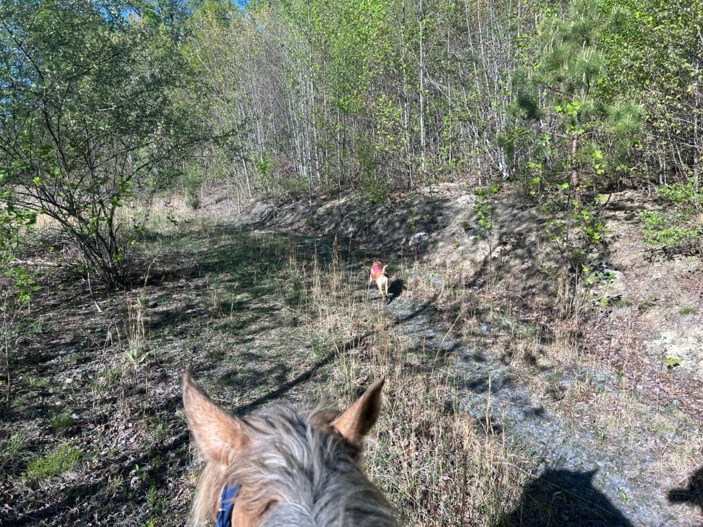
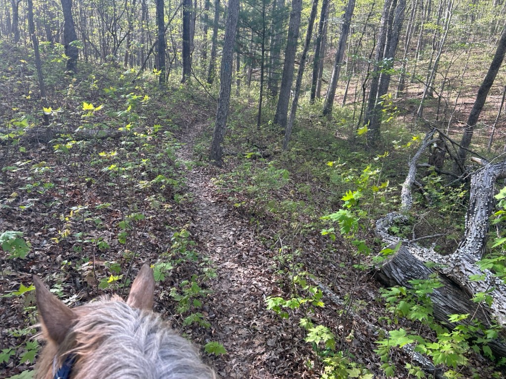
The first 1/2- 1 mile or so appeared to be recently weed wacked. (Eaten, eated?) and then it became very over grown for a bit. Still clear where to go but summer growth was strong. I also saw pretty fresh horse poo and tracks.
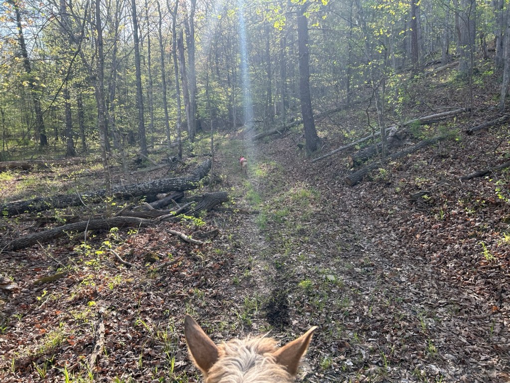
The trail went up hill for a short bit. There was a tree down on the trail. I sawed through the top branch with my hand saw. But then I was unable to move that section enough to get Simon over the bottom branch. And I was out of energy to saw another branch. This made me question how the other horse got through (why did it take me this long to think about that) and then I noticed a pushed down brush area a bit behind Simon. Obvi I took that route. The over growth on either side was pretty dense.
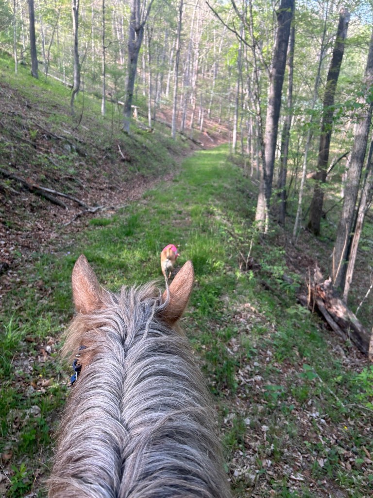
Pretty quickly the trail widened and became grassy with brunt forest on either side. Then rolled into more natural forest.
There was a large rock mass on the left of the trail. I explored it briefly on foot. I would like to explore it more.
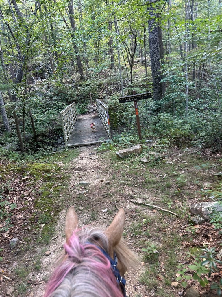
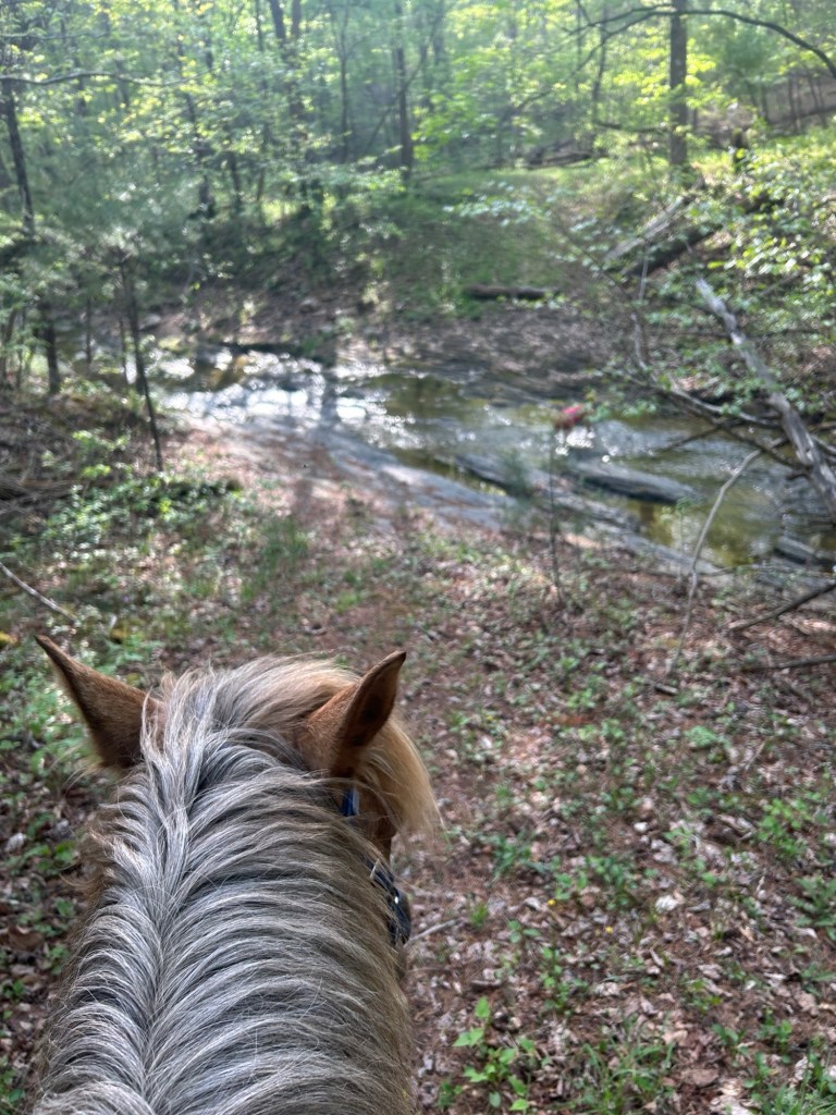
Just at the end of the rock outcropping was a creek, and a bridge. The same bridge Carol Ann and I passed a few weeks ago when riding the loop out from Bucktail parking off Trout Run Road.
We marched over the bridge and went just a little way then turned around to head home.
Perfect weather, although lots of gnats going up my nose and in my eyes.
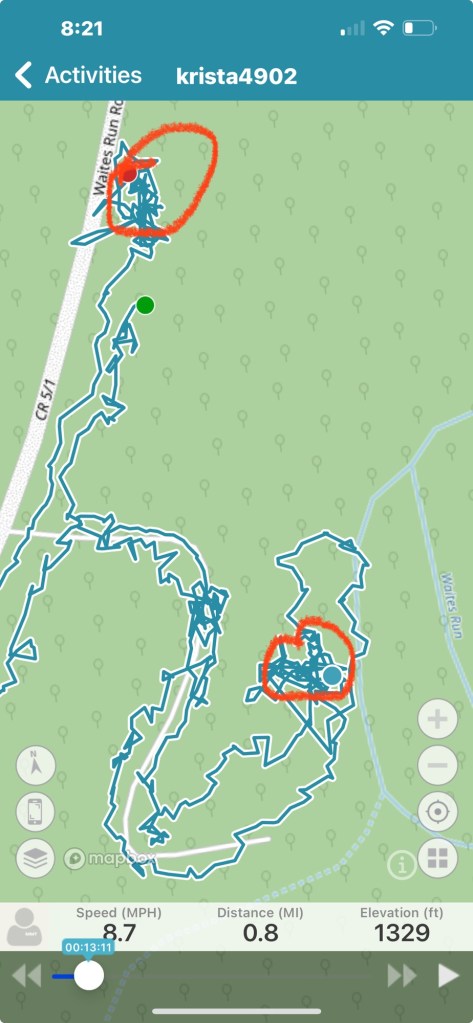
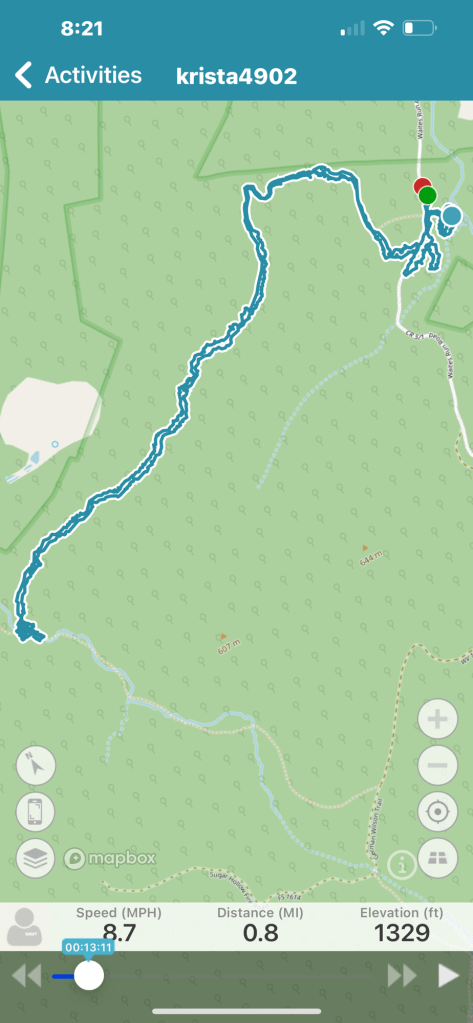
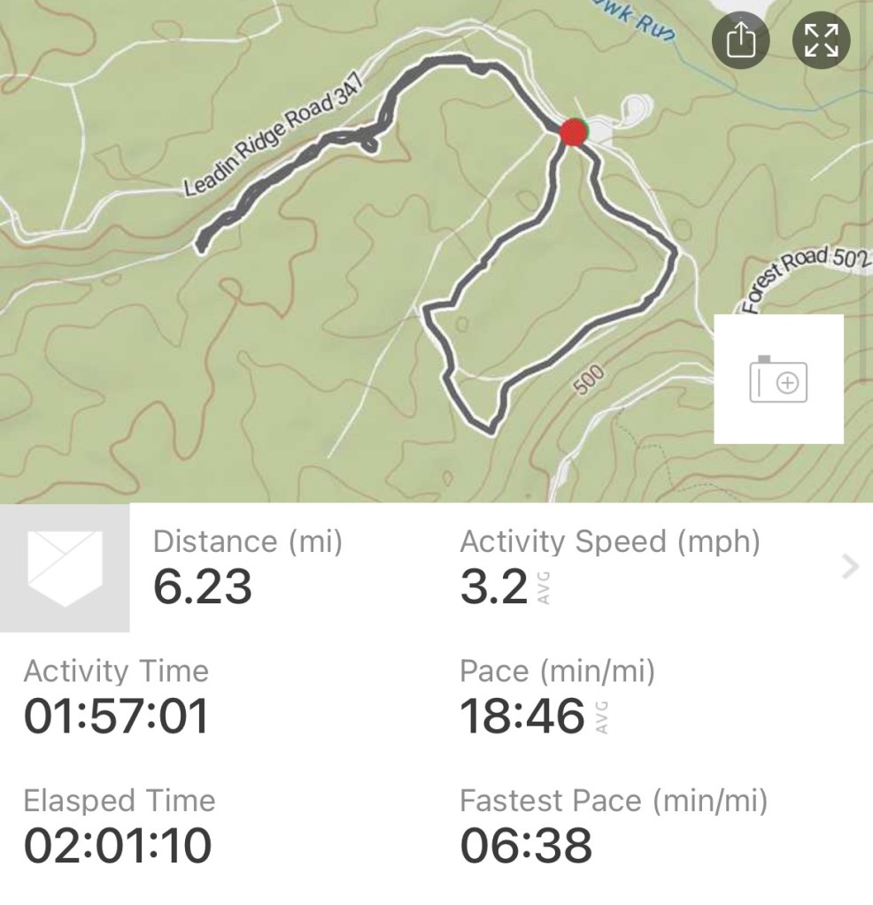
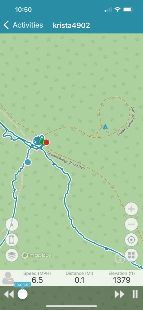
I did some more exploring from the main camp circle in Hawk Recreational Area. This includes Blue blaze, Creek Trail, Harness Trail and yellow blaze, Lost Hunter Trail.
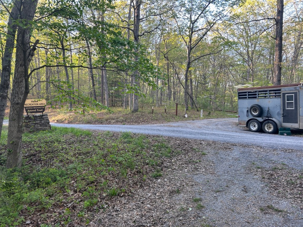
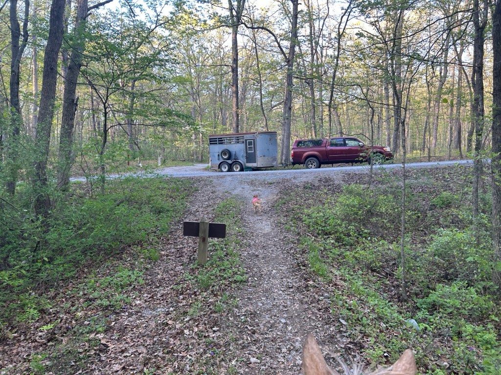
Parking: I parked on the side of the road right outside of the main camping circle.
I took the blue blaze right from parking back to what I’m calling the Creek Trail.
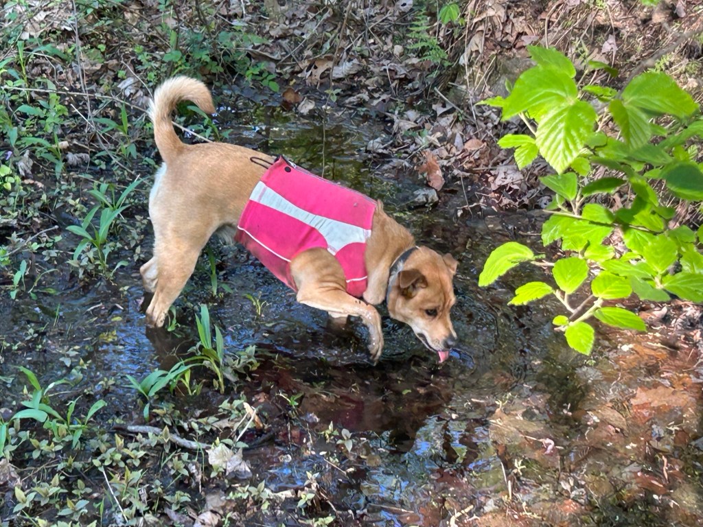
I saw horse prints and poo through out the area. And quite a few different colored/aged flagging tape up. I assume this area is heavier trafficked in the summer. It really is gorgeous, quiet, serene, and a particularly enjoyable ride. It’s also hoof friendly and I’d like to bring Pip out in the near future. He will be ponied from Simon but does not have shoes or boots (Simon’s spares do not go on his feet at all).
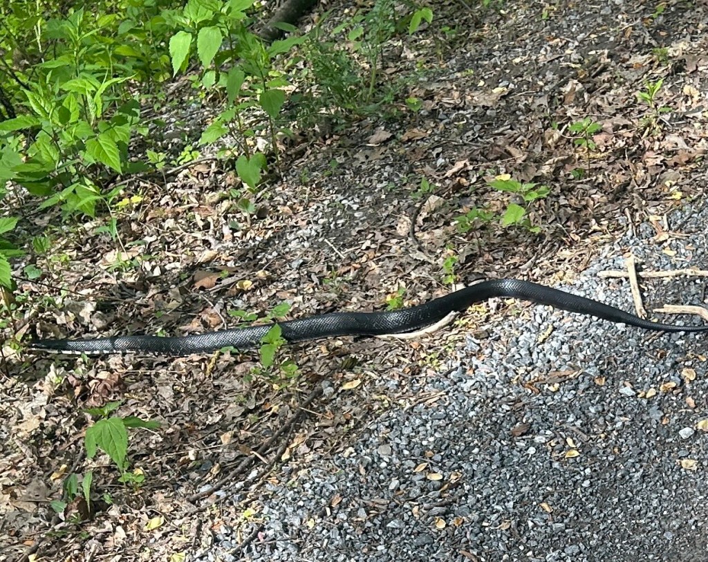
Sunday when I spent time in the area I saw a snake. Monday I saw a turkey. Today I saw another snake. I also picked 5 ticks off of Willow afterwards. I need to check Simon over too.
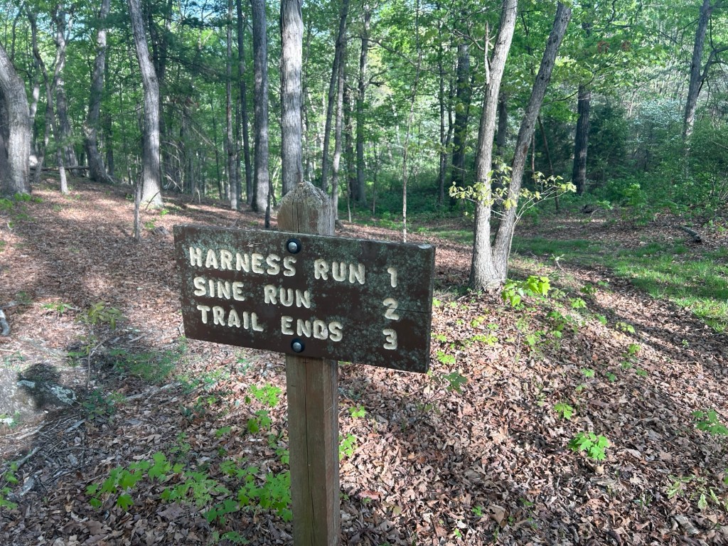
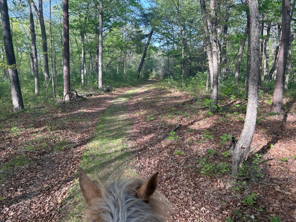
Creek Trail, which I think might actually be called Harness Trail, ended at a T. Yellow blaze, nice and wide and lovely grassed. I went right, going up through the switch backs. It was a mild easy climb and a hardly noticeable decent on the way back.
This trail ended at another T. There is a sign at the T, facing where I had come from. It appears to be telling me I am coming from Harness Trail. I need to reference the forest service map to have a better idea.
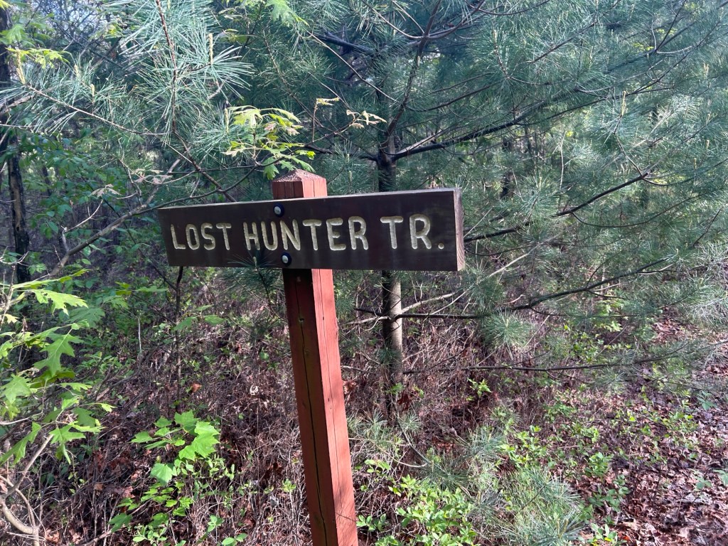
I took a right and followed what I believe is called Lost Hunters Trail a short ways to a fire gate and the road. The same one I am parked on, just further down. There was a camper parked there. And an empty spot across the road. I might try parking down here next time. The trail I am on appears to continue across the road.
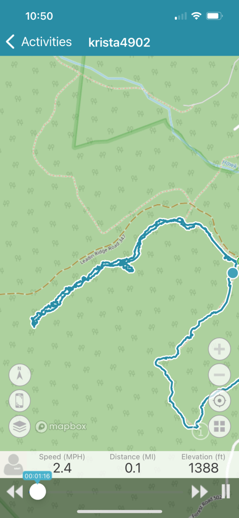
Looking at the tracking map it looks like I should be able to ride right along the road and circle back down closer to the end of Creek Trail.
I turned around and headed back past my turn and explored in the opposite direction. It again splits.
Baring slightly right is a well worn track going into denser forest.
The other track is less dominate and in heavy leaf litter. It bares left. I turned around to head back and saw a sign directing the trail.
Looking at the tracking map when I got home it appears one of these two trails meets up with the end of Creek Trail. I am going to have to explore that.
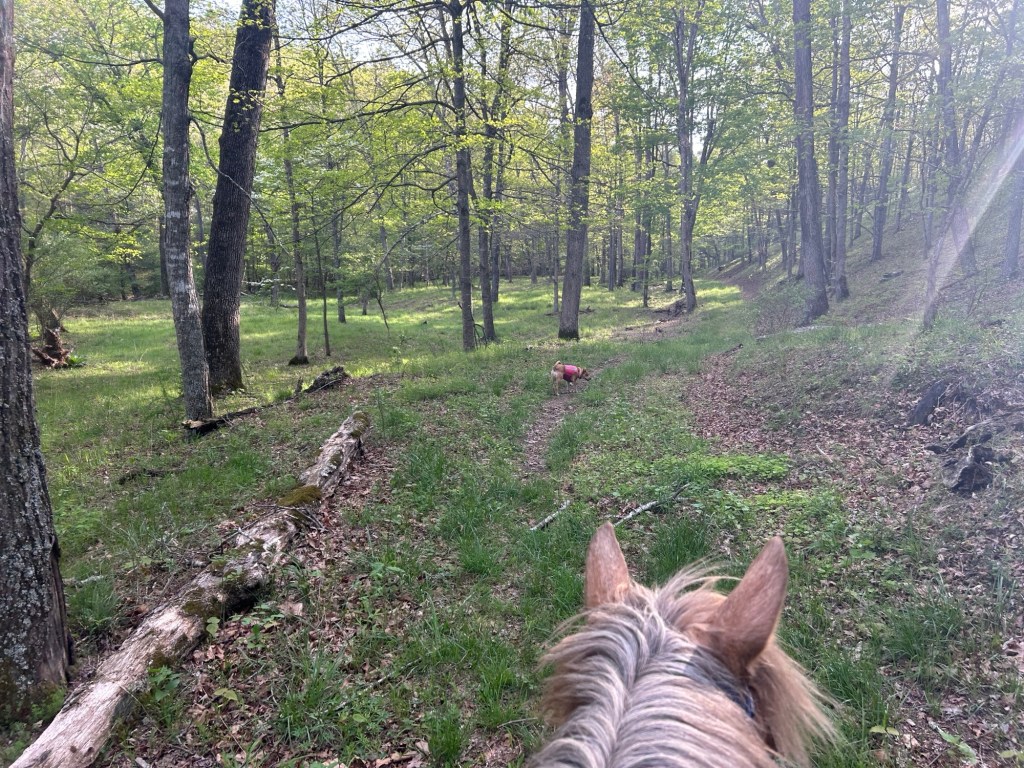
I turned to head back and noted this area is covered in blueberry plants.
When I reached the left hand turn back onto Creek Trail I kept going straight in the direction I had not explored yet. It is a wide grass trail, and I need to check it out closer later.
I headed back towards home, stopping to play with Willow in the creeks and hiking along with Simon for some of it.
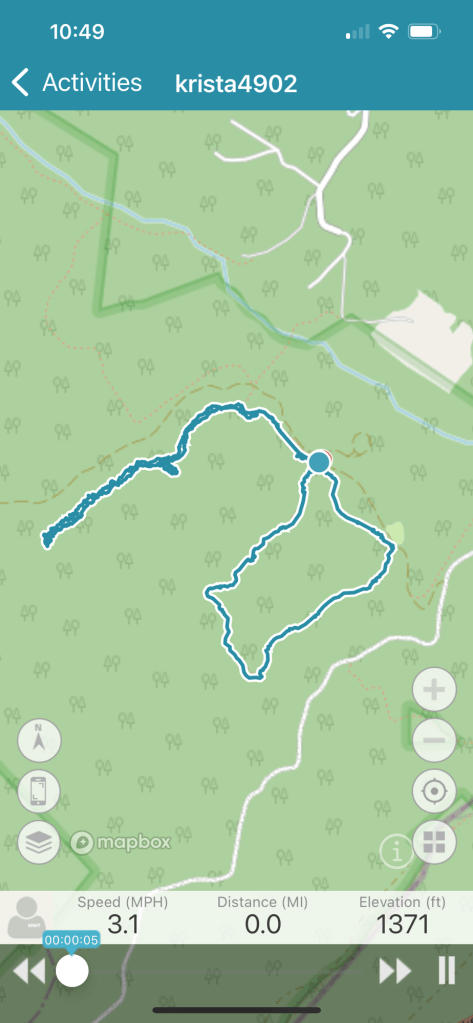
Yesterday I zipped over to the Hawk area after work for a quick spin. This location is super close and with daylight sticking around it makes a good location to get in a weekday evening ride.
Parking: I parked right in front of the camping loop on the side of the road. note, do not pull into the picnic area to turn around. It ends at a rather narrow rectangle with a solid boarder so turning around was a bit of a challenge. It does appear the camping is on a small loop that would be easy to whip around.
I rode straight away from the camping entrance towards the shed, up and past it baring left. The loop stays straight, then bares left through the fields, then bares right along the woods (woods on your left) and back into woods to the left left left again.
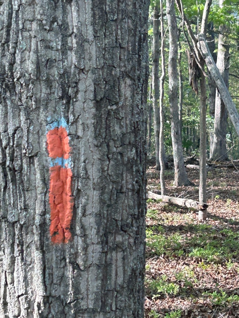
This pops out at the orange/blue blaze.
As mentioned in my previous ride, part of the OD endurance ride took part of this path, but I believe they turned right at one of the points I turned left.
It was a pleasant ride, plenty of space to move out. Some small water crossings and easy footing.
The loop was pretty short so I continued past my parking on the blue blaze (no orange from this point). It was pleasant and rode along the road and then to the left into the woods.
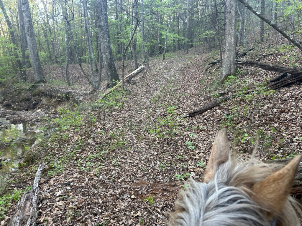
After a bit the trail widens, crosses some other trails, and is sort of moss covered. I kept baring left, and down. I did see some fresh and old horse tracks and poo and even found a horse shoe, which I hung in the closest tree.
It eventually rides down and levels out at a creek. The left hand path is mostly blocked by down fall and not really passable.
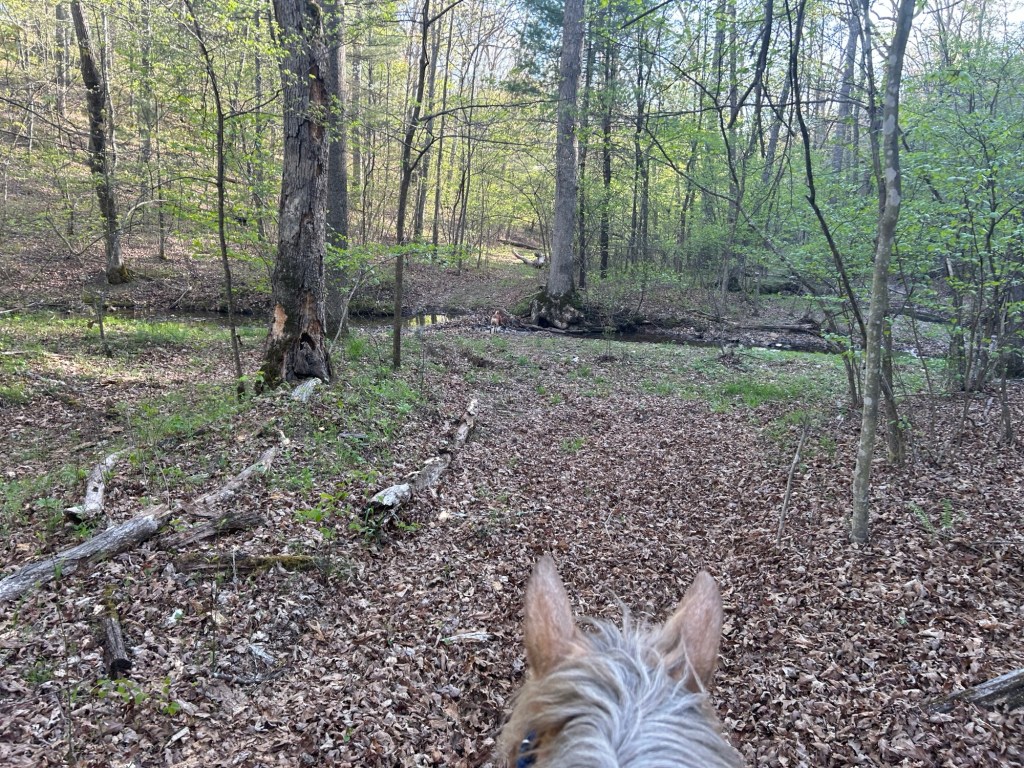
The main branch bares right over the creek and continues in the valley crossing back and forth over the creek. I spent some time enjoying the scenery and splashing about with Willow while Simon grazed.
The trail continued on, with both human and horse tracks, but I chose to turn around at this point and head back for the day. I’m looking forward to my next adventure down this trail.