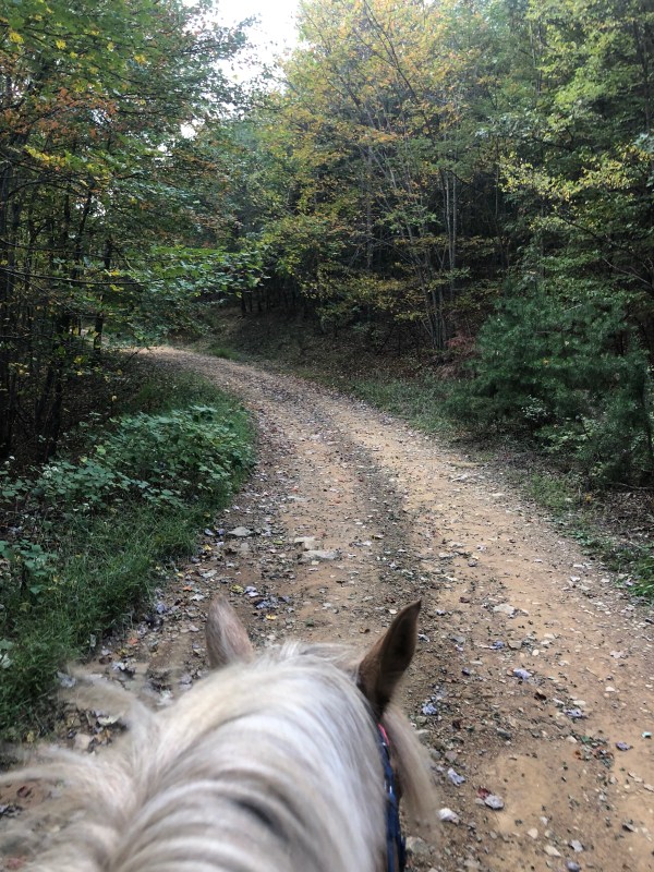
On Friday I got out of work a little early and I had just enough time to fit in a quick trail ride before dark. Score!
I drove up to Turner Run which was a bit sketchy driving in. It was slippery and a bit muddy for going up hill pulling a trailer so I used 4WD and made sure I kept going.
The fire road gate is open but I parked at the circle. Annoyingly the circle was overgrown and trashed making it hard to turn around.
I would not have been able to continue driving up the road passed the gate with the trailer this time. There were some wash outs and rather rough spots from all the rain. The truck would have been fine but not pulling a trailer.
Off we went enjoying the gorgeous afternoon. We got in some nice trotting and some leisurely walking.
And then it started to rain.
(Do bears poop in the woods? I am not sure about the woods but they do poop on the fire road)
And then the sky opened up and it poured.
It rained for a good half hour. Completely soaking us.
And then the sun came back out.
And the day became gorgeous again.
There were tons of old mushrooms along the way.
And some Berries.
And some amazing views.
We got in a few nice gallops and then enjoyed our time riding back to the truck.
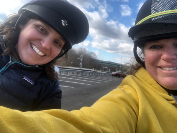
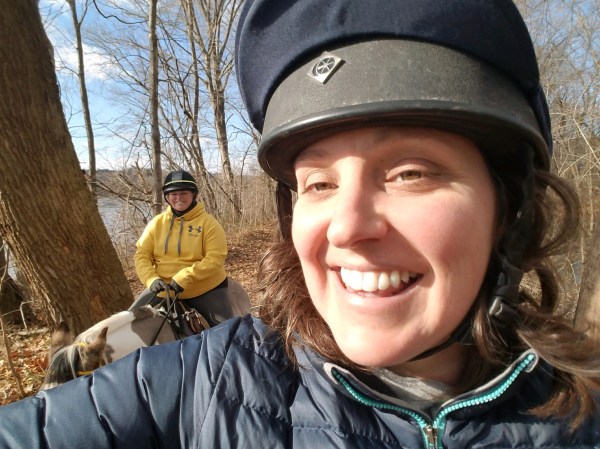
Sunday I went out with my local trail club, the Shenandoah Trail Riders and Horseman’s Association (woe that’s a mouthful) STHA, for a sweet four hour ride. I really enjoy getting out with the club but this is sadly the first time I have made a ride this year!
Excitingly this was a brand new location for me, over in the Strasburg area. I have never driven through this area non the less been here to ride, so it was quite exciting. It was easy to get to, not far off I81. I goggle mapped to Elizabeth Furnace Camp Ground, and then drove just past it to the next parking area on the right hand side.
The parking area has a loop drive and plenty of parking. We had quite a few rigs and all fit just fine with plenty of room to spare. I did note that the parking lot was in terrible shape and untended. I thought I was parked beyond the actual parking area and when I was messing around getting ready I noticed parking blocks lost in the depths of overgrowth, dangerously hidden from view as I nearly tripped over them on multiple occasions (glad my truck and trailer didn’t “trip” over them). I should have gotten a photo of the parking area, but as per my usual when I am riding with other people, I really sucked at getting photos.
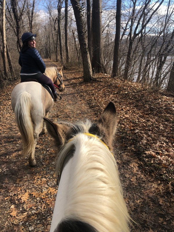
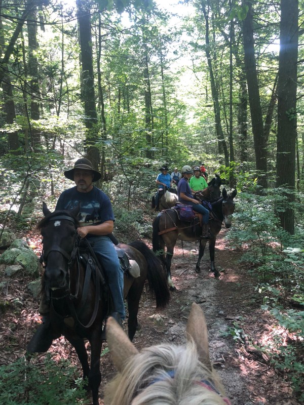
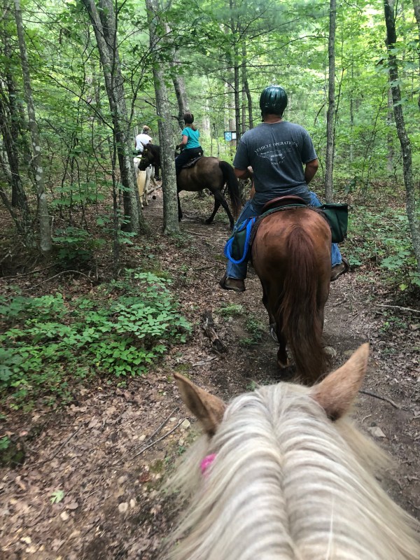
We left the parking area via a trail situated at the back of the parking area. If you were facing the parking area from the road the trail would be in the top left hand corner. This wrapped up through some woods and popped out on a fire road. I am not going to mince words at this point, and am going to be very to the point, I followed along and had a lovely ride but I paid zero attention to our trail. We were on and off of fire roads and trails and I saw some blue and orange (maybe) blazes and several signs telling us which way what trails were but I have no idea which trails we rode on. There were plenty of them though, and lots of options, and plenty of directions to go in. I did notice that one we were on and left crossed back over to another one we were on later. Two of our group broke off not too far into the ride and went a different way and met back up at the end. And when we got back someone else was parked with us and popped back out of the woods just behind us who was also out for a ride. Point being, I could not retrace this exact loop very easily, but there are a bunch of trails out there and with a map it would be an awesome place to spend some days exploring.
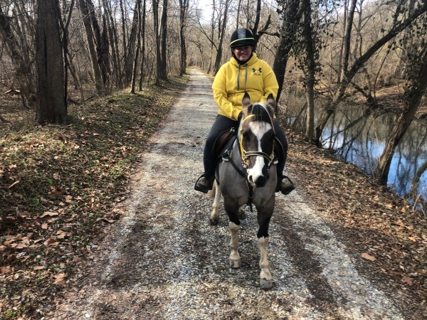
There were a couple creek crossings and lots of lovely scenery. It was a really pretty ride. There was a large log down at one point and Sharon, Mark and a few others quickly cut us a path around it.
In the photo above, that Mule is named Daisy. Very cute.
At one point the trail led through an old unused camp grounds. It was originally a workers camp, which I am already fuzzy on the details that were so kindly told to me. Please excuse anything inaccurate I relay, but I believe it was built in the depression era, by the ECW/CCC Roosevelt initiative to get labor forces working again, as housing for the workers. It was later used by the 4H, and I am told that Ellie can tell me all about that era of its use. Which I would love to know more about.
You can see several of the cabins still standing. It is so sad that it is all gone to disuse. I am sure it was a really neat little camp at one time.
and even a pool!
There is also a pavilion still there with the neatest roof inner structure.
Anyway, these type of over grown structures always make me think of all the – end of the world – books and movies. This area totally had that feel and would make for a good set for the Walking Dead or some such type of film.
We passed through this on the way out and the way back in, and over two little bridges. After a while we stopped for a nice little lunch break.
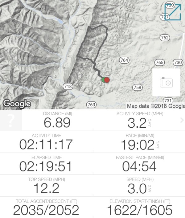
It was a lovely ride and a really good time. It clocked in at 13 miles on the nose and my tracker trimmed out the stopped time so we were moving for a total of 3 1/2 hours.
Simon was a little full of himself, which is quite out of character for him. I am attributing it to him being a only-pony these past two weeks and him being particularly excited to be with other horses. Normally this doesn’t excite him all that much but on this ride he was all full of it. Keeping up with all those gaited ponies he rolled into his little jog for some of the ride home. Not fast enough to do a posting trot and not slow enough to walk. For a non gaited pony he is pretty smooth, but he is not gaited. Note, I had on a really good bra.
I am hoping to make more club rides this fall. I really do enjoy them. Hopefully my games schedule will start to line up a little better with the STRHA schedule!
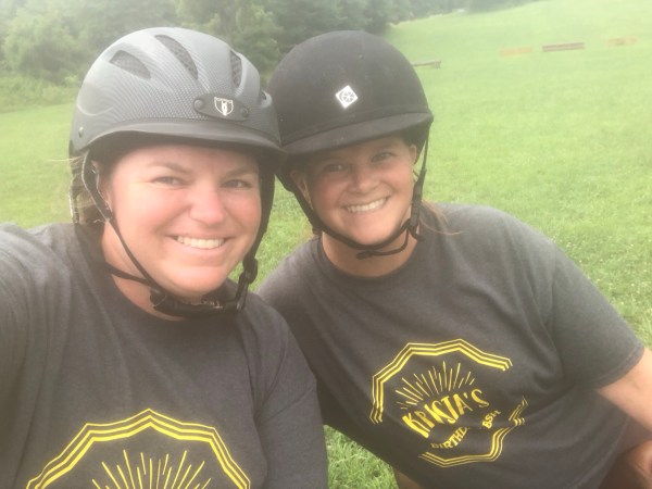
Saturday Val hosted a birthday bash competition in celebration of my 40th, and Sunday she met me back at the facility for a morning hack out.
We both rocked our Birthday Bash commemorative t-shirts she had made for everyone (FYI these are so comfortable).
This park has a ton of trails, and we hardly touched them. we mostly rode around the edges of fields. Lots of soybeans growing. We saw a ton of other riders out in small groups too. This is a very popular park. If I lived near a park like this I would certainly frequent it too.
The Woodstock Equestrian Park is in Beallsville, Maryland on Darnestown Road in Montgomery County making it a county park. It has a beginner-novice cross country course set up on six acres, a large 230×350 all weather arena, a gravel parking lot (actually two different ones) and 16 miles of trails through fields and woods and over bridges. This is all set up on 872 acres. People can use the park free of charge, and can also opt to rent out parts of it for exclusive use, like Val rented the ring for our use on Saturday.
The photo below cracks me up. We tried to get both of us and both ponies in the same shot. Our three faces make me laugh.
Val and I had a nice leisurely ride. We discussed the need for more one day games events with a competition setting. Lots of deep games talk.
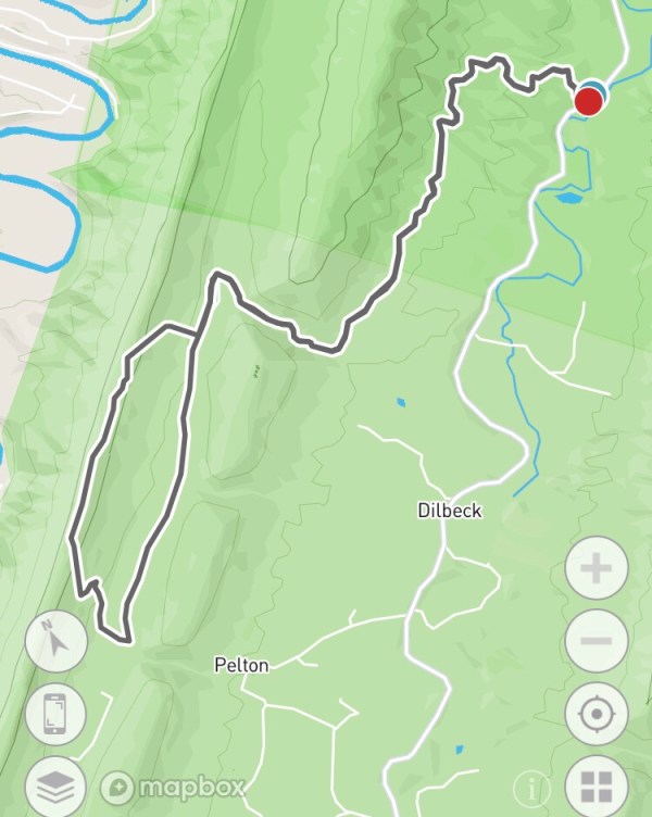
Since my competition was cancelled this weekend due to the massive amounts of rain we have been getting, and Sunday was the first clear day in a week, I needed to get on a trail. I decided to go south to Augusta county since they got less rain. I also wanted paved parking and an area that I expected to have drained well. So I decided on Bear Trap. I have not been here in years but it was one of my favorite places to ride at one time. There are tons of side trails to explore and plenty of rolling fire roads.
Parking: from North River Rd make a right onto Bear Trap Road. Maybe a half mile up the road on the left hand side is the entrance to 536. In the winter the gate is closed, but the gate was open today. It’s still easy parking across from the entrance on the shoulder of the road. I include the turn and parking on the video in this post.
This is a nice area to ride. It drains well and is lightly frequented. I have seen another person here a few times but not very frequently. I have run into Bear here. One time in particular was during a very dry summer when everyone seemed to be running into Bear, assuming they were coming down more in search of water. I ran into three Bear on one ride. The first was on the ridge top. The second was on the trail back down and the third was on the fire road back out and she had two cubs with her. It was a very memorable ride.
This location also has a lot of mushroom growth in the spring and fall. Lots of colorful jack o lantern mushrooms! Very pretty to look at (but not eat). I have also seen more than one turtle here.
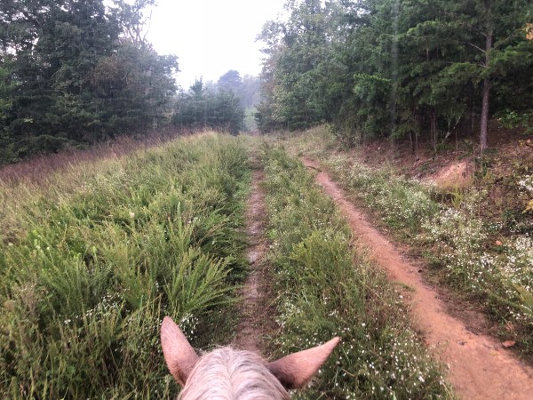
For today’s ride, I decided to do the loop. This runs about 7 miles, is rather slow going, but has a big climb.
Ride in along the fire road, which is nice to move out on. Is smooth and well maintained. The gravel is not too big or bumpy. No bad washouts.
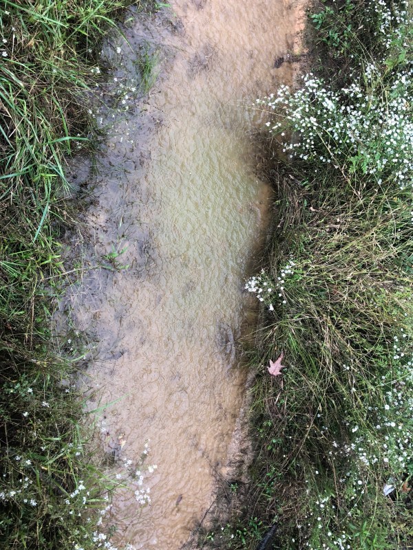
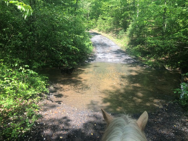
About a half mile in there is a creek crossing. It was pretty average for this time of year considering all the rain we have had. I expected it to be deeper.
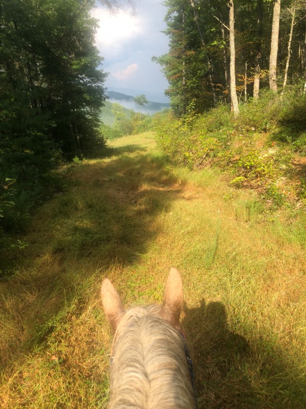
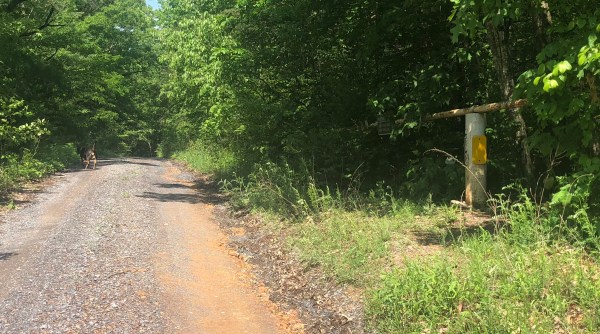
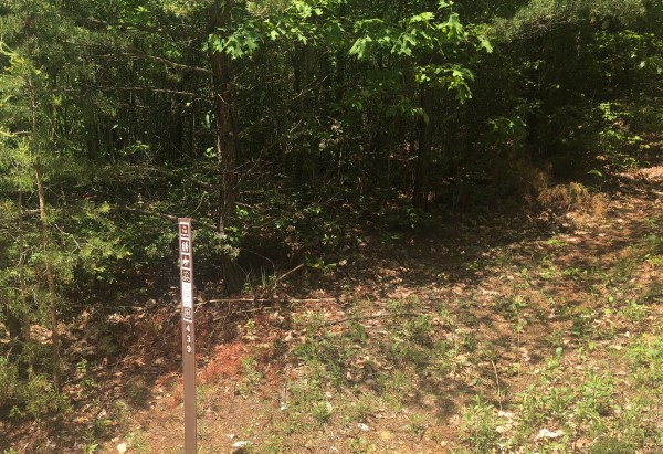
At about a mile in there is a specific turn off for the loop. It is pictured above with the sun glinting down on it.
Straight ahead here – the left hand side of the fire road. Today there was an old metal trashcan there.
Years ago I called and asked the Forest Service about some of the side trails in this area and I was told that these are old logging roads that have grown back. I was encouraged to enjoy them, ride out on them, but know thy are not maintained. Some are still marked on maps and some are not. Which can be confusing. In this area there is on on the left we already passed that is marked on the map that is not there.
This is a well used bit of trail. It is a bit uphill but not bad. After a short while it comes to what was probably the end of the logging road. Or more likely a circle, parking area. There are two old parts going left and right that I have ridden in the distant past, but for the loop we want to go over the berm and up the hill. This is where the climb begins.
The last time I was here this circle area was more of a clearing than it is now. The under growth has taken over more in the past few years and it takes a tiny bit of imagination to picture the “circle” part.
Up and over the berm and up the climb. It is still a pretty established trail, easy to follow and clear. And it is a good workout. Simon needed to stop and catch his breath.
I came down it once and it sucked. I got off and hiked, meaning slid down. I did not enjoy it.
At the top, the trail runs into a ridge top trail running perpendicular right and left. For the loop we want to head right. There used to be a very clear mark on the tree ahead to help mark the turn from the other direction, for those going down, but it was mostly washed away now. I wonder if this is a less traveled trail these days. The turn to the left looked pretty over grown too.
The ride from the fire road to the top of the mountain was just about .9 miles I believe. I call it out on the video.
Off to the right it starts off a bit over grown here too. Luckily it clears out after a bit and there were no downed trees to obstruct the path, but there were some branches in the way.
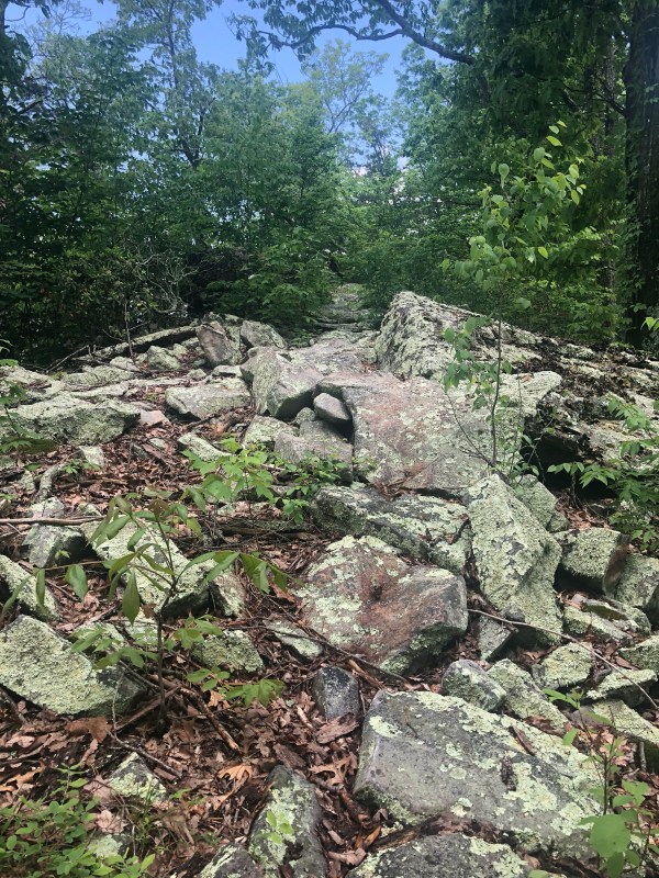
Not too far on there is a rocky area. I used to ride below it easily but it is much over grown below it so I dismounted to check it out and decided to lead Simon over it instead. It’s very short and not that bad at all. I could have stayed Mounted. Honestly I was more likely to fall leading him than the danger being on his back would have posed. I did video this bit and purposefully did not replay it before loading it here.
Most of the trail is like the photo above. Simple. A bit tight, with a few knee knockers. But mostly clear of over growth. Some rocks but not bad.
Eventually it spills out onto the fire road. Going left heads up to the picnic area by the cell phone tower. Which is not far at all. The new 432 is also just to the left as well.
For this loop we turn right and go just a very short ways down to pick up 439 on the right. It’s down hill, slightly steep at first and then less so. It was also a bit over grown at first and then cleared.
Nothing too impressive along here.
It pops back out on the fire road and we make a right. Of course left is another option for miles and miles of fire road.
This is still a nice bit of fire road, with an easy to set good rolling pace. The creeks on the side are generally dry in the deep summer.
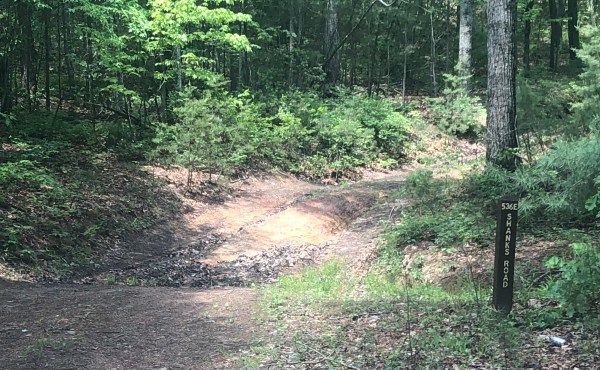
The only true fire road turn off you pass is on the right, 536E Shanks Road. But there are tons of unmarked trails. Lots of exploring out here. I remember that’s why I loved this area so much. But I am not as excited about this loop as I used to be.
and eventually back out to the road where parking is. Then drive straight ahead and the road wraps on back out to North River. Simple.
It was a nice ride. And if I lived closer I would enjoy exploring here all over again. But it’s a bit far now so I’ll keep exploring the areas out my way.