
May 22, 2018
Since my competition was cancelled this weekend due to the massive amounts of rain we have been getting, and Sunday was the first clear day in a week, I needed to get on a trail. I decided to go south to Augusta county since they got less rain. I also wanted paved parking and an area that I expected to have drained well. So I decided on Bear Trap. I have not been here in years but it was one of my favorite places to ride at one time. There are tons of side trails to explore and plenty of rolling fire roads.

Parking: from North River Rd make a right onto Bear Trap Road. Maybe a half mile up the road on the left hand side is the entrance to 536. In the winter the gate is closed, but the gate was open today. It’s still easy parking across from the entrance on the shoulder of the road. I include the turn and parking on the video in this post.
This is a nice area to ride. It drains well and is lightly frequented. I have seen another person here a few times but not very frequently. I have run into Bear here. One time in particular was during a very dry summer when everyone seemed to be running into Bear, assuming they were coming down more in search of water. I ran into three Bear on one ride. The first was on the ridge top. The second was on the trail back down and the third was on the fire road back out and she had two cubs with her. It was a very memorable ride.
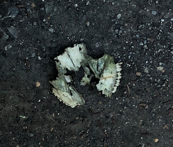
This location also has a lot of mushroom growth in the spring and fall. Lots of colorful jack o lantern mushrooms! Very pretty to look at (but not eat). I have also seen more than one turtle here.

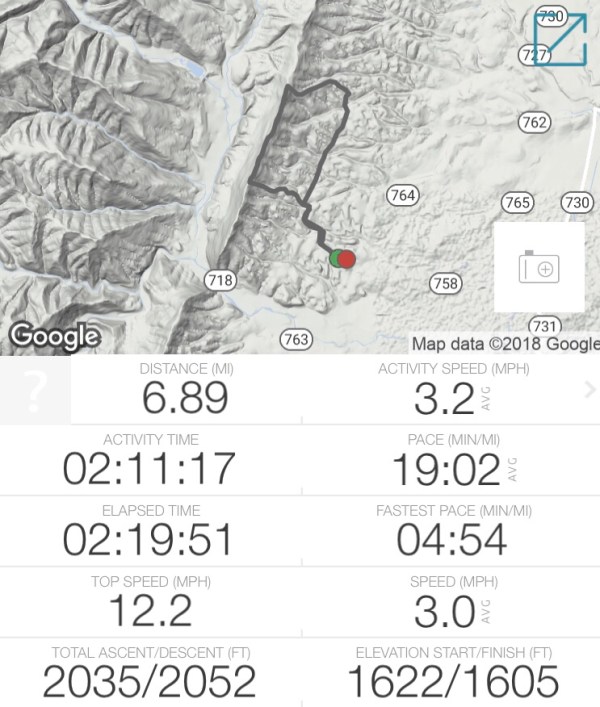
For today’s ride, I decided to do the loop. This runs about 7 miles, is rather slow going, but has a big climb.

Ride in along the fire road, which is nice to move out on. Is smooth and well maintained. The gravel is not too big or bumpy. No bad washouts.


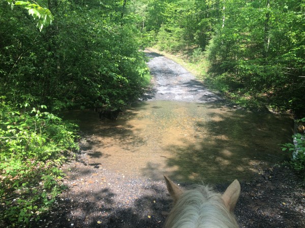
About a half mile in there is a creek crossing. It was pretty average for this time of year considering all the rain we have had. I expected it to be deeper.

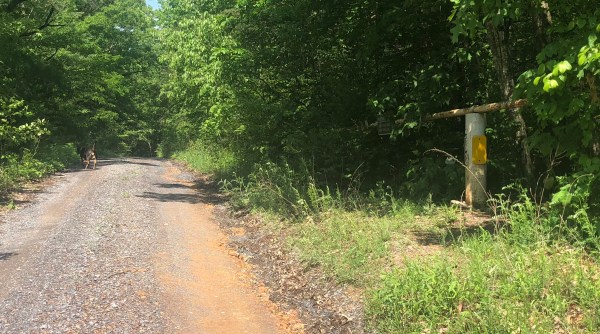
At about a mile in there is a specific turn off for the loop. It is pictured above with the sun glinting down on it.
Straight ahead here – the left hand side of the fire road. Today there was an old metal trashcan there.


Years ago I called and asked the Forest Service about some of the side trails in this area and I was told that these are old logging roads that have grown back. I was encouraged to enjoy them, ride out on them, but know thy are not maintained. Some are still marked on maps and some are not. Which can be confusing. In this area there is on on the left we already passed that is marked on the map that is not there.
This is a well used bit of trail. It is a bit uphill but not bad. After a short while it comes to what was probably the end of the logging road. Or more likely a circle, parking area. There are two old parts going left and right that I have ridden in the distant past, but for the loop we want to go over the berm and up the hill. This is where the climb begins.

The last time I was here this circle area was more of a clearing than it is now. The under growth has taken over more in the past few years and it takes a tiny bit of imagination to picture the “circle” part.
Up and over the berm and up the climb. It is still a pretty established trail, easy to follow and clear. And it is a good workout. Simon needed to stop and catch his breath.
I came down it once and it sucked. I got off and hiked, meaning slid down. I did not enjoy it.

At the top, the trail runs into a ridge top trail running perpendicular right and left. For the loop we want to head right. There used to be a very clear mark on the tree ahead to help mark the turn from the other direction, for those going down, but it was mostly washed away now. I wonder if this is a less traveled trail these days. The turn to the left looked pretty over grown too.

The ride from the fire road to the top of the mountain was just about .9 miles I believe. I call it out on the video.
Off to the right it starts off a bit over grown here too. Luckily it clears out after a bit and there were no downed trees to obstruct the path, but there were some branches in the way.
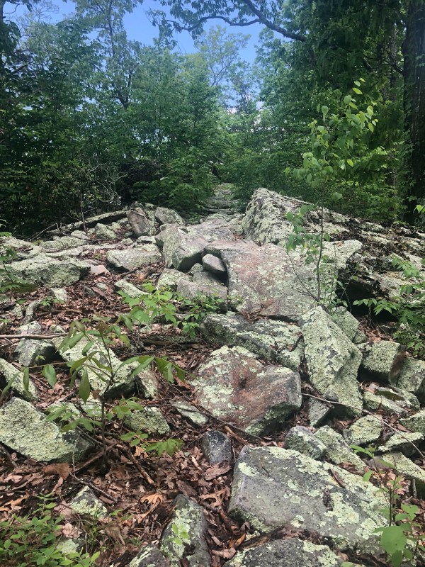
Not too far on there is a rocky area. I used to ride below it easily but it is much over grown below it so I dismounted to check it out and decided to lead Simon over it instead. It’s very short and not that bad at all. I could have stayed Mounted. Honestly I was more likely to fall leading him than the danger being on his back would have posed. I did video this bit and purposefully did not replay it before loading it here.

Most of the trail is like the photo above. Simple. A bit tight, with a few knee knockers. But mostly clear of over growth. Some rocks but not bad.

Eventually it spills out onto the fire road. Going left heads up to the picnic area by the cell phone tower. Which is not far at all. The new 432 is also just to the left as well.

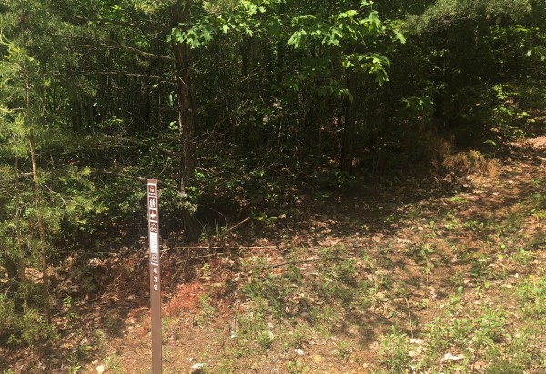
For this loop we turn right and go just a very short ways down to pick up 439 on the right. It’s down hill, slightly steep at first and then less so. It was also a bit over grown at first and then cleared.

Nothing too impressive along here.

It pops back out on the fire road and we make a right. Of course left is another option for miles and miles of fire road.
This is still a nice bit of fire road, with an easy to set good rolling pace. The creeks on the side are generally dry in the deep summer.

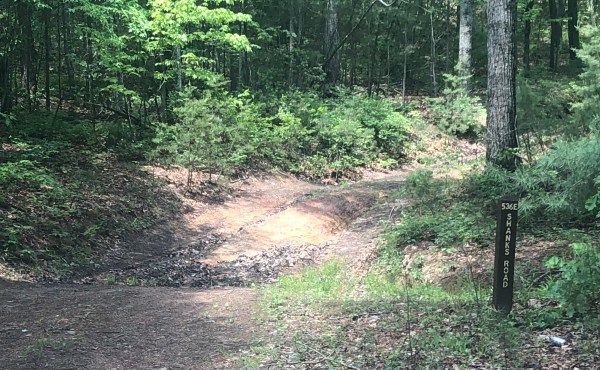
The only true fire road turn off you pass is on the right, 536E Shanks Road. But there are tons of unmarked trails. Lots of exploring out here. I remember that’s why I loved this area so much. But I am not as excited about this loop as I used to be.

and eventually back out to the road where parking is. Then drive straight ahead and the road wraps on back out to North River. Simple.
It was a nice ride. And if I lived closer I would enjoy exploring here all over again. But it’s a bit far now so I’ll keep exploring the areas out my way.
Video part 1/2
Video part 2/2
