
April 3, 2015
*My tracker cut off and did not get my entire ride back in the below images.

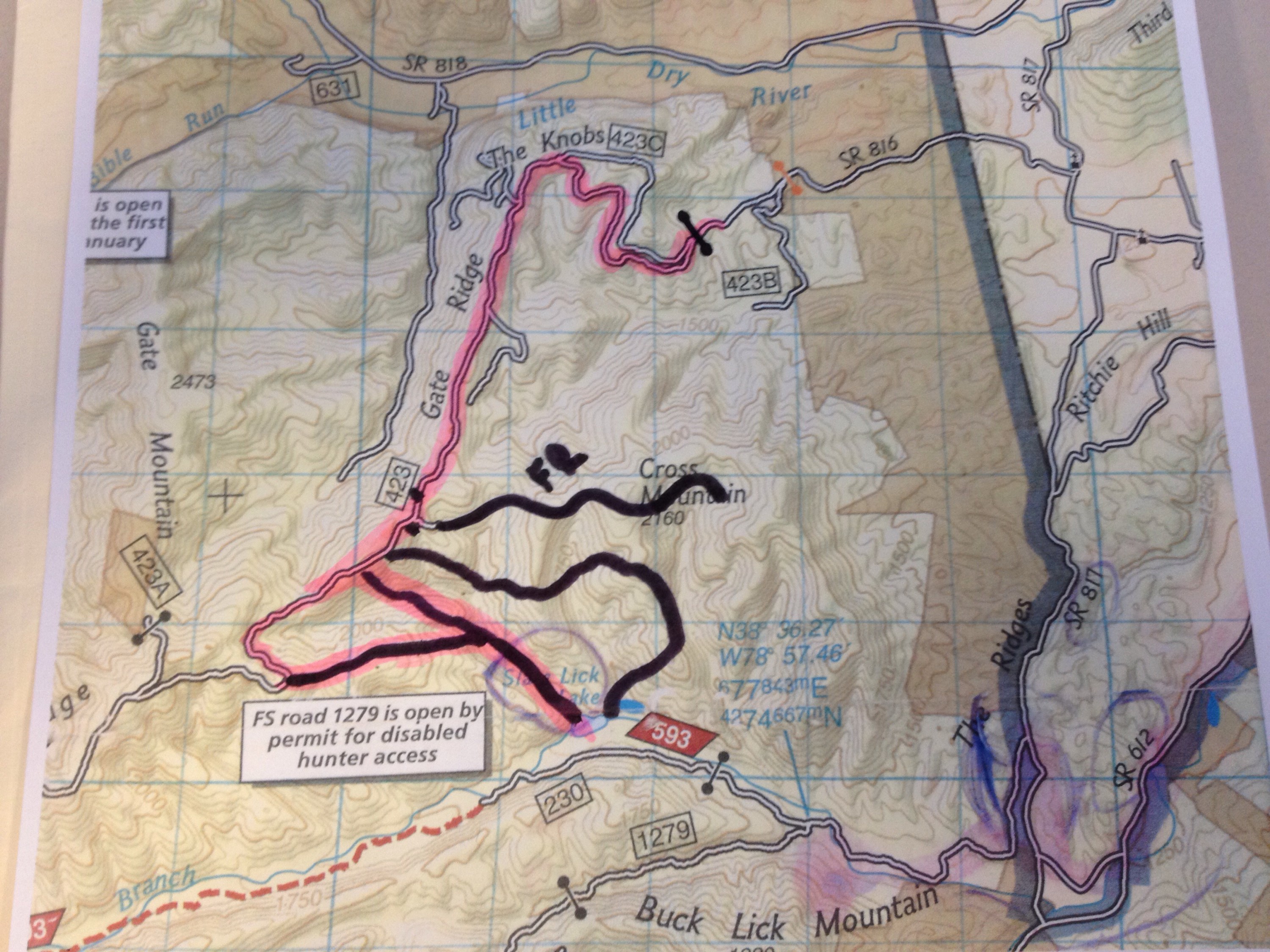
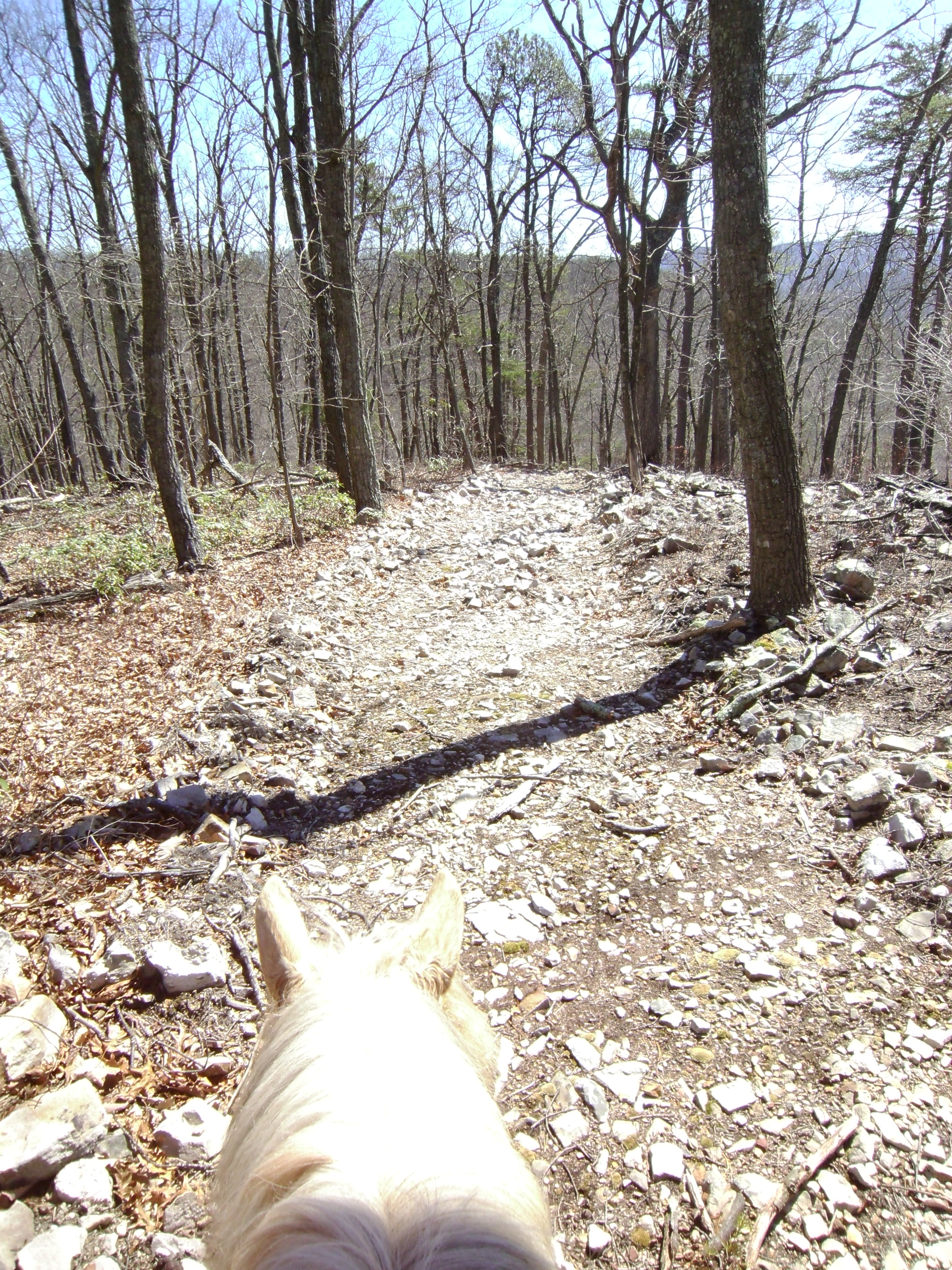
Last Sunday I went back to Turner Run and checked out a trail I have been wanting to follow. It appears to have been a fire break, with burned forest only to the right hand side of it, and is wide and clear and rather new. It is rocky and goes steeply down for a while. It eventually starts to level out and then comes to an extremely vertical down at a creek bed. The down is only about (if memory serves me – curse my waiting nearly a week to write this) two pony lengths long and ends on a flat creek side.

Once down the bank onto the creek side you have two options.
1. Cross the creek and follow the lovely trail to the right. I did this first.
2. go left and cross the creek and then up the hill. I did this a bit later and will add details later.
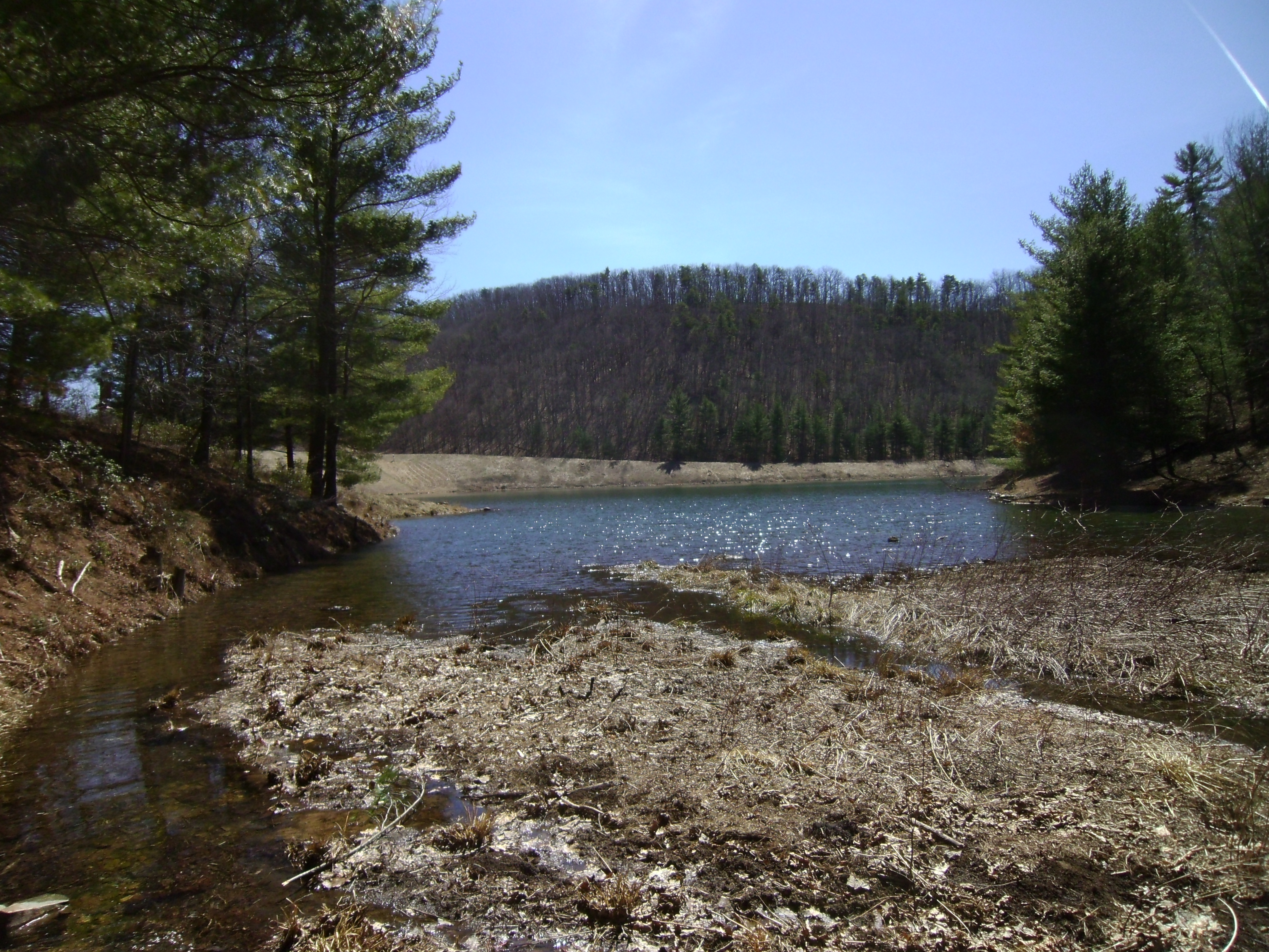
So going across the creek and heading left is a nice, well used trail. It will split just a little ways up, and although going straight (a little to the left) is possible, this trail is older and mostly sucked with downed trees. It was clearly more used angling to the right. The trail crosses the creek a few times and eventually pulls up behind Slate Lick Lake.
There are a couple markers from out by the lake (in the open grass field that is to the left in the second and third photos below).


I turned around and headed back to OPTION 2! Along the way back you can see a trail rather clearly on the other side of the creek. And again, I did investigate and it sucked. But have at it if you want, I certainly didn’t explore all of it.
So back to the creek bed where you were faced with two options, left and right. Heading right is a bit more of a blind start to a trail, although there are some pink marking tape up, you go into the creek, walking just a bit up it and then cross the it and go up the hill. There is another lovely trail, with pink tape markets along it that follows the creek.
Both trails had plenty of foot and hoof traffic evidence.


I rode this for a while, going slightly up for the majority. At a few points the trail was a bit hard to see when it crossed the creek but looking for a pink marker tape helped out. Finally it did seem like it was petering out, and I was down in a deep creek ravine. I think I must have missed the trail at that point, but I new we were super close to the fire road. So I climbed Simon up a hill and we went a just a little farther up, and the fire road was just a head. the final few lengths were extremely steep, and I would not attempt to ride down there, but it popped up onto the fire road.
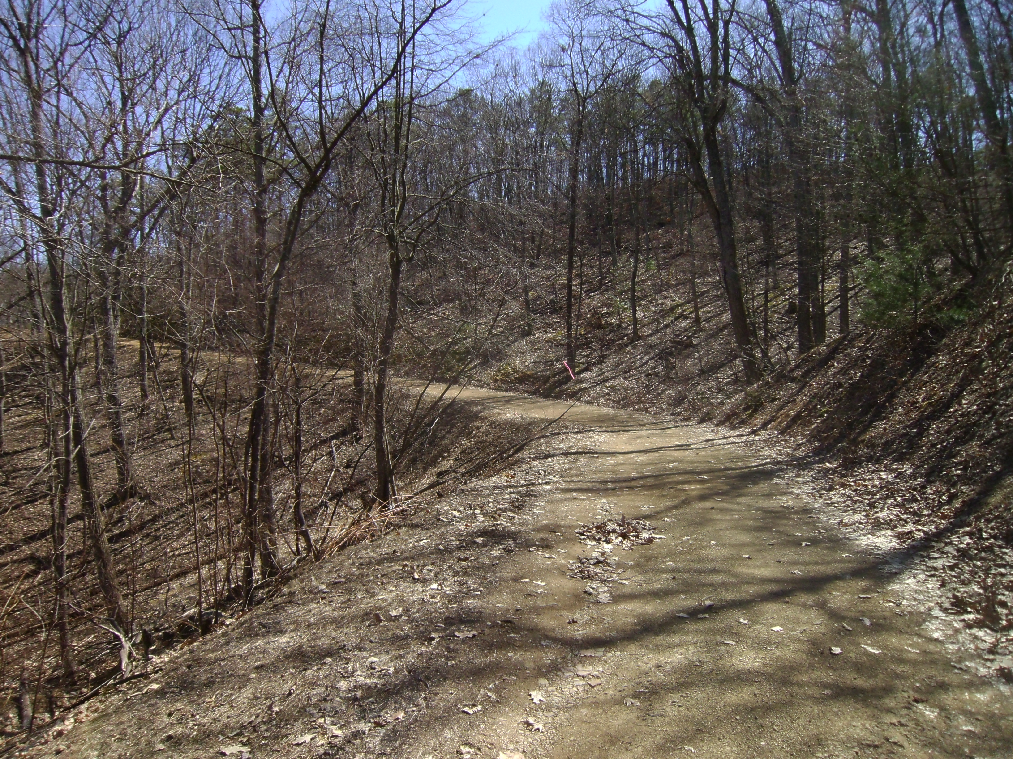
At this point I remember from a previous ride seeing a pink flag tied to a fallen branch of the side of the road, but it didn’t appear to lead any where. This is where it popped out.
I took the photo below while riding away. If going up the fire road the flag is on the left right where the road bends. If you look hard you can spot it in this photo.
It was a pretty cool trail, both down and up and it being a loop to the lake and back is pretty neat too. I think my choice for a future ride will be to take the first trail on the left, the one I rode on a week or two ago that starts out the back of a graveled pull off on the left of the fire road, and then coming back up either of the two trails I did on this ride.
This particular ride was about 11 miles, and I did do a bit of wondering and exploring on the bottom. It would probably be more like a 9-10 mile loop without any detours.
