February 21, 2017
Today I went to Blue Hole, turned around at the end where I normally park, and then drove back, over two cattle grates and just a bit past the 302a disabled hunting access branch (which is on the left as I drove) and parked on the left side of the road.

I headed back down the road and started up 302a (now on my right), around the closed gate, and continued on.


I stayed straight to the end of the fire road, close to 2 – 2.5 miles, where there is a brown wooden post to prevent 4 wheeled traffic, and on up the trail that continued. Off to the left is a big field to explore at a later time.

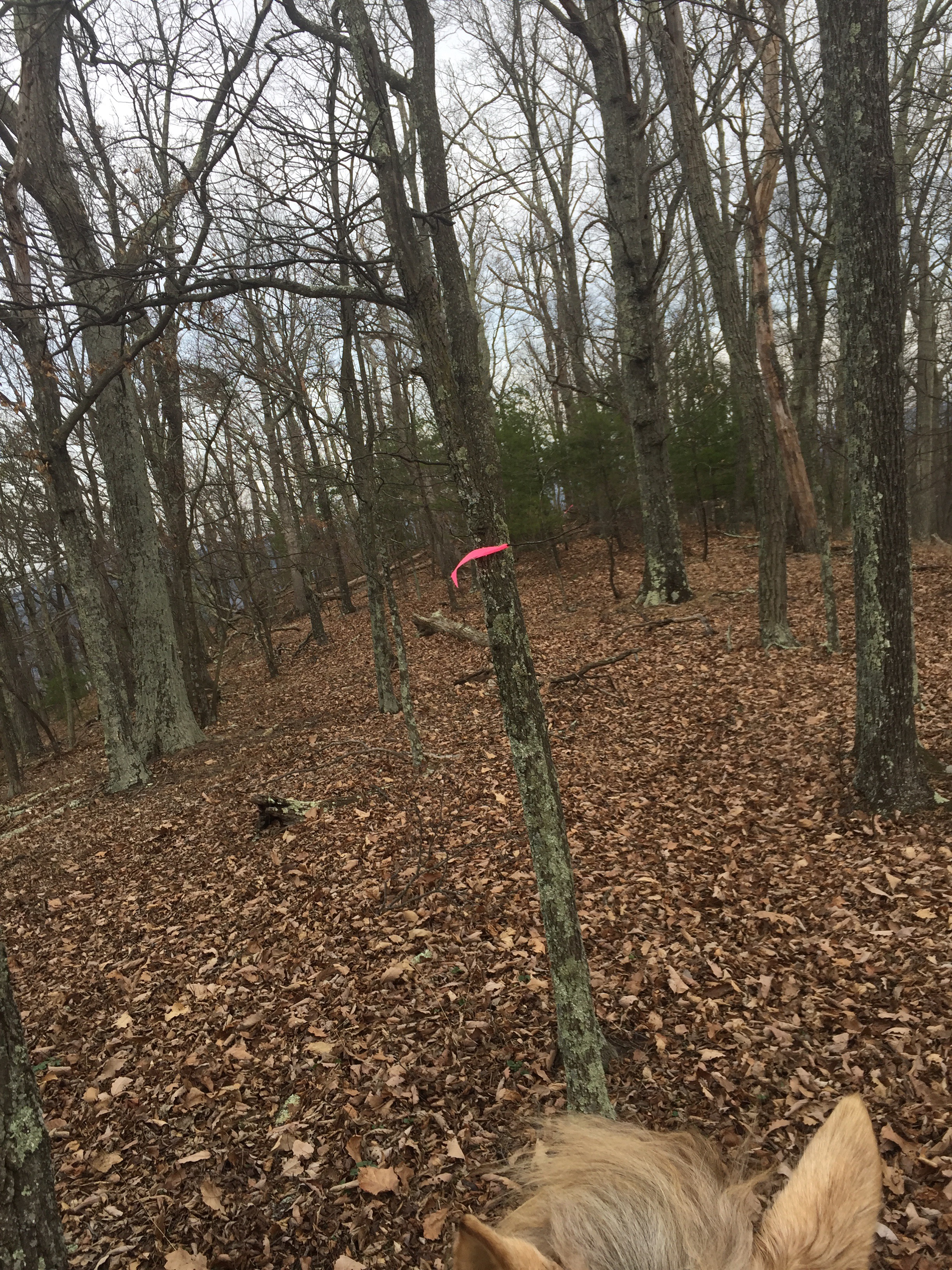
The trail ended or I could have just lost it. It was pretty clear right up to the end, and I did see old hoof prints. I also saw some old blue blazes and some pink flags that looked pretty new. It ended right around 3.2 total miles at this point. I turned around and started back. Then I went up hill to the left following pink tags, up to the top of the hill, and onto an actual trail running along the top.
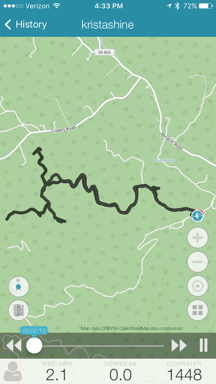
On this map below – I entered the map from the top right corner, on the FR at that point, and I rode up, taking the top where the black line splits. This is where the FR ends. I continued straight on the top line, and down the map and ending on the line on the right hand side of the map.
I turned around and rode back to the branch off to the left. This is the big hill that the pink flags go up. The path at the top went in both directions but the short branch is where the trail fades out. The other direction kept going with nice views on both sides, well flagged in fresh long pink tape, and a worn path. The leaf litter did get deep in places and made following the trail tough in a few points. But really, this trail has been groomed.
Looking again at the zoom in of the map below, I suspect it meets up with the trail marked in the light red dashes just below the black line.

When I lost the pink flagged trail I turned around and followed it back to the main trail and continued back towards the fire road. There is one spot that there is quite a bit of downed trees on this trail. A path has been cleared for all but one, that seems rather fresh. Right around this are is an old FR or logging road going down to the right. The entrance has a screen of trees over it but beyond it is perfectly clear, and a closed fire gate can be seen. I went down this road. Of course.
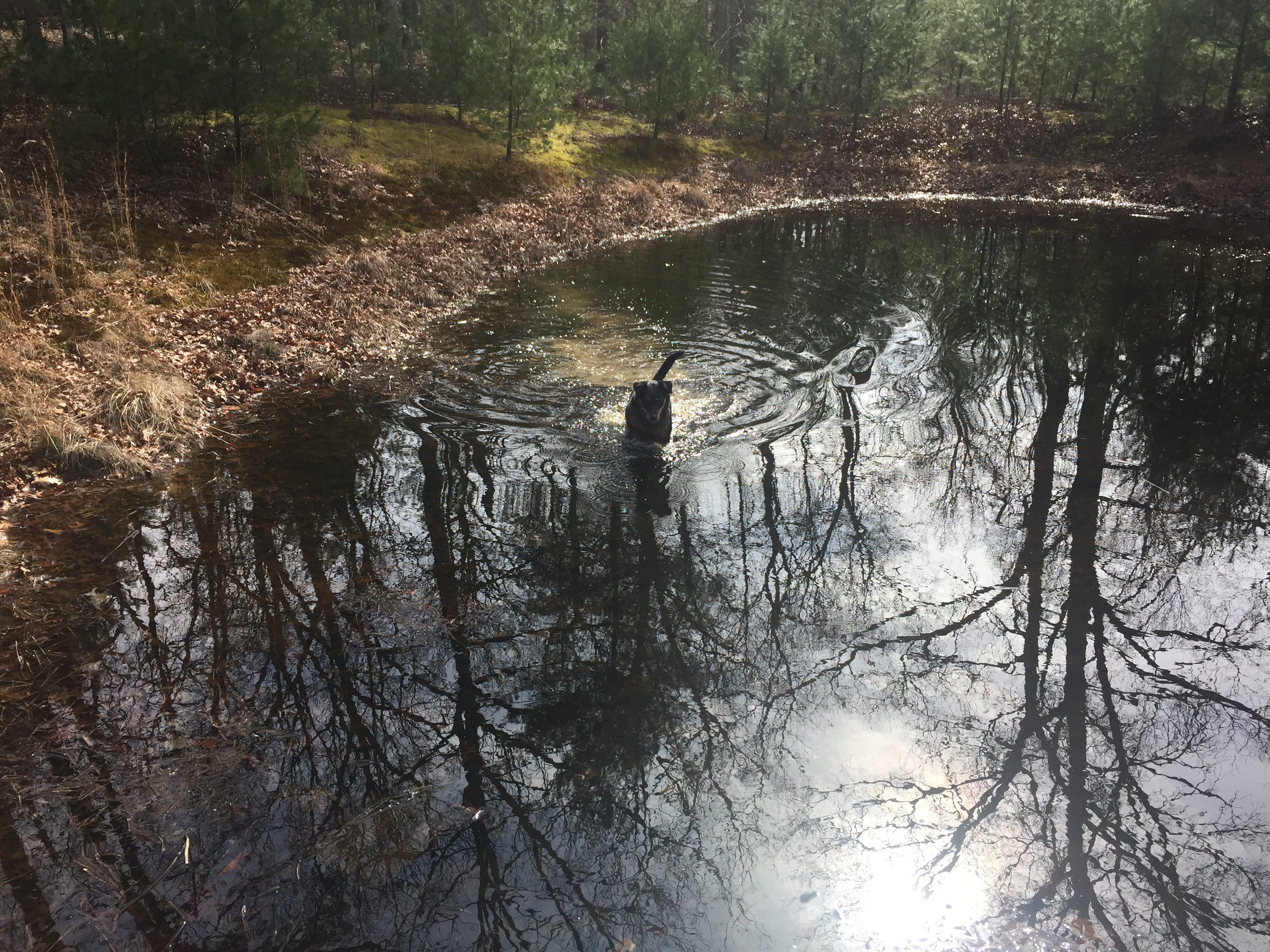
It was cleared, and still nice and wide, although at one point the leaf litter was up to Simons chest. He seemed to enjoy this. I rode it down till it leveled out at a camp type circle and a pond. The road goes off left and right and appears to continue straight as well. I went very briefly left and right and then turned around and headed all the way back to the trailer.
Duh I am super excited to explore more here. There are close to a dozen fire roofs, old logging roads, and what appear to be trail heads along this ride from today that I did not check out. You can look forward to some more exploring over here.