Trail Report: 1117 Old Man Run/Tom’s Park 4/5/2020

April 7, 2020

I had a lot of work to do Sunday and not much time for a ride but I needed a metal break and some exercise. So I went out early and did a quick spin. *sorry Carol Ann, Ill make plans with you when I have a bit more flexibility.

I went to Tom’s Park off Little Dry River Rd. To park I pull just past the first turn (still in sight of Little Dry River, back into the turn and then pull around. I can easily do it in one back with room to spare with my two horse. Then I pull to the right facing out at the pull over. There is easily room for two of me nose to tail in the pull over.

I headed up the fire road 1117 Old Man Run. It’s a bit over a mile to the split in the fire road. I hung a left and wrapped up and around.

After a bit (about two miles in) there is a closed fire gate.

Continuing on it is a nice grassy/leafy fire road, clear and rolling. Very nice for changing paces.

It flows out around a few view points.

It crosses the tower lines a few times before ending at the lines. It’s sort of a hard end.

It’s just shy of four miles in and four miles out. And pretty easy grade. No big climbs or super rocky areas.

Trail Report: Vepco Rd/240E Kritchie Mountain 3/13/2020

March 15, 2020

My tracker did not work properly back here and kept cutting off. There is no cell service here so I assume that is why. I tried to draw in a very rough yellow line adding where I rode to the trackers line.

Friday I was out of work in time to fit in a quick ride so I headed down Little Dry River Rd until it turned to gravel, then I made a left onto FR240 Vepco Rd. They have been cleaning up this road which was already in rather good condition. I took note that the FR branch on the left looked well cleared and I want to ride that next time. I don’t think it is terribly long so might be best for a day with limited time. Last time I rode it I believe it was so overgrown I turned around and drove to a different spot.

I drove up to the first right hand fire road, 240E Kitchie Mountain. This turn off has a loop but it’s always full of dumped trash and is awkward so I simply pull past the entrance and then back in and park on the side rather than pull in and use the loop. There’s plenty of room for this even with a larger rig.

I rode out past the closed fire gate and along the fire road. It did not appear to be recently used although it must have been, which I’ll discuss further into the ride.

Normally I bare left at the split. I did go straight several years ago, there was a tree down that was easy to navigate but the trail became over grown (these are old fire roads). Today I decided to check it out and found the downed tree moved and the path much improved. It did not appear to be cleared for vehicles but it appeared to be cleared for hiking. It would make a nice hiking trail. It’s not too steep at any point and the trees and such vary in type.

Do be aware that this area does have thorn trees. These are the ones that look like normal trees, so perhaps you reach out to push a branch and find yourself stabbed by large thorns.

The trail continues and I found a few downed trees that were no issue for on foot traffic. I dismounted at the second one and Simon sort of jumped it. A larger horse that is trail smart would probably be fine. But it was maxing out Simon’s height capability. The drop off to the side was pretty intense and the ground was soft and crumbly so a little sketchy. But I still felt comfortable progressing.

The trail wrapped around for a while and there was a few evident old turn offs that did not appear to be cleared. Eventually the trail just sort of disappeared so I turned around. I estimate it was a little over a mile in from the split and a mile back. It was also walking pace because of the narrowness of the trail. Watch your knees.

I returned to the split and took the normal left hand path (now to my right). This fire road is pretty open and clear and wraps down and around. Eventually I came to a cut in the ground. It appears the covert is being changed out. It was dug out and a piece of a new one is in there along with a piece of the old one. Just on the other side is a righthand turn up the mountain that I had once taken. I was hoping my tracker would show this meeting up with the branch I took earlier. But my tracker did not show anything.

I turned around and headed back letting Simon trot up the few miles of mountain and returned to the truck.

Trail Report: Massanutten Visitor Center – Wildflower Trail

March 6, 2020

Last Friday I managed to get out for a nice little ride through the woods.

I parked at the Massanutten Visitor Center and headed down the Wildflower trail to the closed picnic area, then followed Orange to Pink blaze and enjoyed a leisurely ride.

Last time I rode this way I had to turn back at some heavy downed trees completely blocking the way. That was probably a year ago and they were clear and there were no obstructions.

I got out to Turner Run in early February but did not record it here. It was a nice ride and I took the left hand old fire road back. It did require me to go off trail and slide down and climb up a rather steep bank to get around a down tree. Which I believe was there the last time I took this path. But was otherwise decent.

Trail Report: Edinburg Gap 12/22/19

December 25, 2019

Jenny and I met back up at Edinburg Gap. Our significant others brought their dirt bikes and took a tour of the area while we rode out.

We parked at the East if the two parking lots, this is the one with the big loop and the toilet. We decided to check out the chaotic looming area of mush mashed trails to the right on the map (all the 553 trails).

We had limited time for this ride because of a pending afternoon appointment so we could not run over. We also met up with the guys a little ways into the ride and spent a bit of time chatting, which killed some more of our time.

Like last time we rode out on 493 at the bottom of the parking lot, crossed the creek, and this time we made a left onto 494. This trail co ti yes to be pretty dang rocky and ride along the woods parallel to the road and meets up with the trails at the other parking area, the 553 trails.

Although it’s rocky getting over there, with lots of nice big icy puddles to navigate, once to the other side the trails are nice and smooth and pretty wide. Some areas were plenty wide for four wheelers to pass each other. We zipped around here for a bit, mostly checking the area out.

E headed back a tiny bit early, not wanting to risk being late. The trail 494 connecting the shirt part of 493 that connects the two parking areas took us about 15-20 minutes to navigate on the horses.

There were some bridges to cross. But no big climbs or big hills.

Another lovely ride.

Trail Report: Edinburg Gap 12/15/19

December 24, 2019

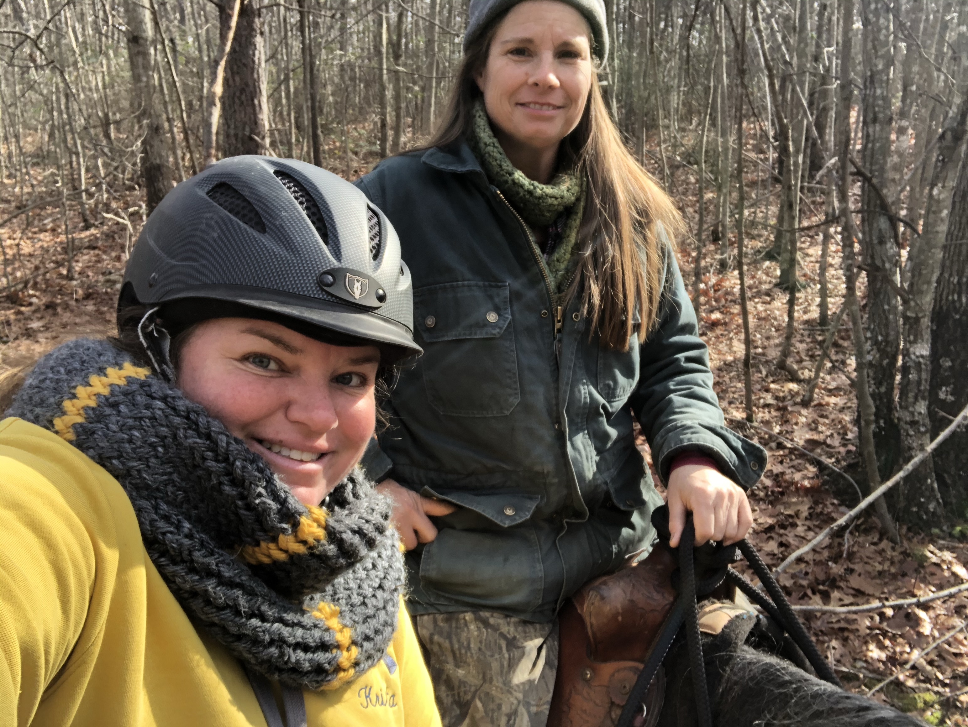
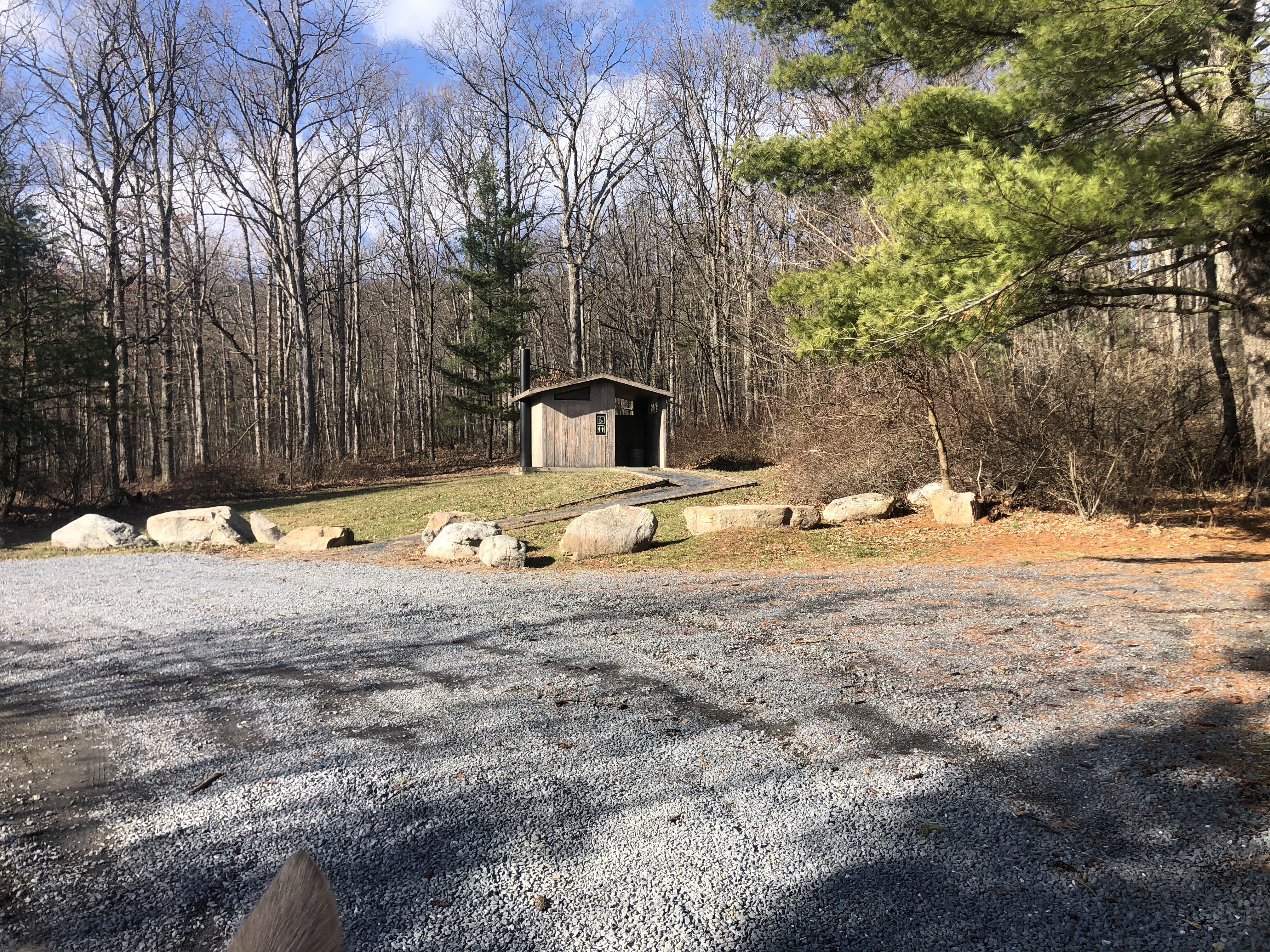
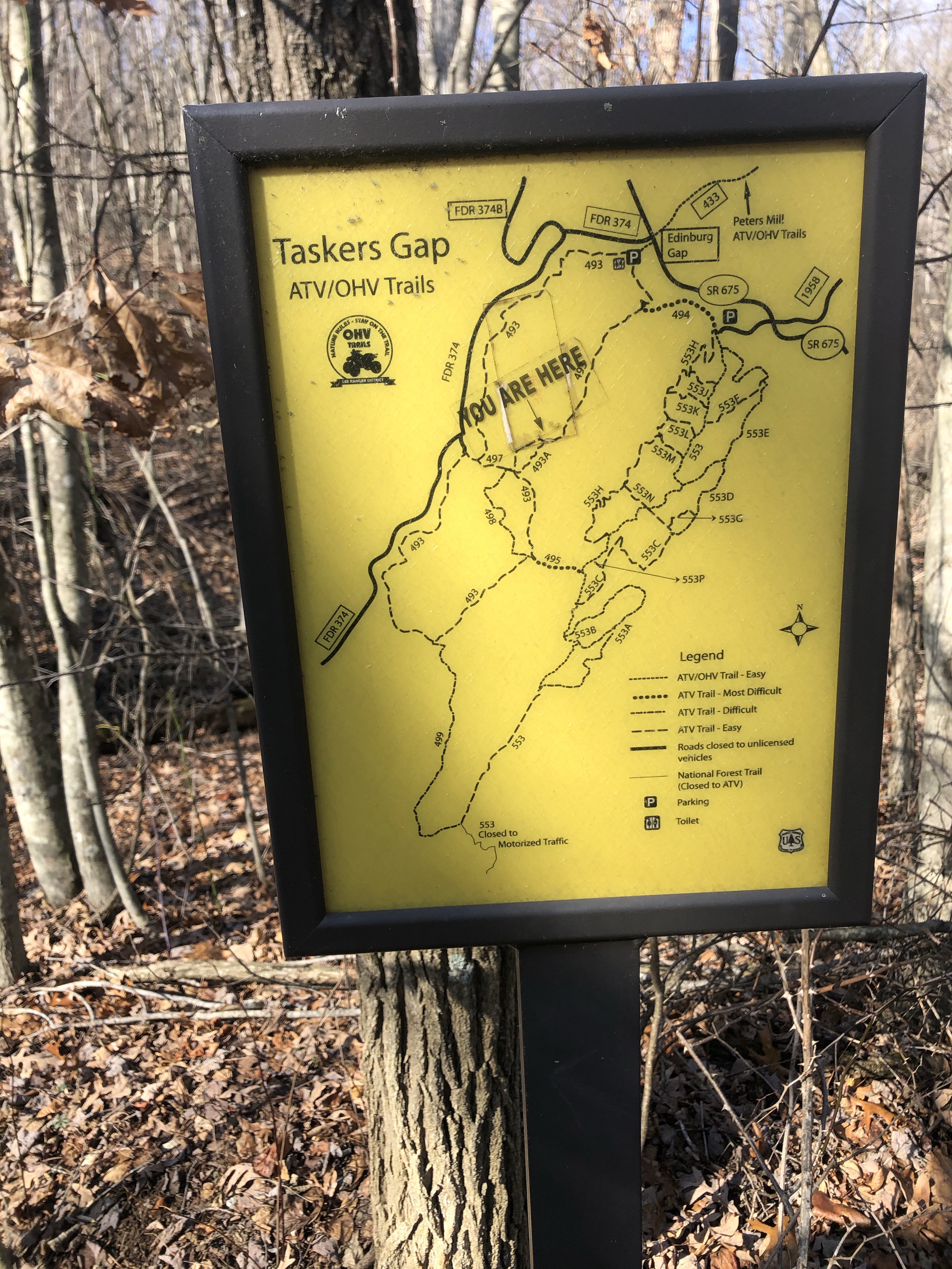
Jenny and I were looking for a place to trail ride sort of between us and we decided to check out the Edinburg Gap area. It has a lot of ATV trails which are also open to horses. There are two parking areas, one with a big loop, tons of parking, and even a toilet.

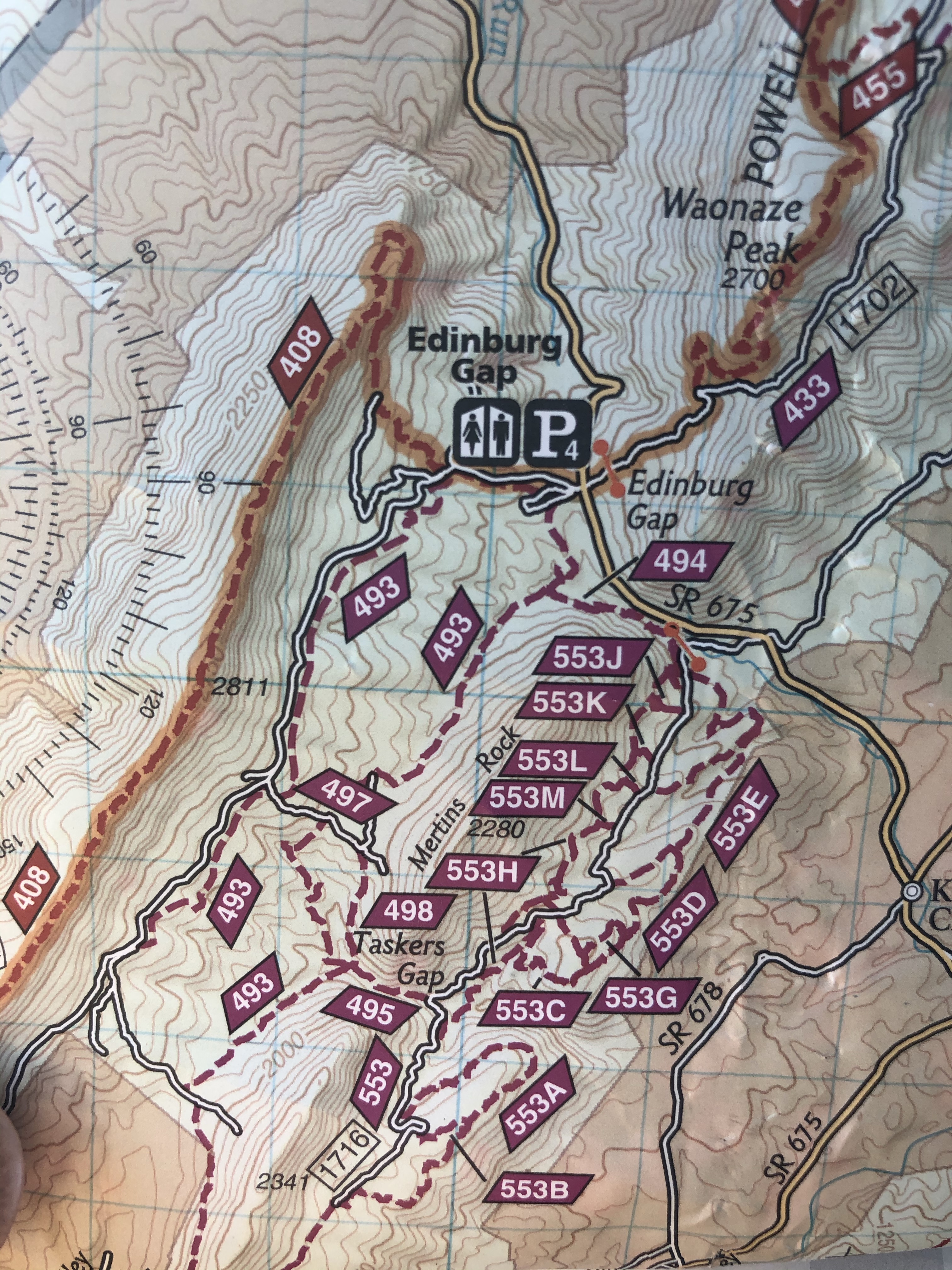
Look at all those trails. Tons of them. We parked at the lot to the west (where the toilet sign is in the image above). The other lot (where the P is in the image above) it just a little further East along the road. It also has a lot of parking and room to turn around but if it’s a particularly busy day a trailer could have some difficulty.

There is a rather rocky trail that connects the two parking lots. There are also trails across the road. Lots of options.

Below is a quick clip of part of the parking area.

There are signs up near the entrance. They have maps up and lots of trail info.

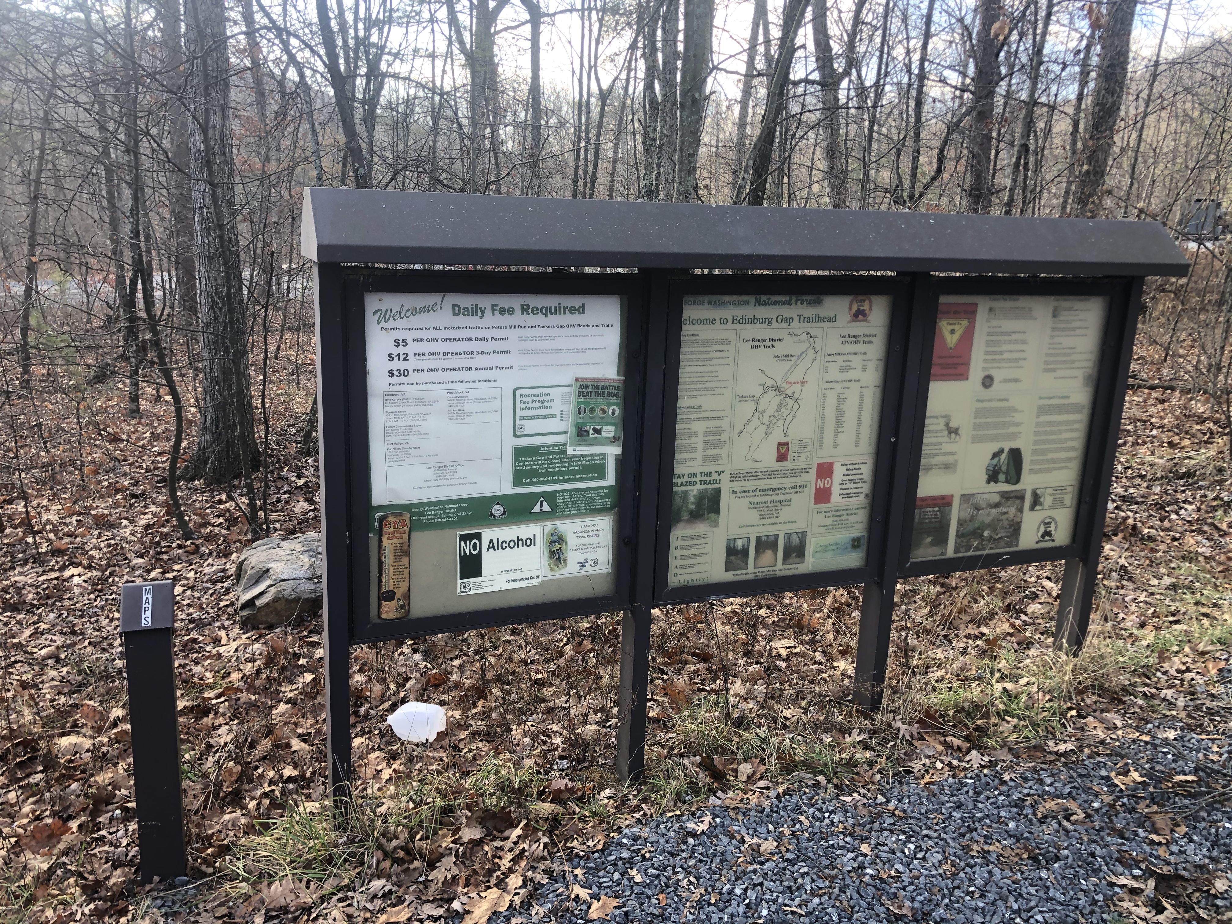
There are also paper maps you can grab and take with you. Very handy.

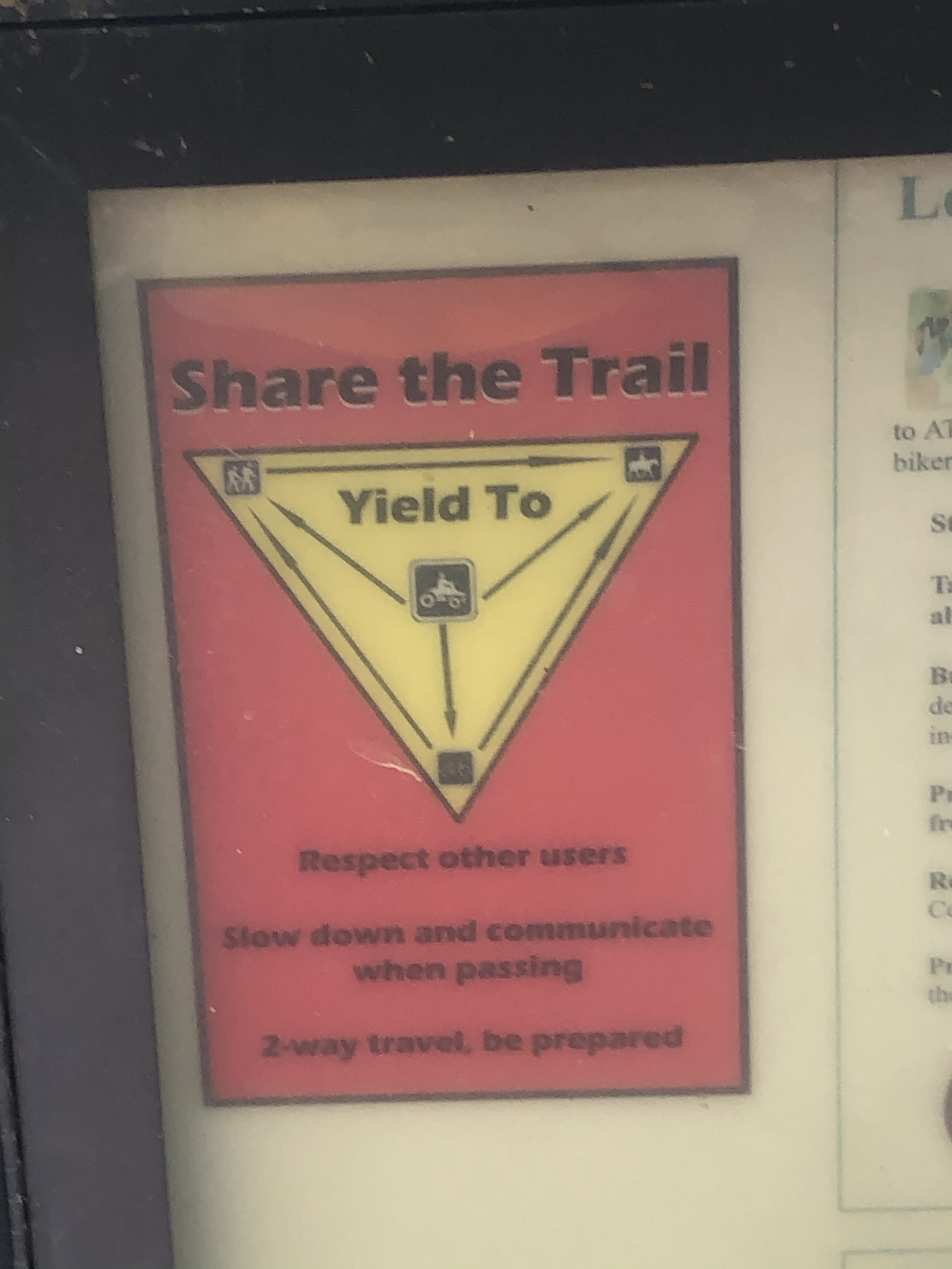
Although the parking area was packed (especially when we got back) we only passed two groups of dirt bikes and both knew right of way. They stopped and shit off well in advance of us and have a polite “have a nice one” in exchange when we passed.

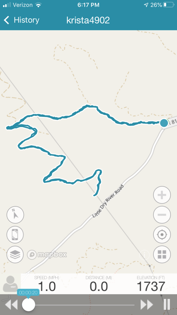
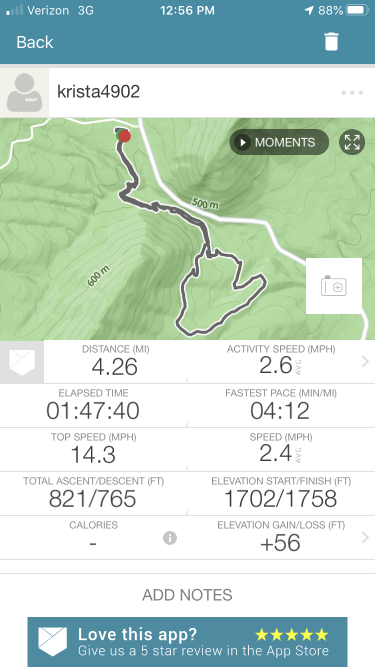
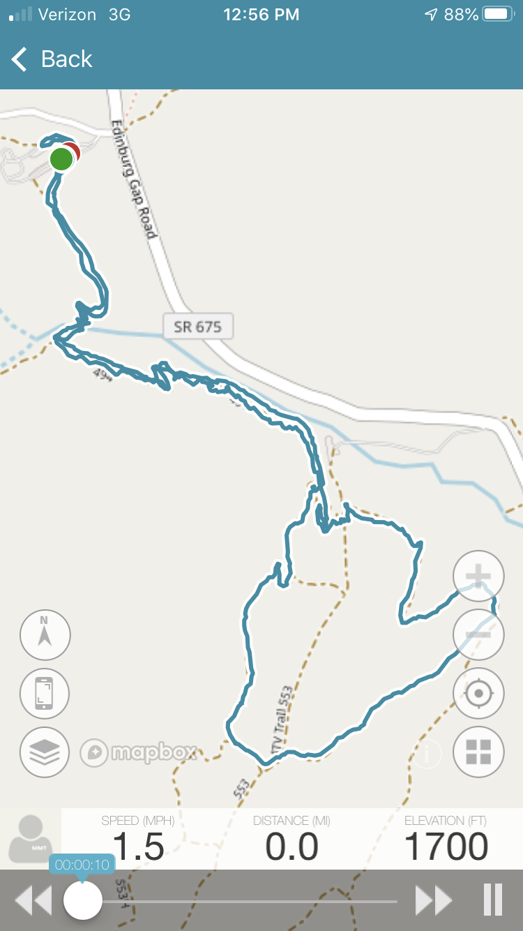
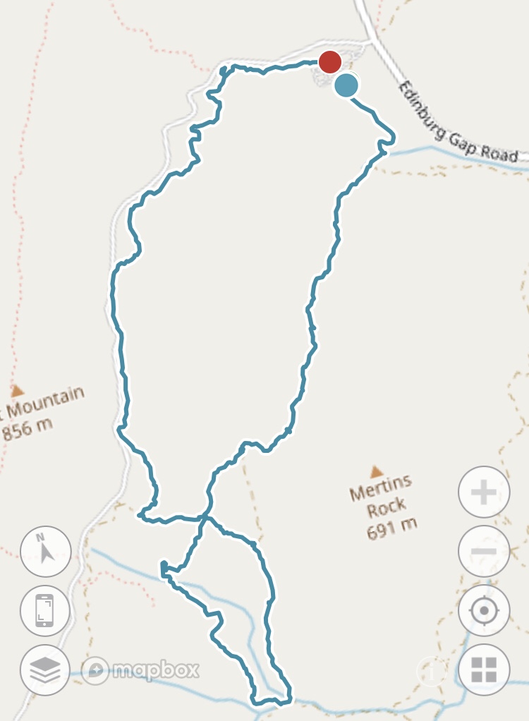
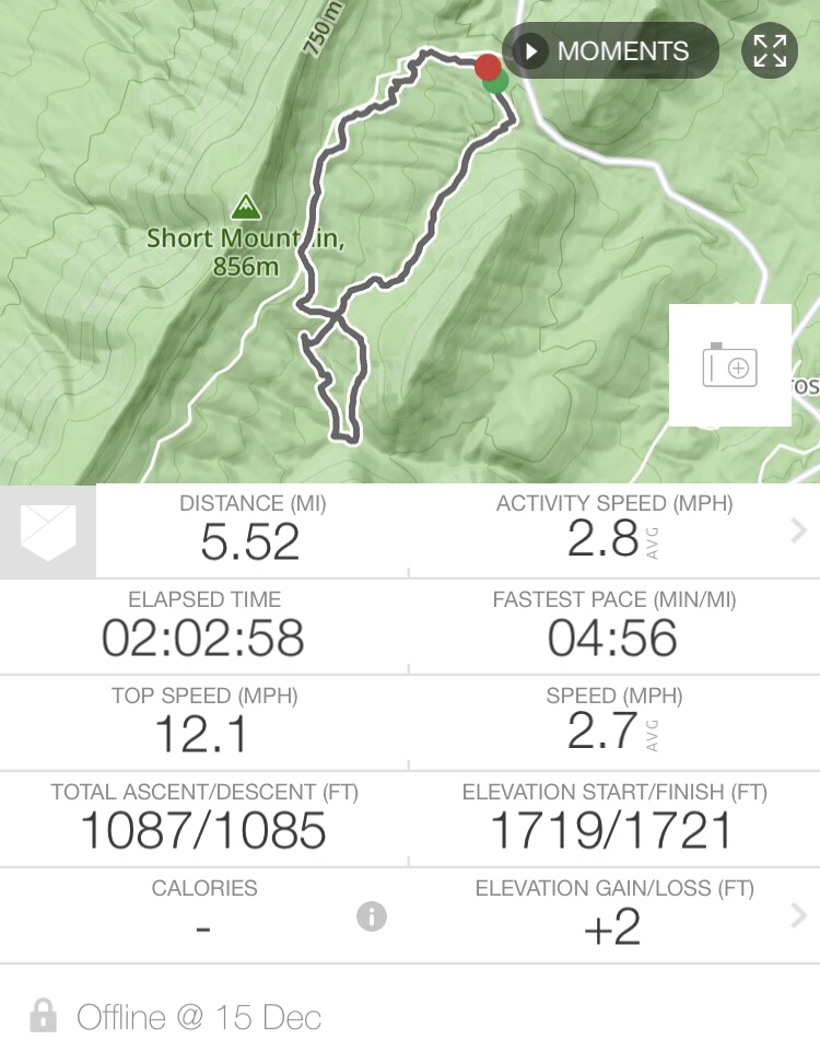
For this ride we decided to keep it to two hours and try the loop that goes in and out of the larger parking area. We rode out on trail 493 on the bottom of the parking area.

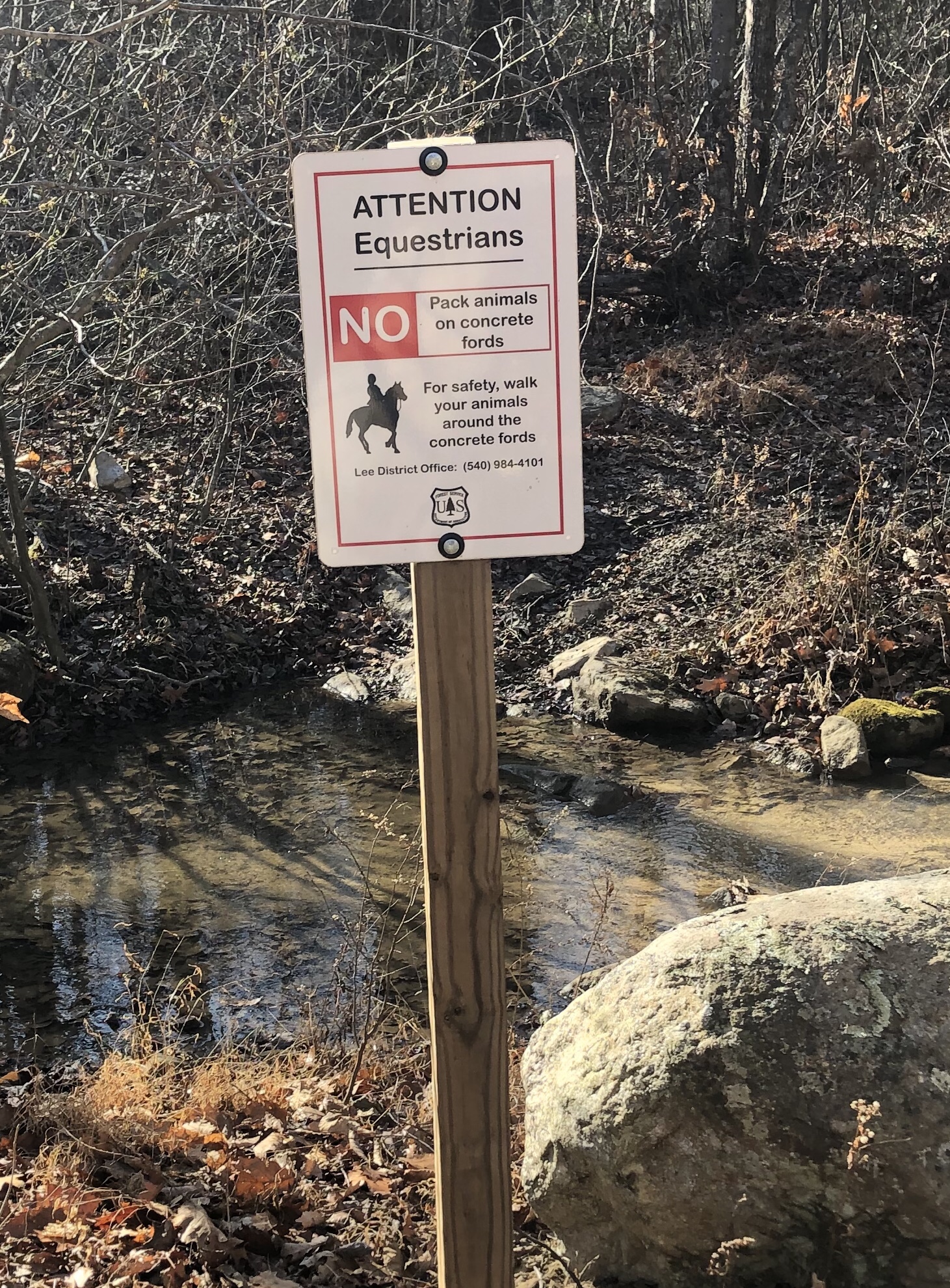
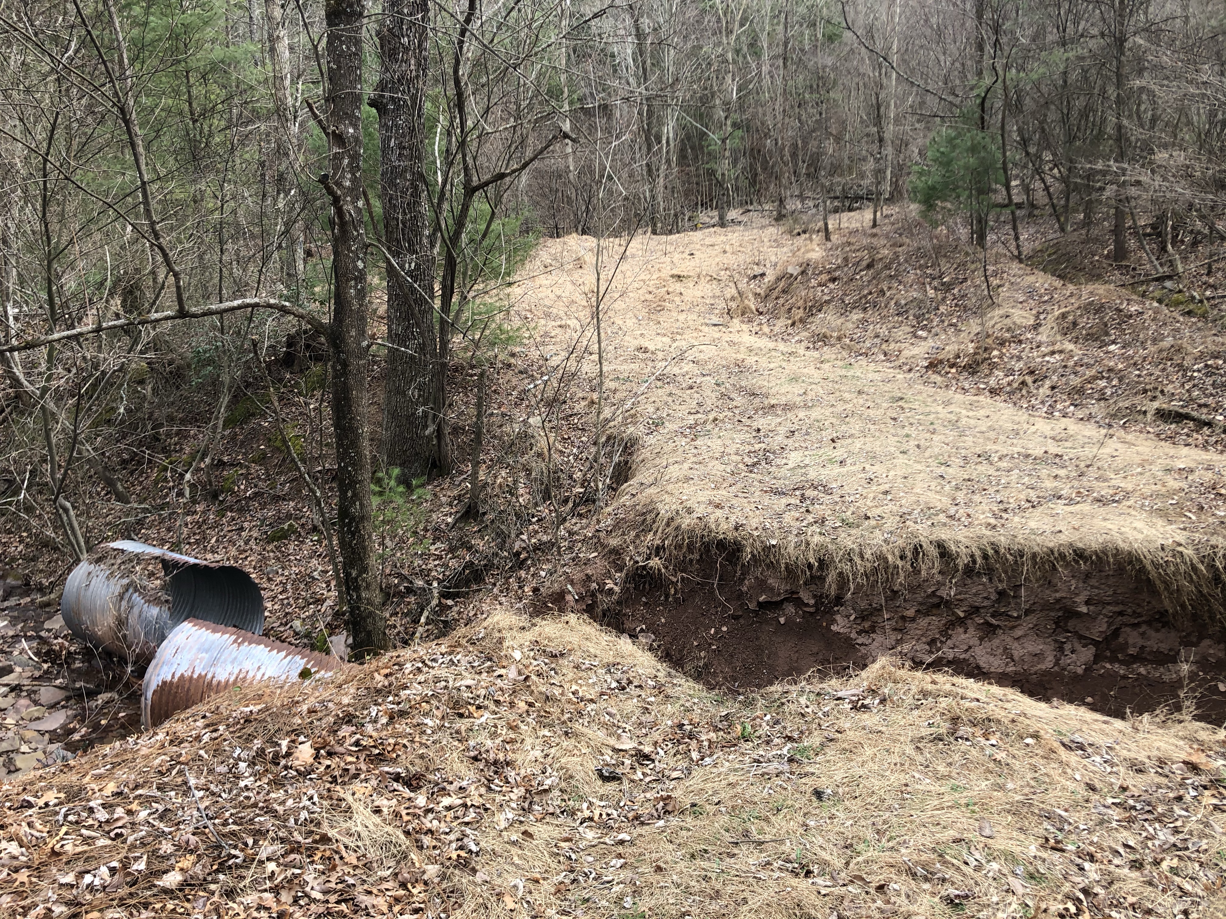
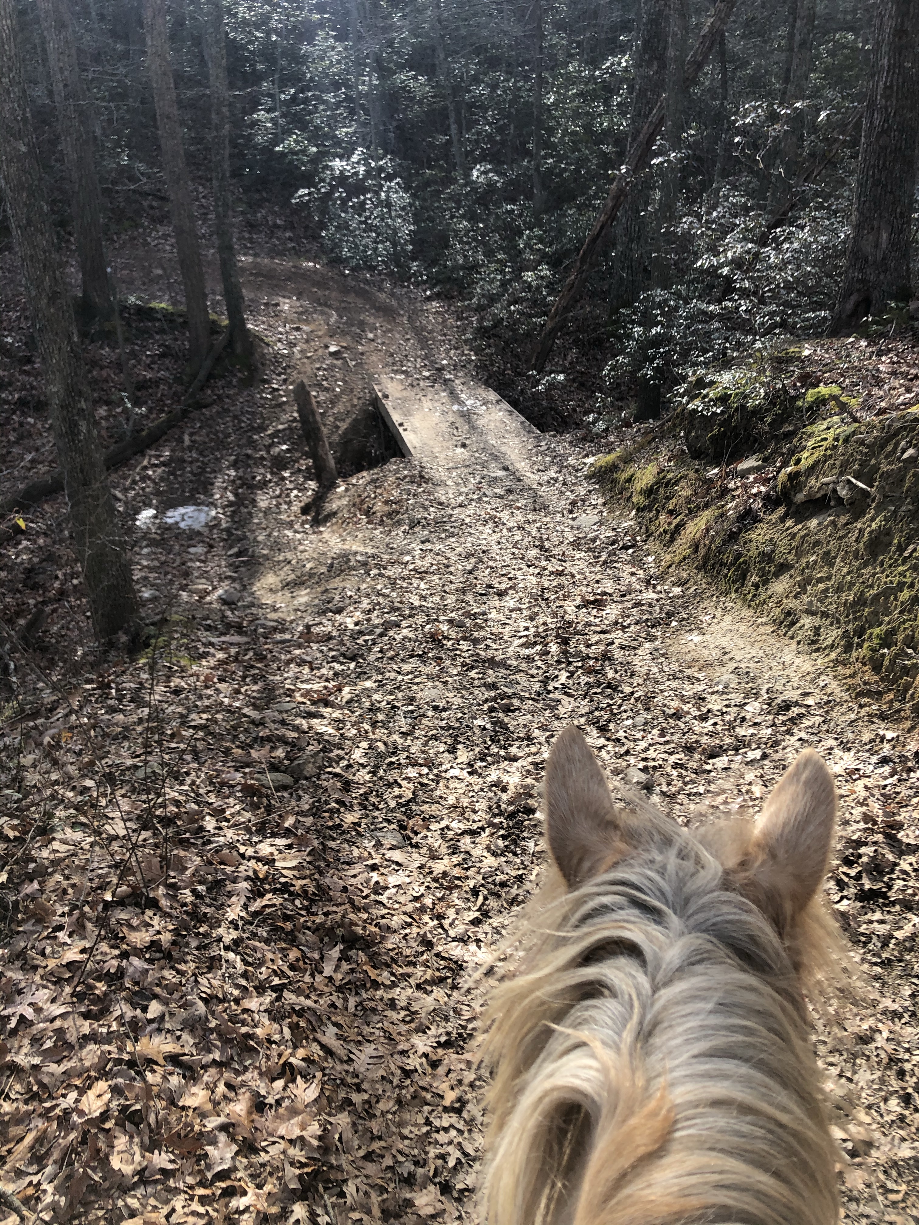
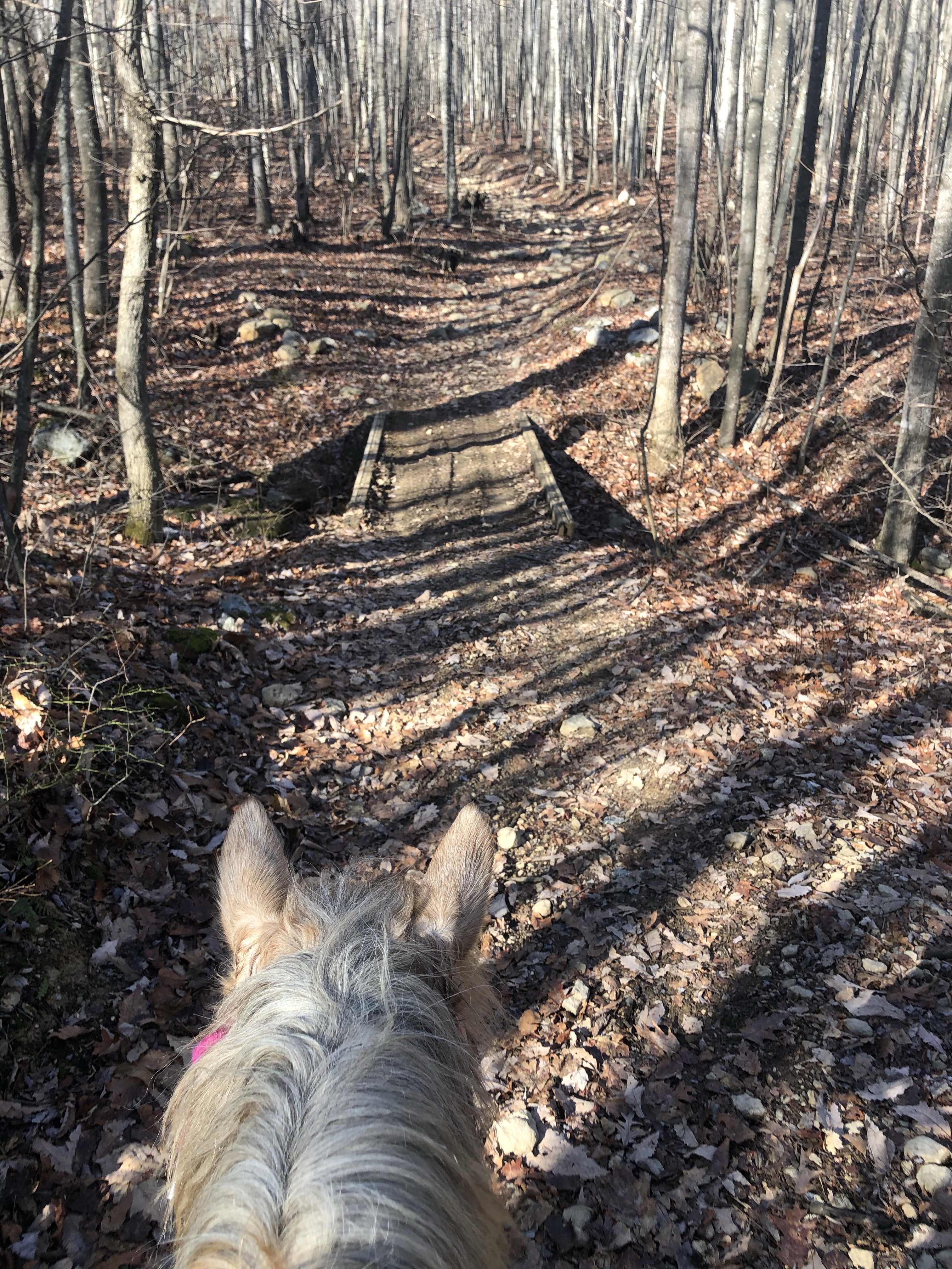
There is a concrete creek crossing pretty quick on which has signs warning equestrians about footing. There is also a creek crossing right next to it off the concrete. We went ahead and rode over the concrete and found it just fine.

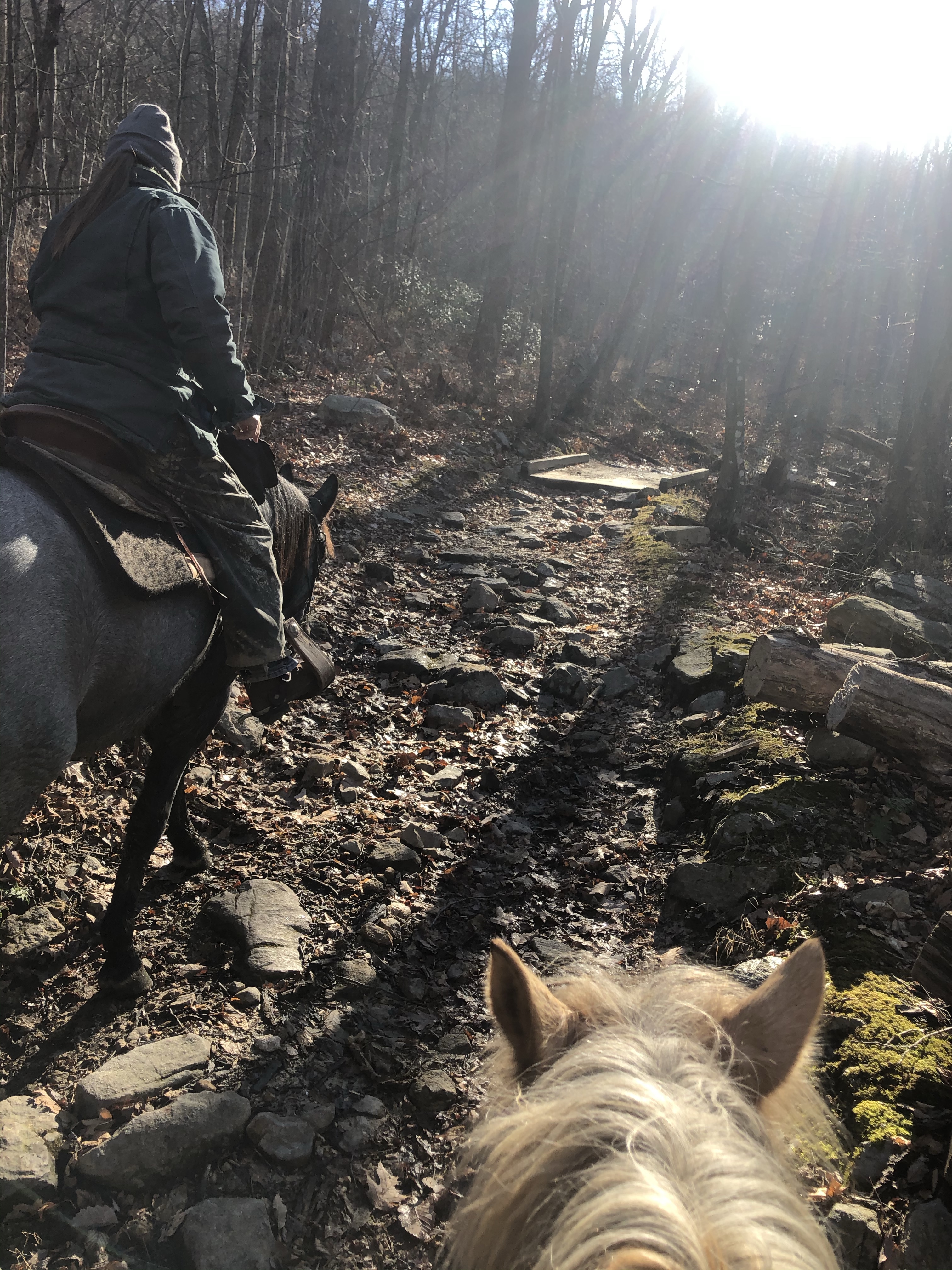
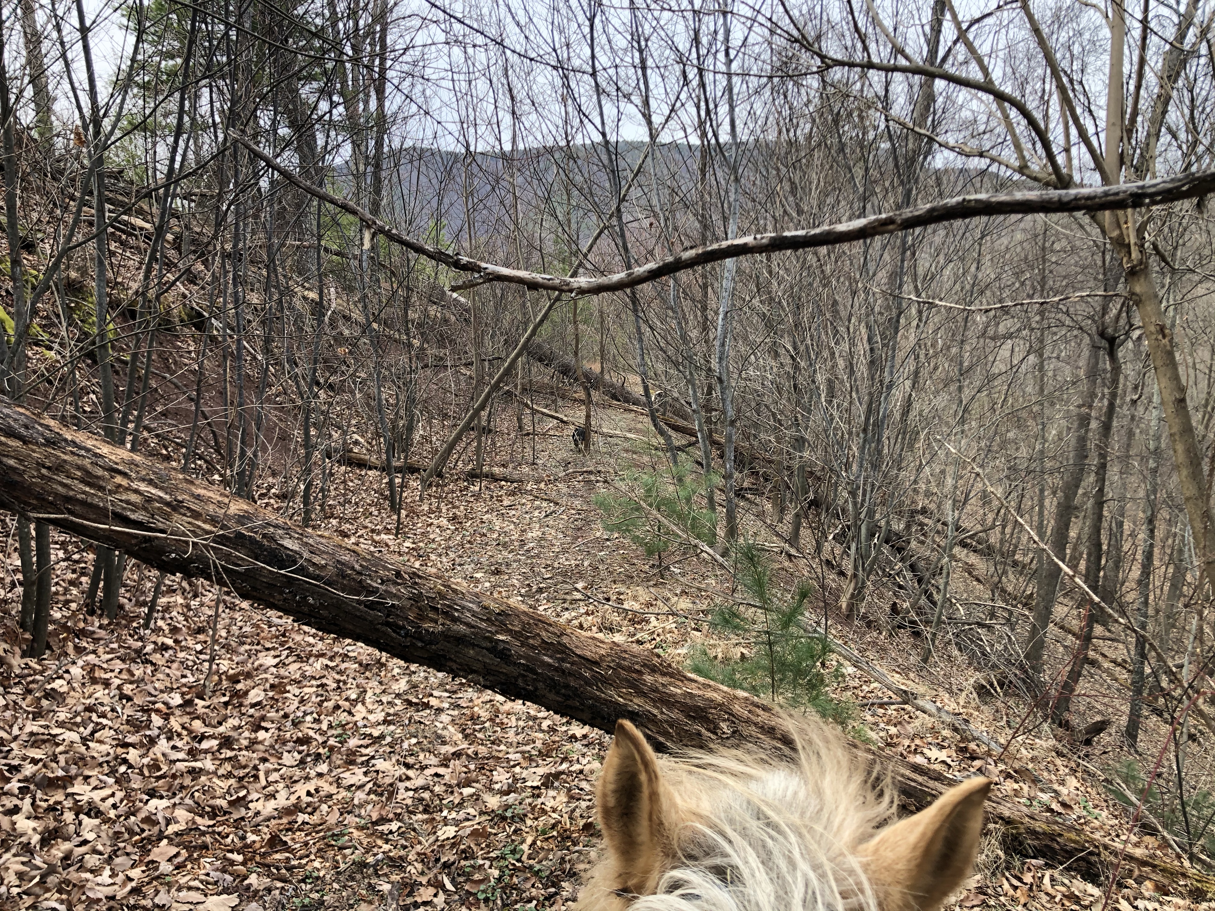
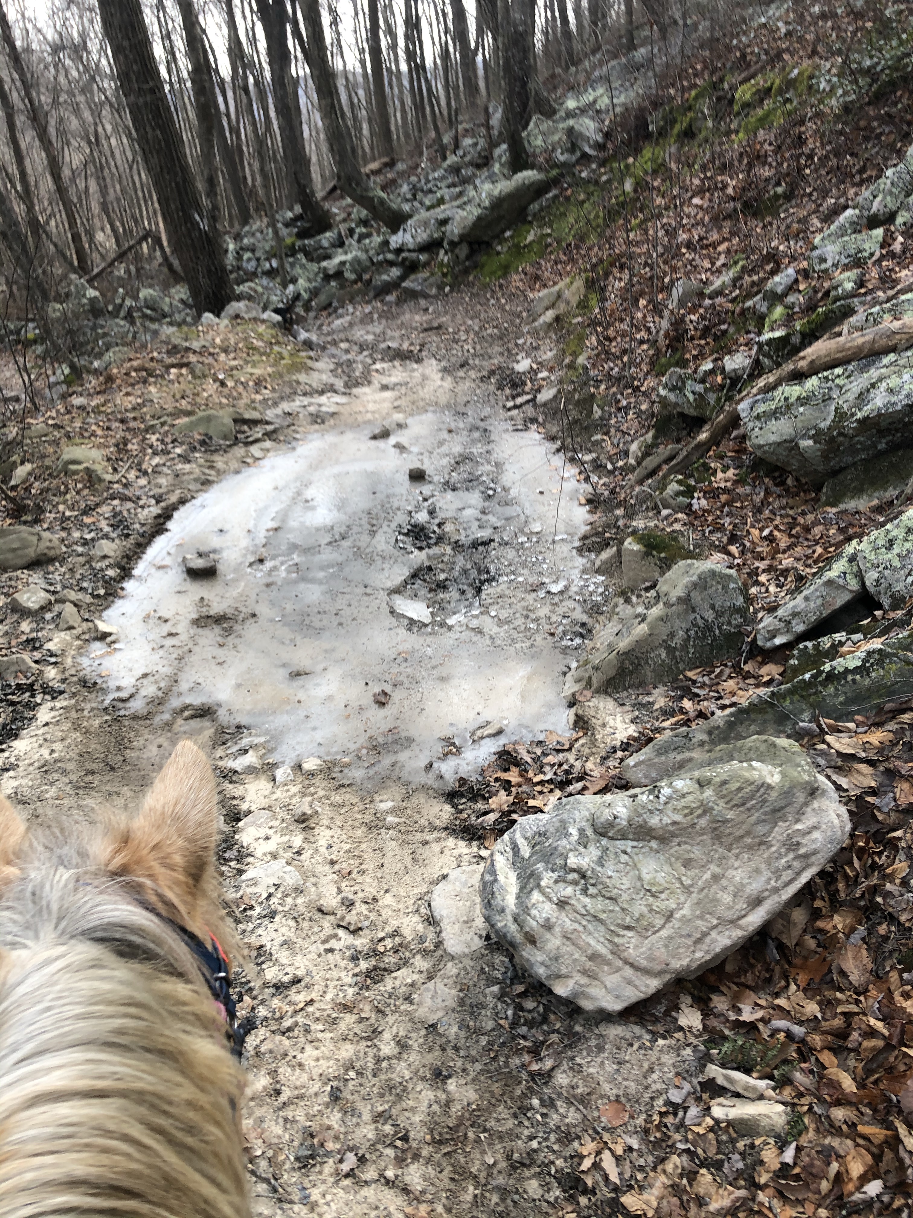
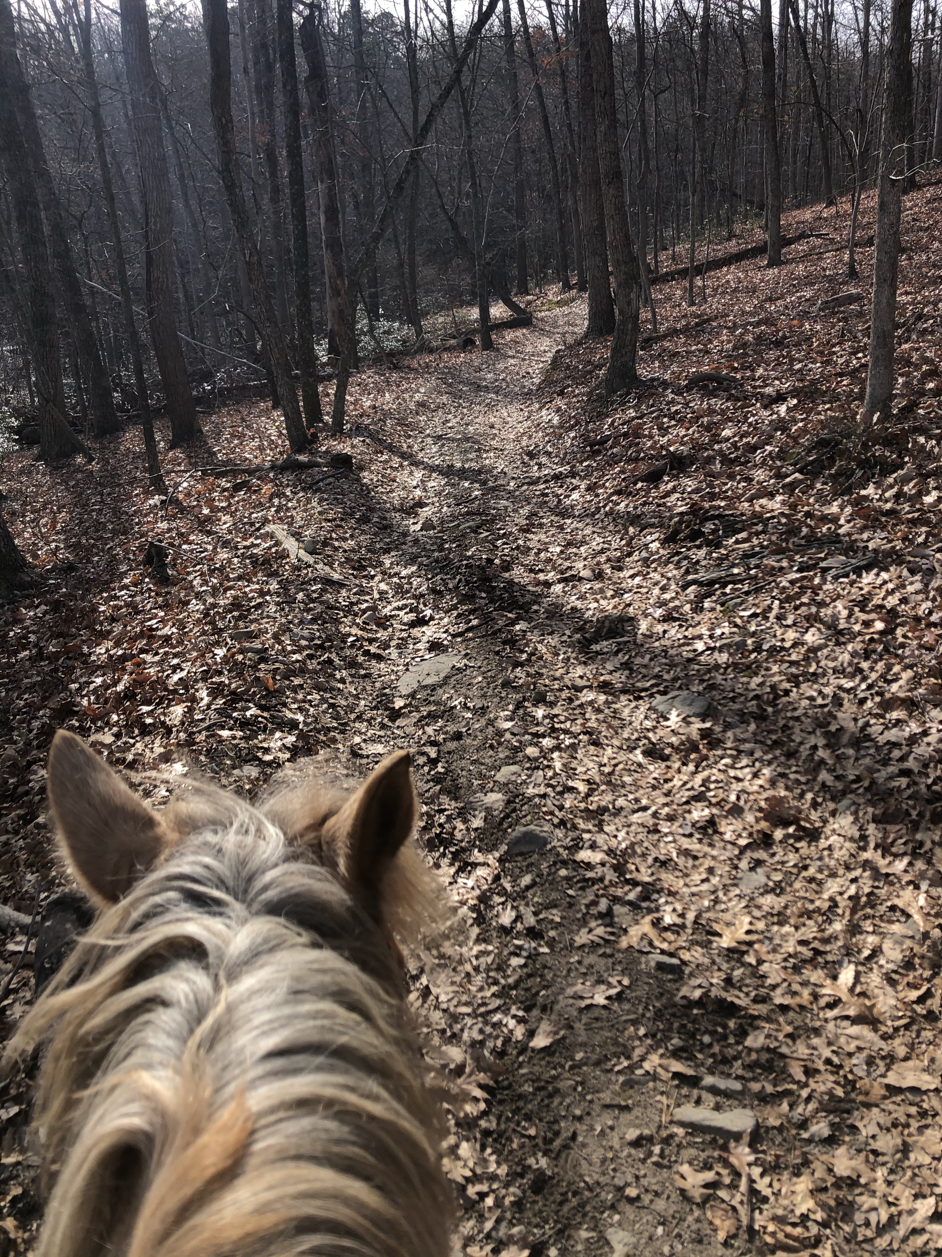
This trail loop continued to be pretty rocky, nothing too out of the ordinary for this general area.

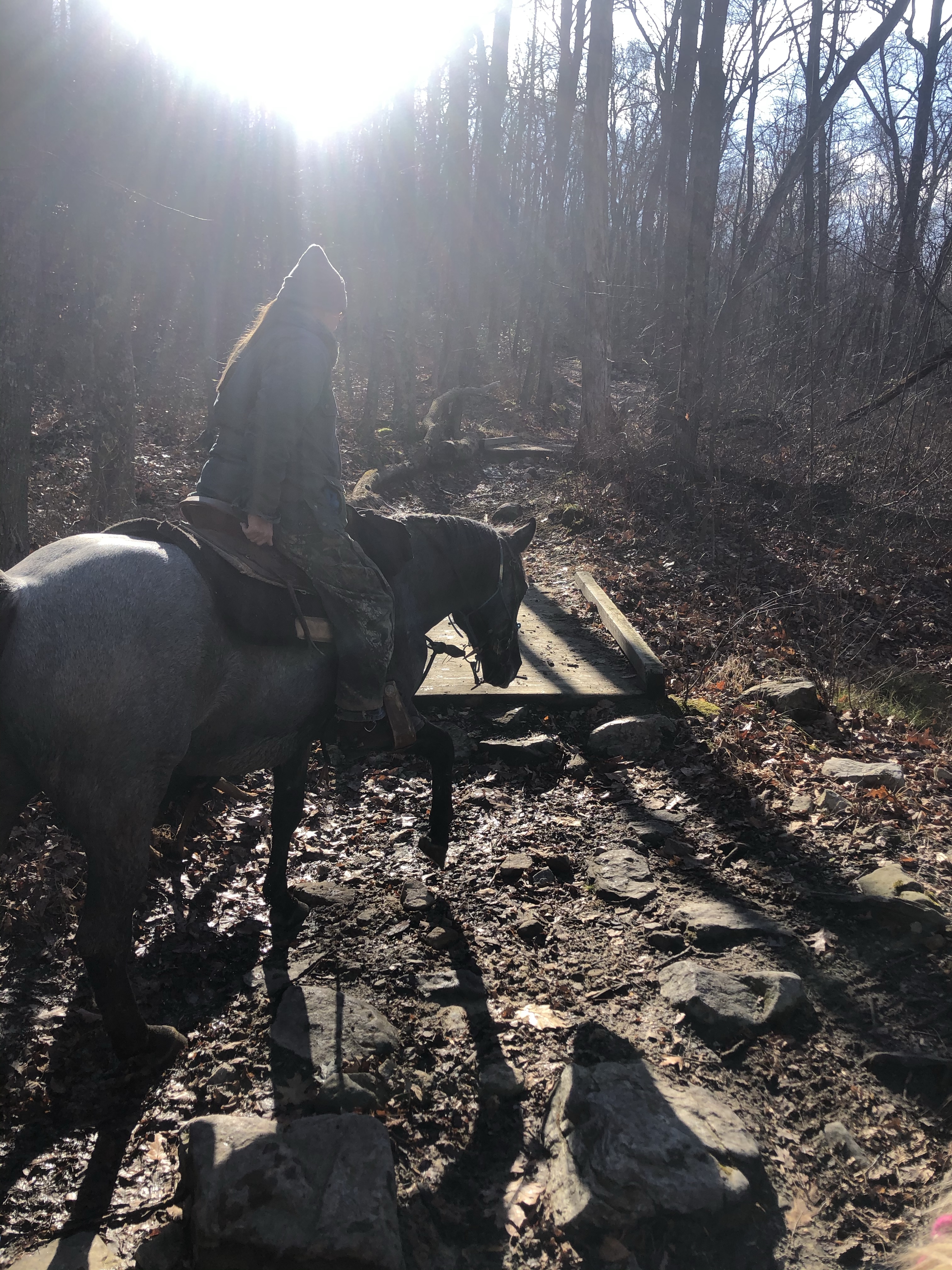
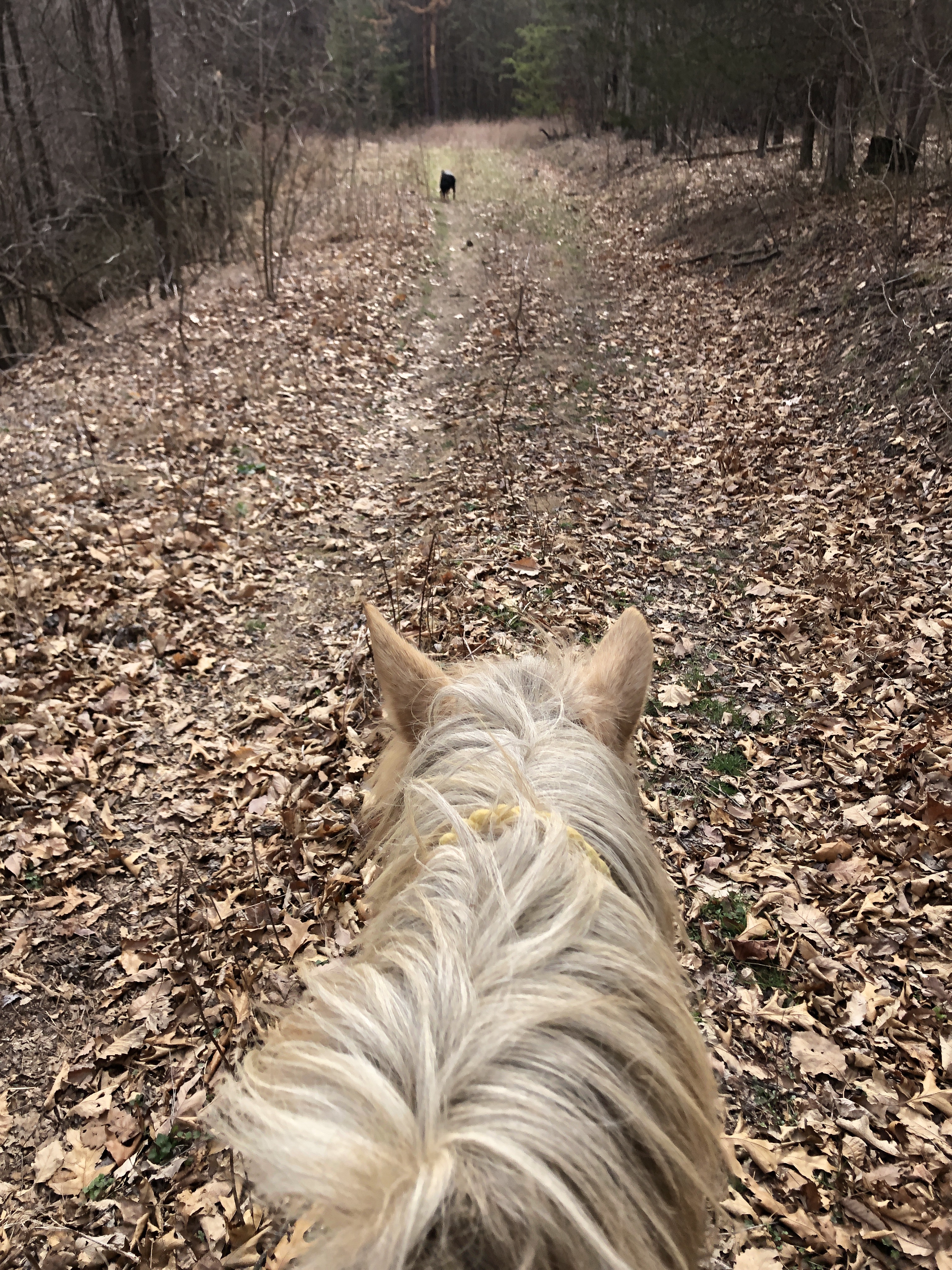
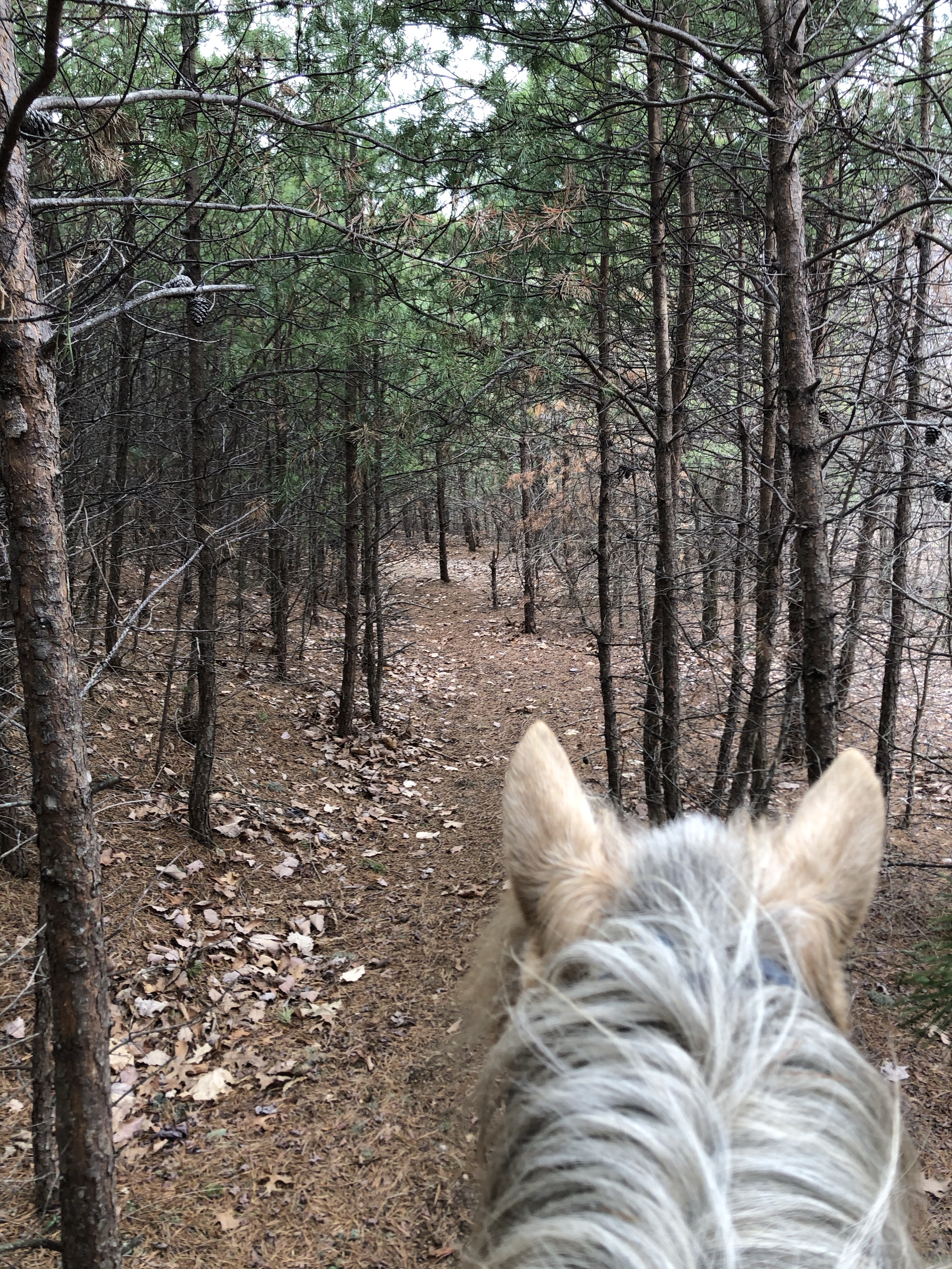
One thing that I love about this loop is it is covered in bridges. We must have crossed well over a dozen of them. Some were bare wood and some were packed in with dirt. Some were long and some were short. Luckily both Jenny’s horse King and my pony Simon don’t bat an eye at bridges. But if you have a horse that need some bridge work this would be a good place to get that work in.

And this trail network is also super well marked. Not only are colored trail marks clearly visible on trees (We followed the blue Vs) there are also maps posted at intersections with “you are here” stickers on them.

The loop was mostly a walking loop since it was pretty rocky, but we opted to add on the little lower loop you can see in the images at the top (south on 493, made a left onto 497 cross trail to 498 loop back to 497 cross trail and rode back north on 493 to the parking area popping out at the top of the parking area).

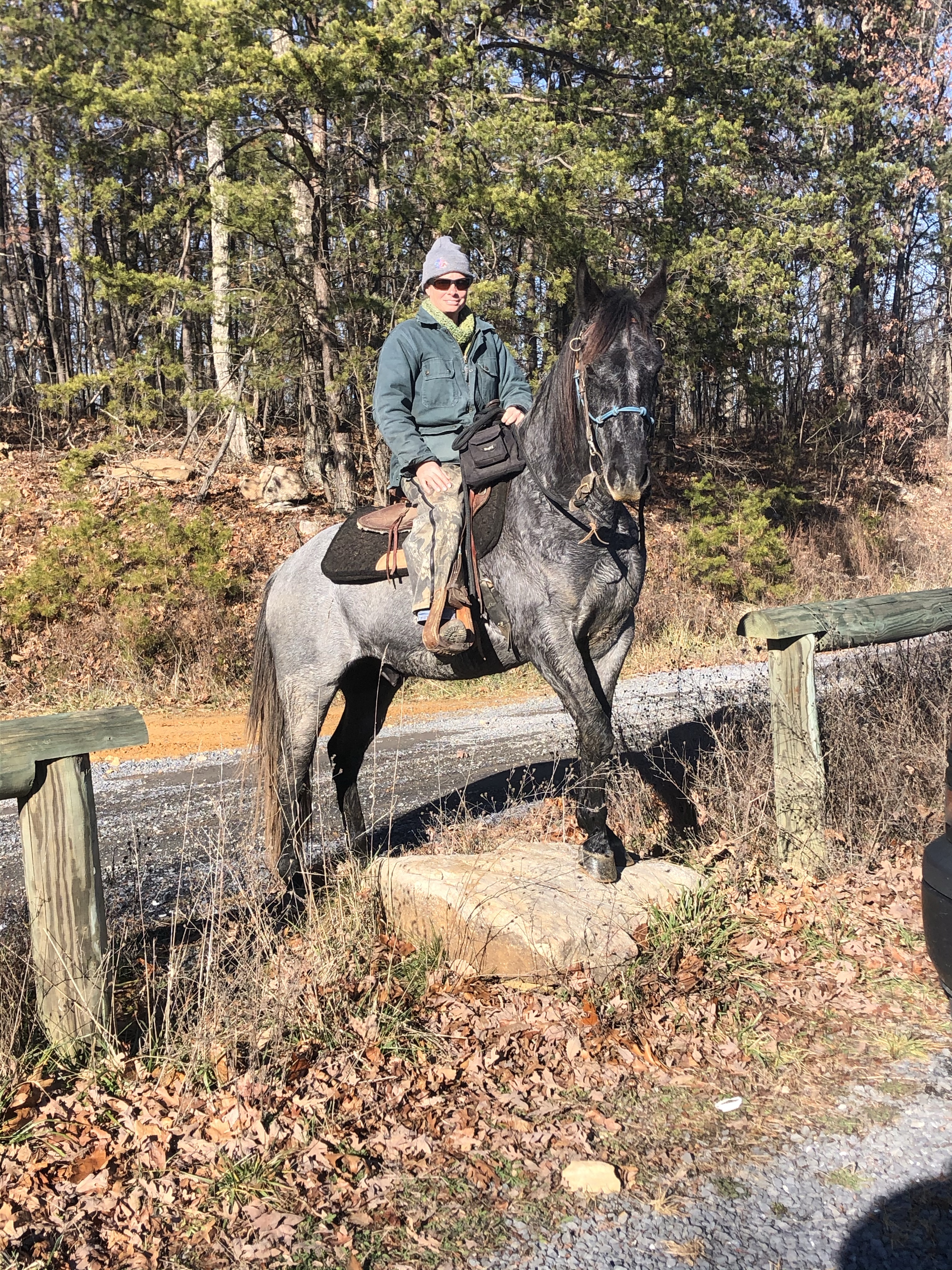
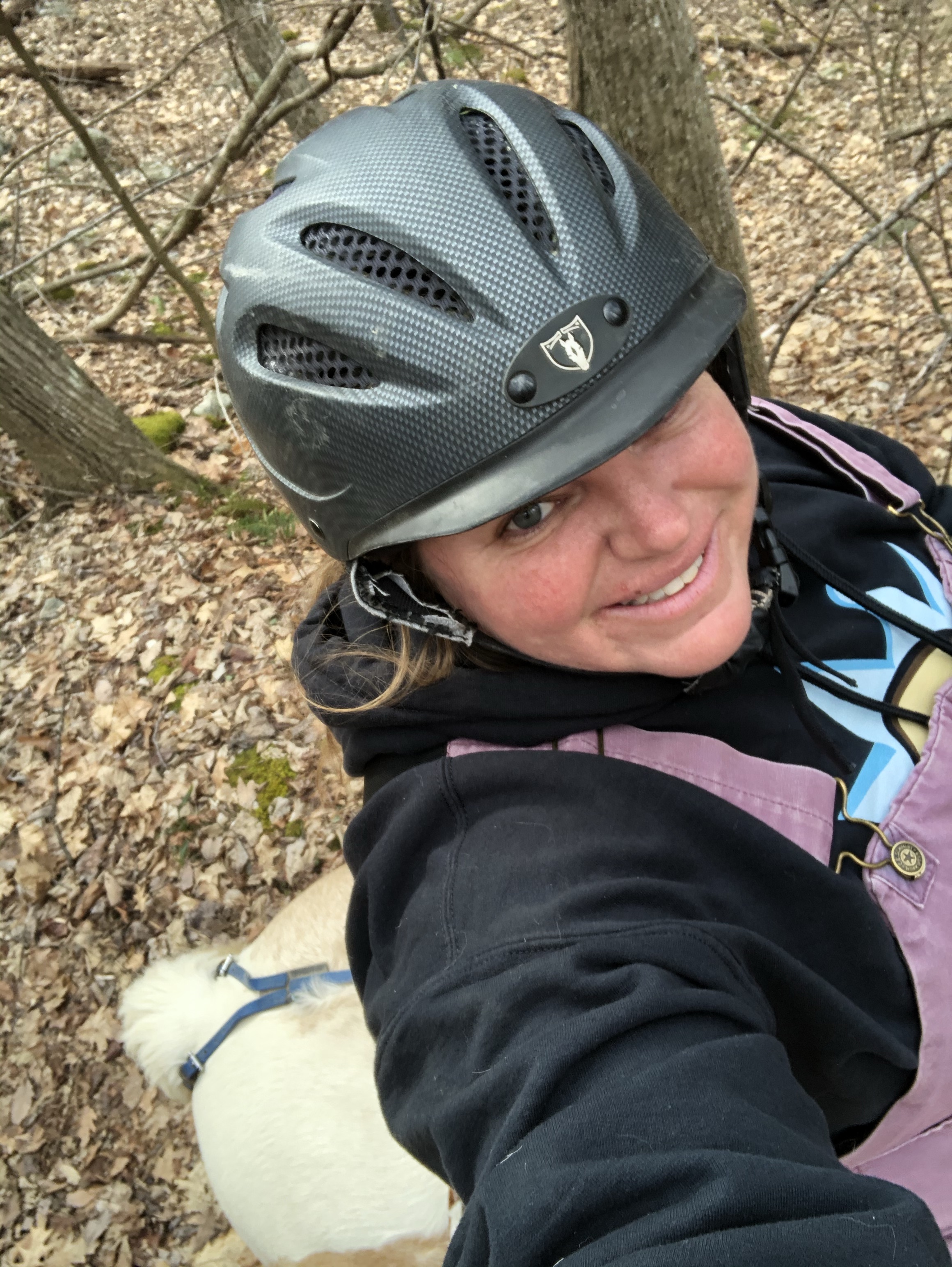
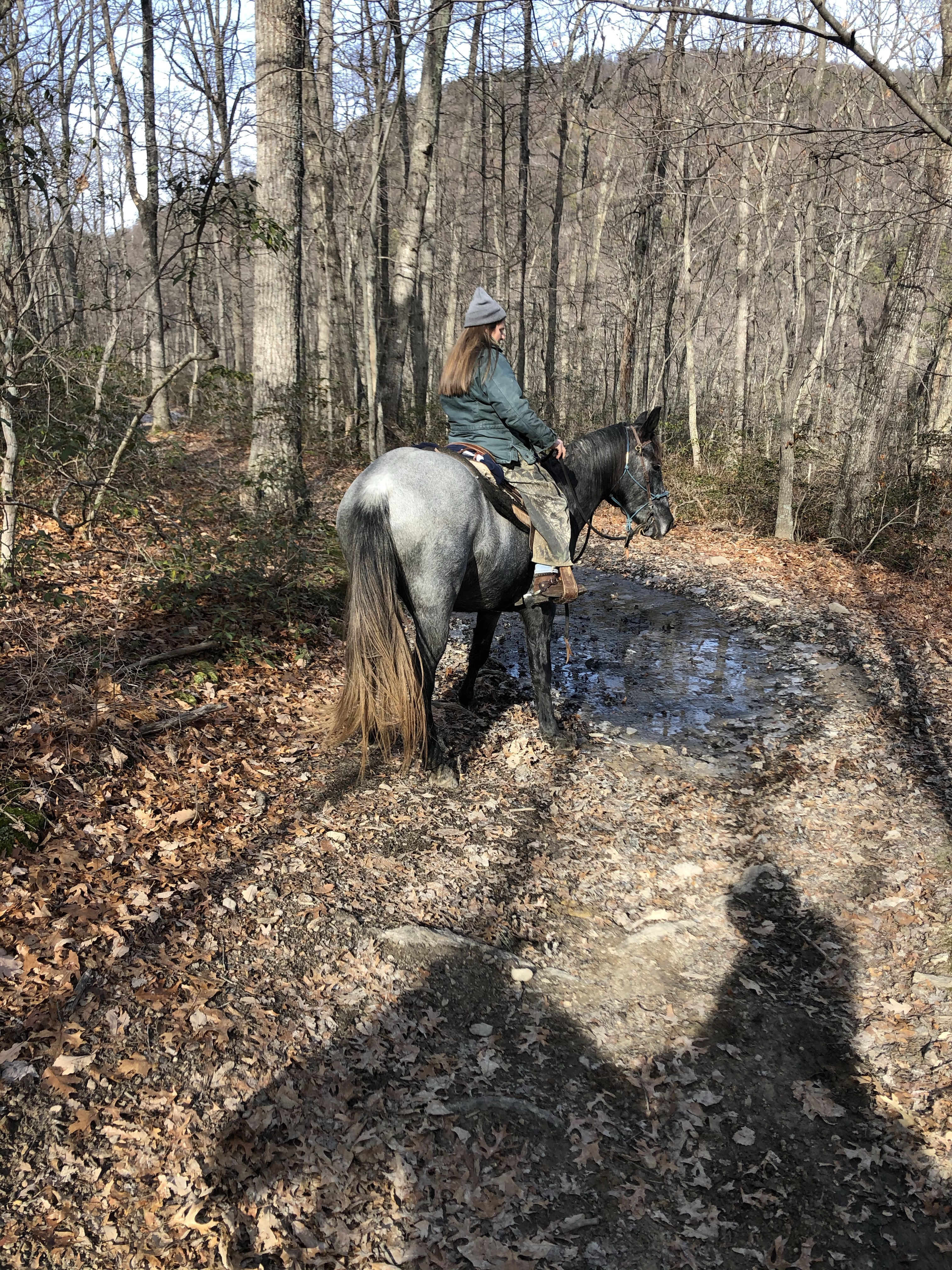
Look at King being cool.